Gloucestershire
Carr reported that he had published three editions of a map of Gloucestershire, but there may be four based on the maps seen and entries in ISBN databases.
(Last updated on 7/12/2020)
MAP-GLO1: First edition
Publisher: J.L. Carr
Year: 1967?
ISBN: none
Limitation: 250 sheets
Size: approx 440 x 490 mm
Signed: Yes
Colophon: Sun face with address
Proofs where:
Notes: Only known from a copy sold at auction in 2013. The coats of arms are probably painted in watercolours by hand, so every proof will be slightly different. This map is labelled a 'first edition' and has a smaller limitation than the next, which is assumed to be the second edition. If it is the first edition, then it was published between 1966 and 1968.
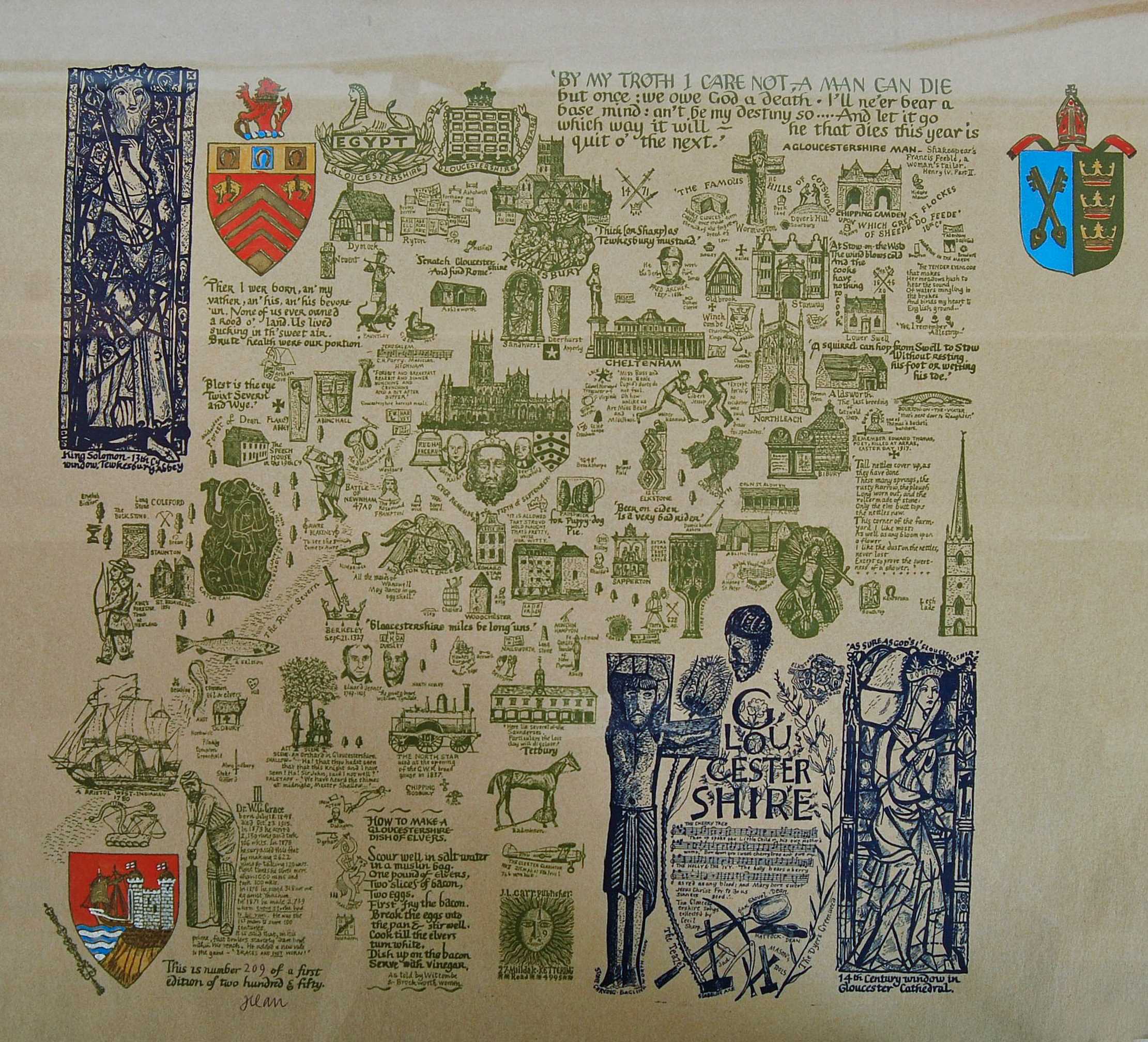
Image of map (click to enlarge)
Detail of limitation (click to enlarge)
MAP-GLO2: Second edition?
Publisher: J.L. Carr
Year: October 1969 (dated on map)
ISBN: none
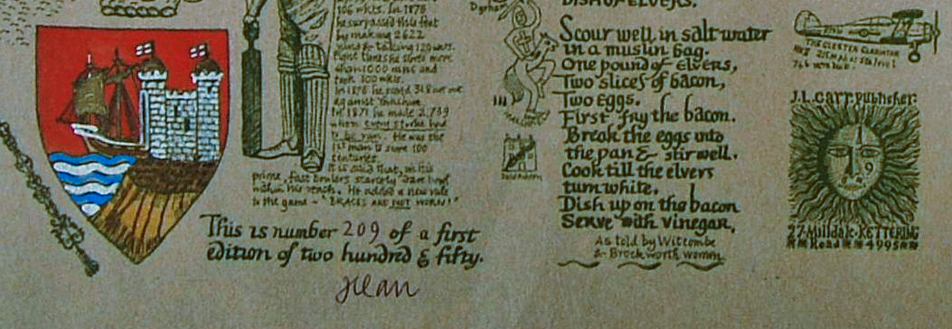
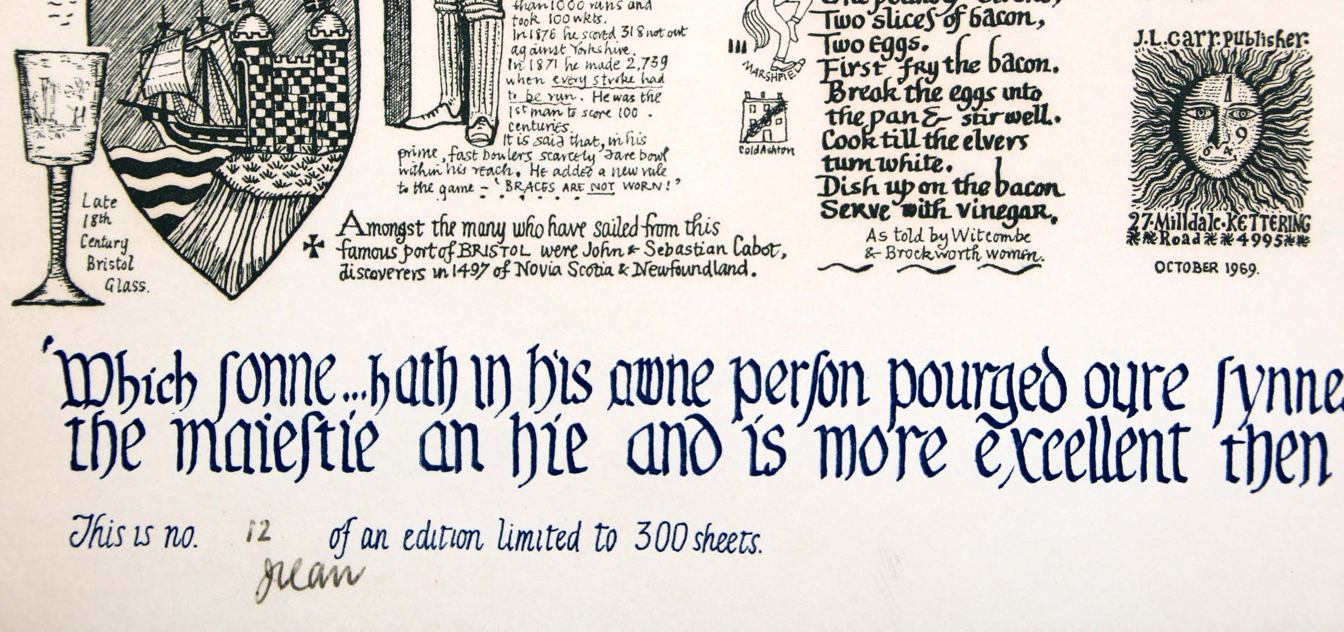
Limitation: 300 sheets
Size: 515 x 400 mm
Signed: Yes
Colophon: Sun face with address and date below
Quotation: 'Which sonne...hath in his owne person pourged oure synnes and is fytten on the right hande of the maiestie an hie and is more excellent then the angels' from Wm Tyndale's translation' (of the Bible).
Proofs where: Kettering Public Library (proof), AH
Notes: The basic map is the same as the first edition but the shields are different and text has been added to the top and bottom. A few figures have been added and a horse and rider at the top. The shield is painted by hand as another proof is painted in blue and black (TD). This means that no two maps are the same.
A version printed in black and brown ink is known with a limitation of 300 sheets (TD) whereas the proof shown is printed in dark blue and brown ink (AH). This suggests that there were two print runs: either the edition was printed in two batches and the ink was changed, or the edition was reprinted in full or part?
A proof of this map without the text or relief carvings at the top and missing the text at the bottom has been reported by a Gloucestershire reader of these pages (Mike). It has similarities with the first edition such as the text under the shield at the top left, and there is text to the left of the steeple to the right, but it is also similar to the second edition in that there is a goblet next to the shield in the lower right, not a sceptre. The date under the colophon is missing and it is printed on card, which is unusual. It could be that the map has been trimmed to focus on the geographical part of the map, so the limitation has been lost, but that's perhaps unlikely if the limitation was signed by Carr. I wonder whether it is a second edition and the second edition shown here is in fact the missing third edition? The new map could be transitional design between the two? I would like to see a version signed by Carr which suggests that it is complete, as sold by him, with a limitation. Only the very early maps such as Norfolk had no limitation.
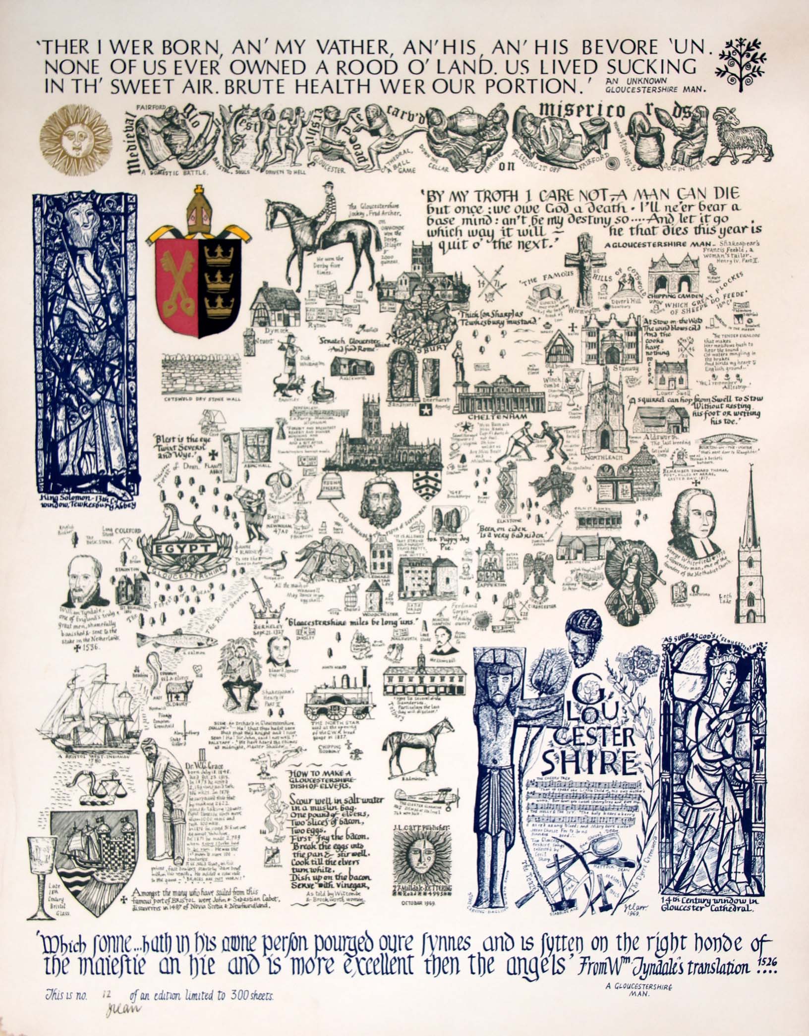
Image of map (click to enlarge)
Detail of limitation (click to enlarge)
MAP-GLO3: Third edition
Publisher: J.L. Carr
Year: 1971
ISBN: 0900847166
Limitation: 503? sheets
Size: xxx x xxx mm
Signed: not recorded
Colophon: not recorded
Proofs where: Kettering Public Library (proof)
Notes: The entry on this map on Amazon states that it is a 'Revised edition (May 1971)'. See the entry above on the second edition: a version may have been printed without the date under the colophon, and it could be the third edition, especially if the limitation has been changed. Other maps issued in 1971 had a limitation of 503 sheets, such as Essex or 502 sheets such as Northumberland.

Image of map (click to enlarge)
Detail of limitation (click to enlarge)
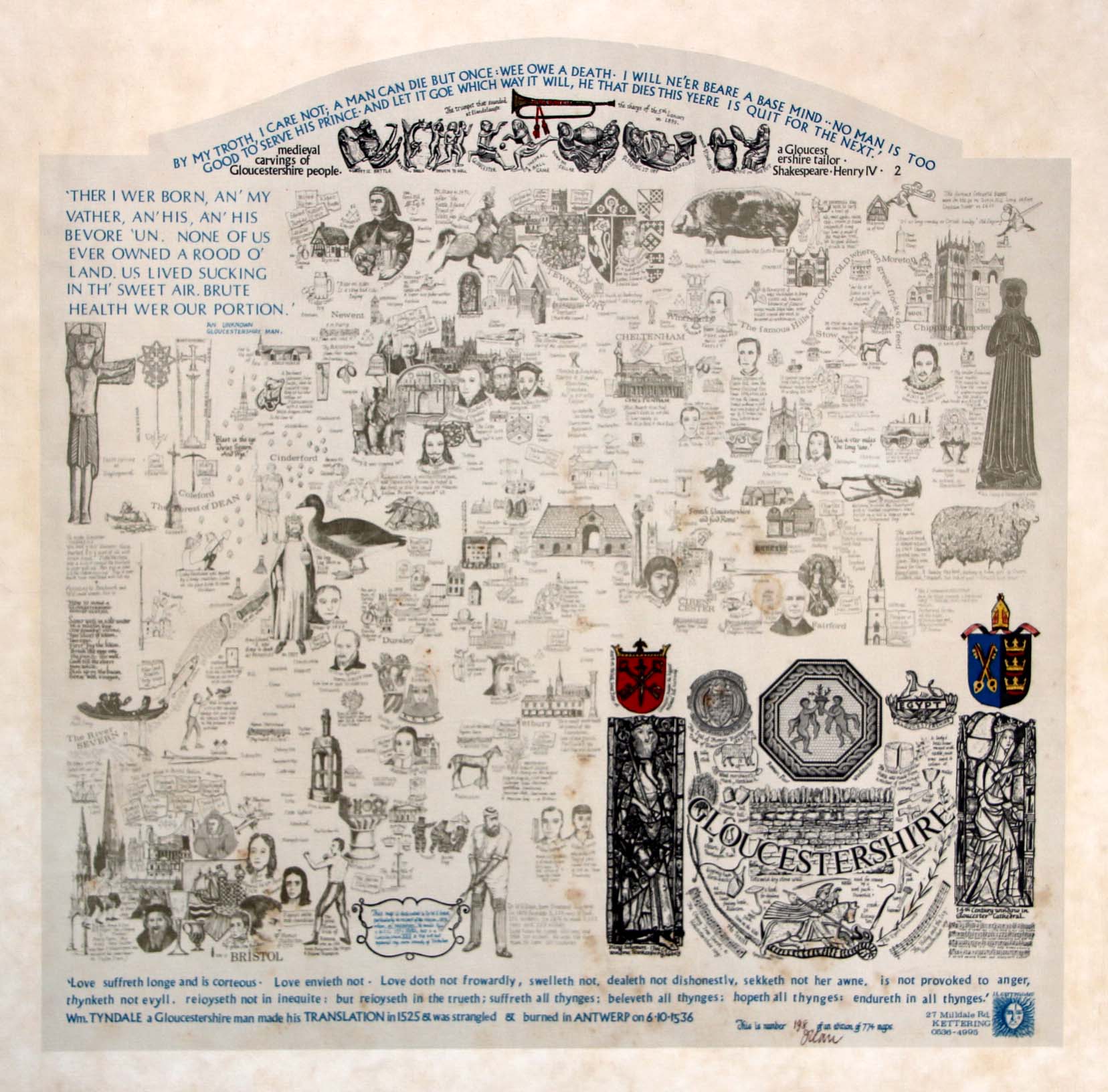
MAP-GLO4: Fourth edition
Publisher: J.L. Carr, 27 Mill Dale Road, Kettering
Year: 1974 or 1975
ISBN: 0900847433
Limitation: 774 sheets
Size: 450 x 469 mm
Paper: white linen-textured paper
Signed: Yes
Proofs where: Kettering Public Library (map), AH
Notes: Quotation at bottom:
Love suffreth longe and is corteous. Love envieth not. Love doth now frowadly, swelleth not, dealeth not dishonestly, sekketh not her awne, is not provoked to anger, thynketh not evyll, reioyseth not in inequitie: but reioyseth in the trueth; suffreth all thynges; beleveth all thynges; hopeth all thynges: endureth in all thynges. Wm. Tyndale a Gloucestershire man made his translation in 1525 & was strangled & burned in Antwerp on 6.10.1536.
The entry on this map on Amazon states that it is a 'Revised edition (Sep 1971)' but the limitation of the map indicates that it was published in 1974.
Full map (stained and possibly faded example)
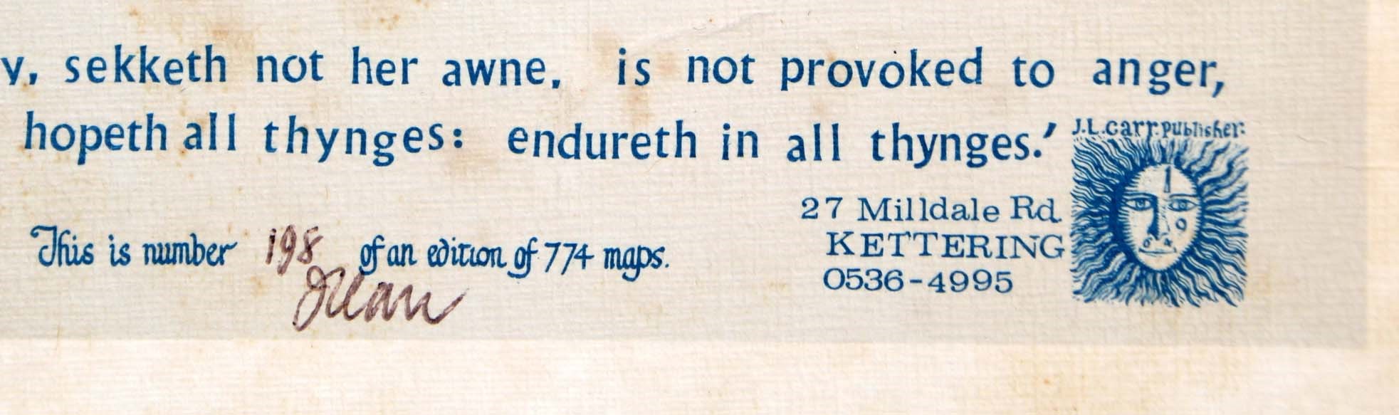
Detail of limitation (click to enlarge)