Yorkshire
Yorkshire is Carr's native county, so he knew a lot about it. In his History of the QTP (1987) Carr reported that a sixth edition was current, but there may be eight editions. Carr sent a proof of what I think is the third edition, designed in 1971, to the British Library. Carr modified the basic design of the map of 1971 for the later editions by changing the design or crest at the top right corner and the design on the lower right corner for the limitation or dedication. The basic content of the map remained the same including the bull to the left and the lighthouse to the right. Of the maps seen, only the edition of 1982 has a title of Yorkshire
; in all the others the county is not labelled.
What I think is the fourth edition has been seen in two different impressions: a map printed in colours, so for sale, but without the limitation text underneath the oval decoration of flowers in the bottom right; and a proof with the limitation. I suspect that the limitation was added when Carr reprinted the map to commemorate the 100th anniversary of building the Methodist Chapel at Sherburn-in-Elmet.
My thanks to Tim Dean (TD) for images of two maps from his collection.
My thanks to Andrew Eyre (AE), a reader of these web pages, for the photographs of the second edition map which added a new one to the list and meant that the numbering had to be revised in January 2025.
(Last updated on 20/01/2026)
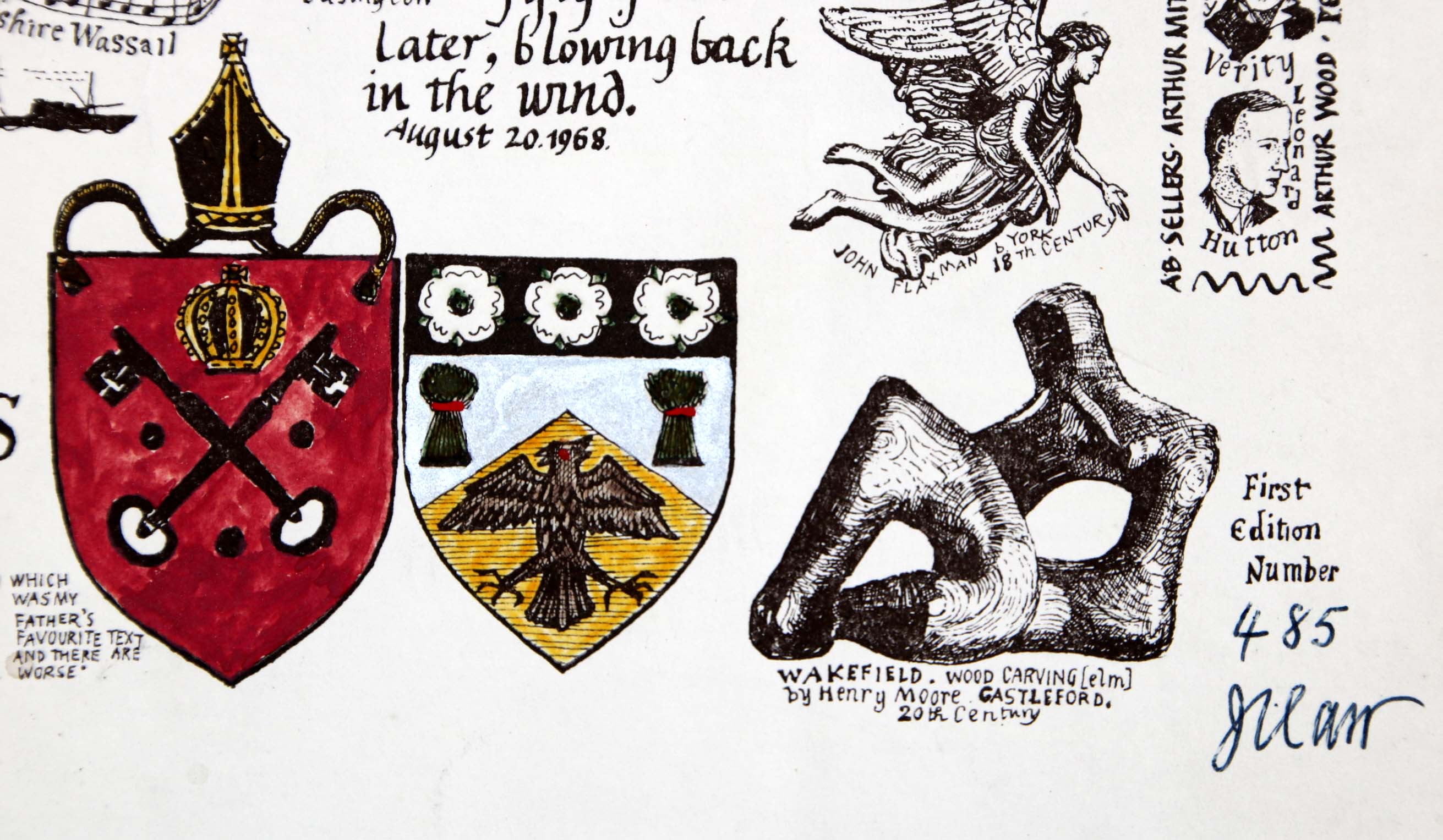
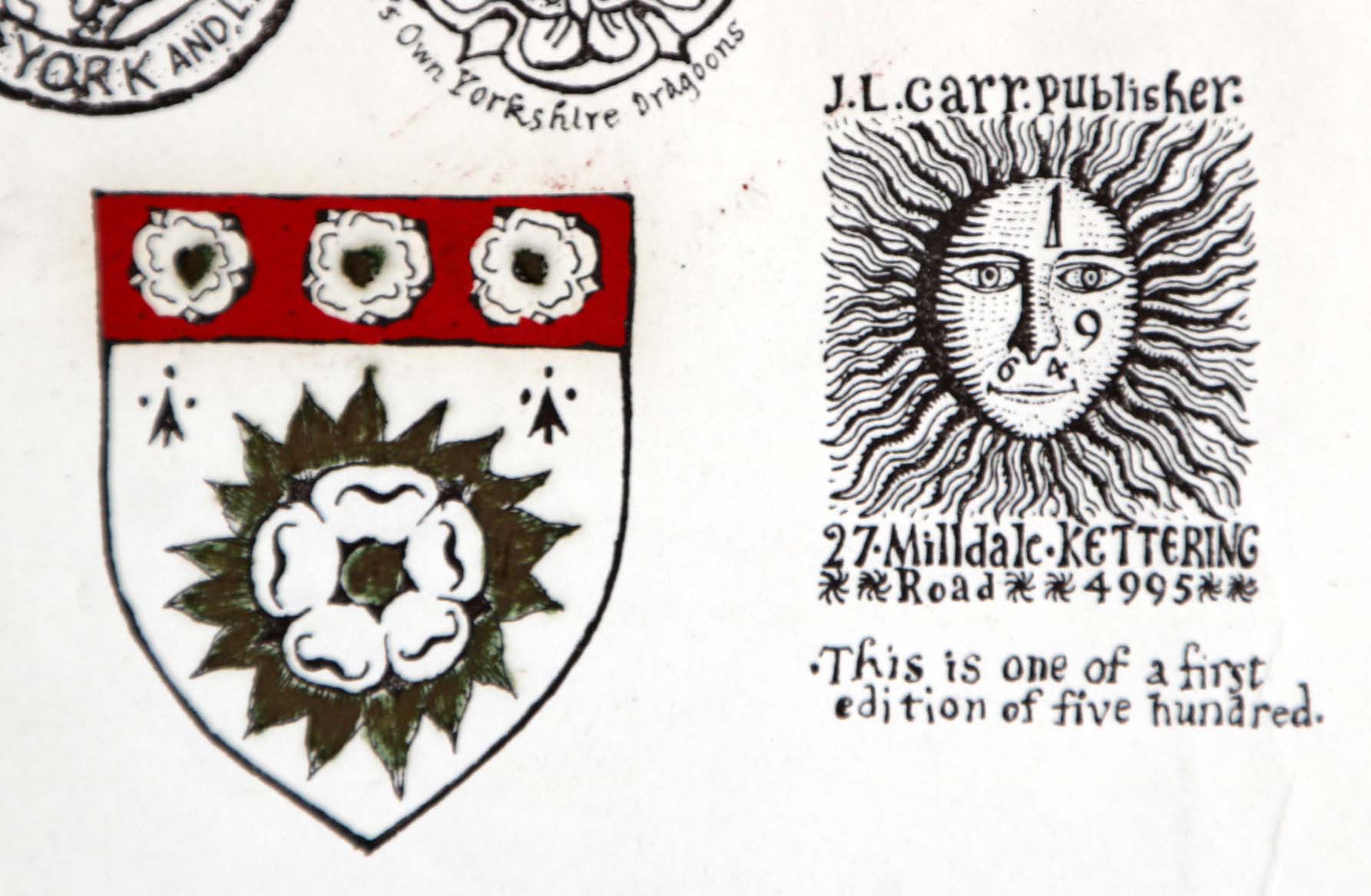
MAP-YOR1: First edition
Publisher: J.L. Carr
Year: 26th August 1968
ISBN: 0900847026, assumed to be applied to this map
Limitation: 500 sheets, under the colophon; numbered at lower right corner under First edition number
Size: 440 x 565 mm
Paper: white paper
Colophon: sun face with address in lower left, between shield and angel
Signed: yes, in lower right corner; the limitation is under the colophon
Proofs where: Kettering Public Library (proof and map); AH (map)
Notes: The colouring on the map shown left is done by hand, so every map is likely to be different. The framed proof in Kettering Library, which is not numbered, is uncoloured, so is probably rare.
The quotation at the base is: Where there is no vision people perish. After this Carr has written: which was my father's favourite text and there are worse.
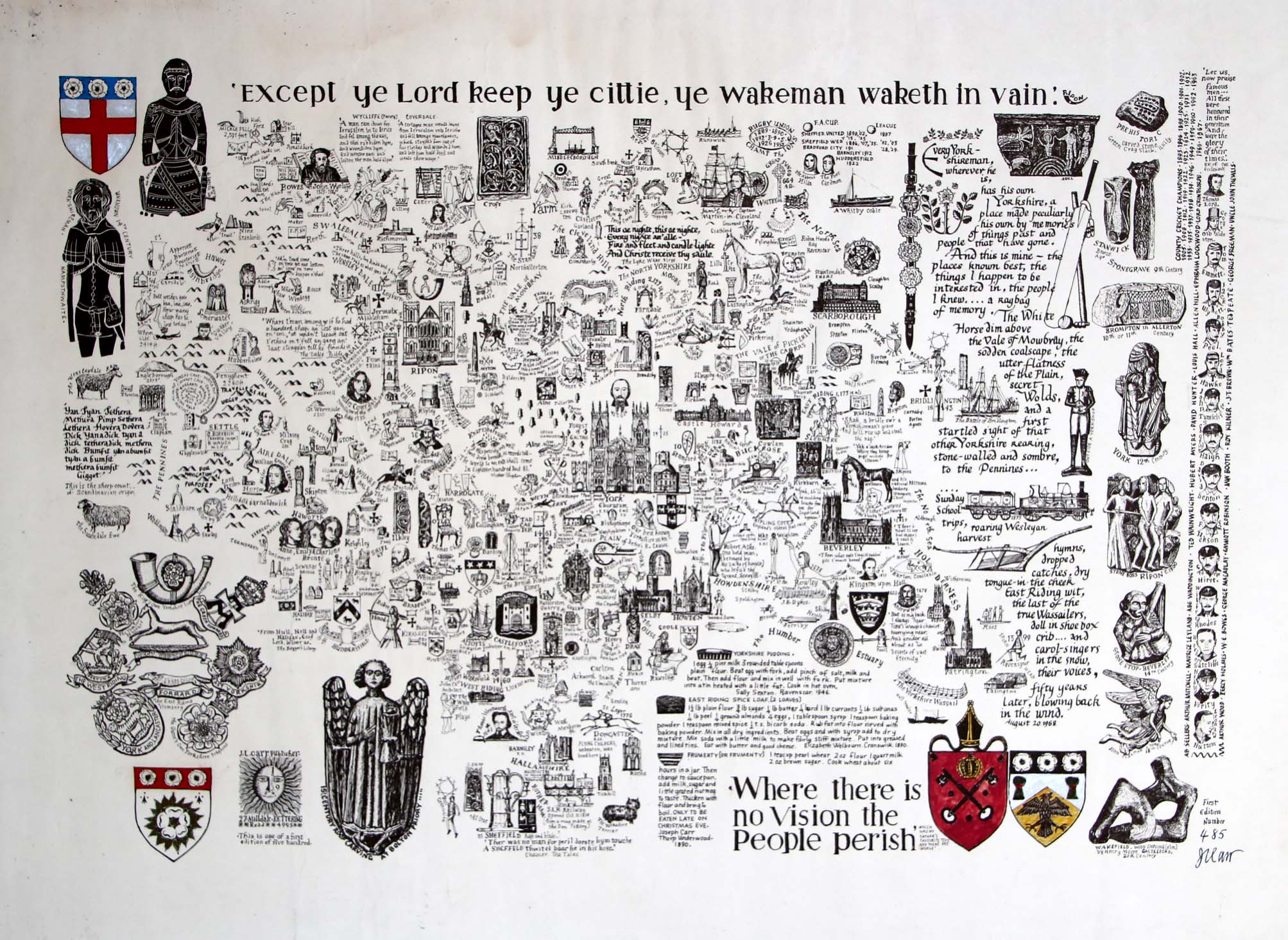
Image of map (click to enlarge)
Detail of edition showing hand colouring (click to enlarge)
Detail of limitation (click to enlarge)
MAP-YOR2: Second edition
Publisher: J.L. Carr
Year: 1969
ISBN:
Limitation: 569 sheets, next to the shield, lower right
Size: 455 x 582 mm
Paper: white paper
Colophon: sun face with address in lower left, between brass rubbing and angel
Signed: yes, in lower right corner, next to the limitation
Proofs where: AH
Notes: The colouring on the map shown left is done by hand, so every map is likely to be different.
The quotation at the base is: Shak but a bridge ower a Yorkshireman's graave and he'll rise up and tak thee gallowa'. After this Carr has written: An envious and only partly true saying . . . .
Thanks to reader Andrew Eyre for telling me about this map and kindly sending me photographs. I now have a proof.
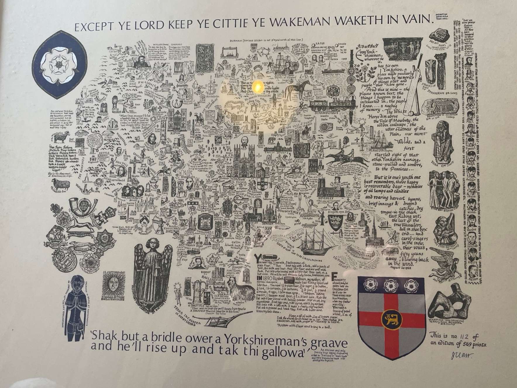
Image of map (click to enlarge)
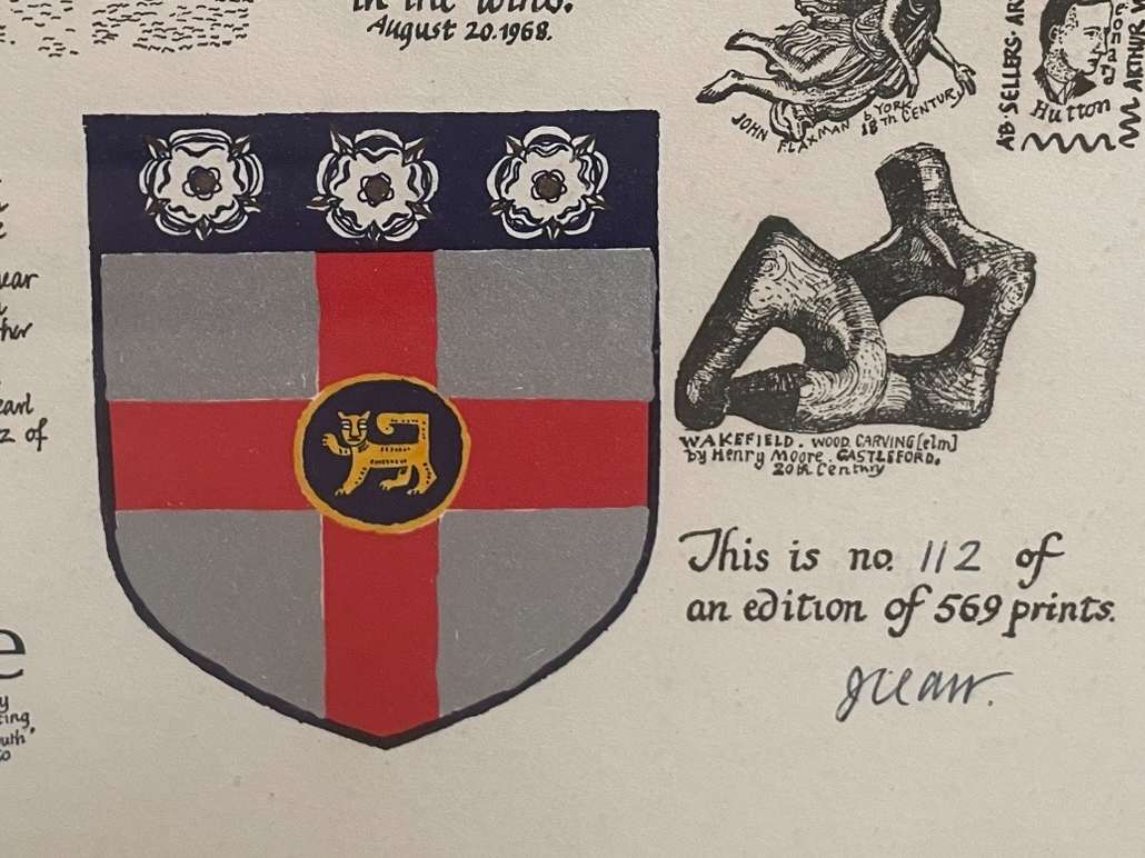
Detail of limitation (click to enlarge)
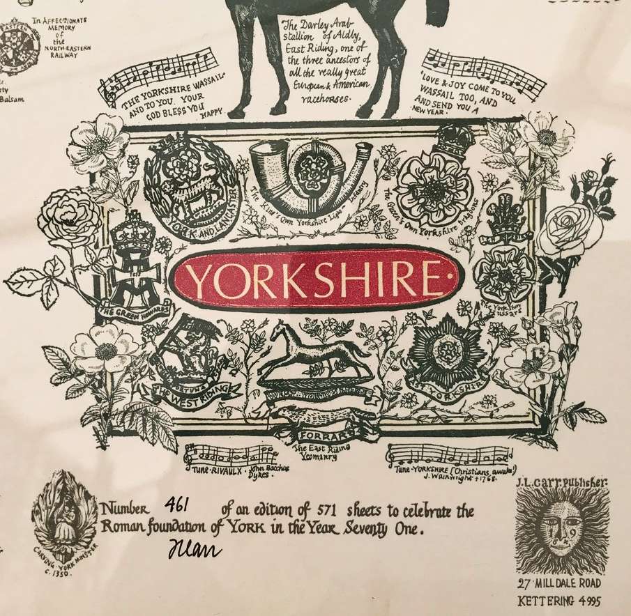
MAP-YOR3: Third edition
Publisher: J.L. Carr
Year: 1971
Limitation: 571 sheets
Size: 522 x 588 mm
Paper: white wove
Colophon: Sun face with full address
Signed: Beneath limitation, to left of colophon
Proofs where: British Library, number 49; AH
Notes: Edition of 571 sheets to celebrate the Roman foundation of York in the year 71
.
Quotation at base: 'The Lorde governeth me and no thing shall faile to me: in the place of pasture there he hath set me. He nurischide me on the water of refreshing: He convertide my soule. He led me forth on the path of riztfulness for his name.' From the first translation of the Bible into English by John Wyclif of Hipswell in the North Riding. He was later excluded from Oxford University and the Bishop of Lincoln burnt his bones & threw them in a Leicestershire stream.
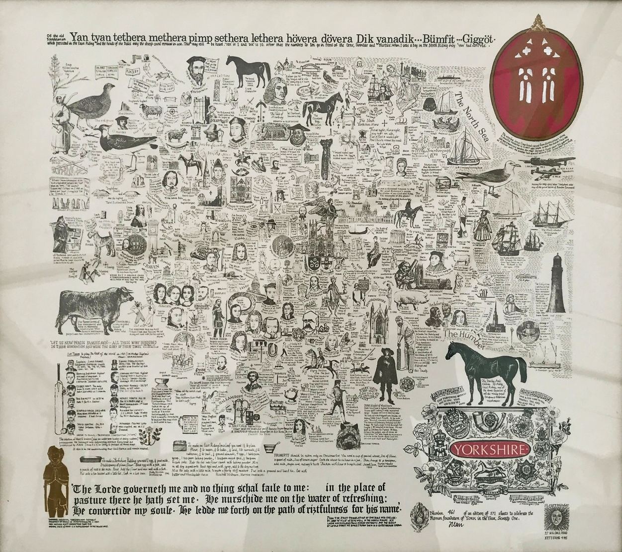
Image of map (click to enlarge)
Detail of limitation (click to enlarge)
MAP-YOR4.1: Fourth, 1st impression?
Publisher: J.L. Carr, 27 Mill Dale Road, Kettering
Year: 1972 (but ISBN registered in 1975)
Limitation: none stated
Size: 530 x 500 mm
Paper:
Colophon: Sun face
Signed: no
Proofs where: TD
Notes:
This map has no written limitation, unlike the almost identical proof shown immediately below, which suggests that it was issued first, before the text was added. The colophon is also slghtly lower on the sheet next to the roses than in the version below. Otherwise it seems to be the same.
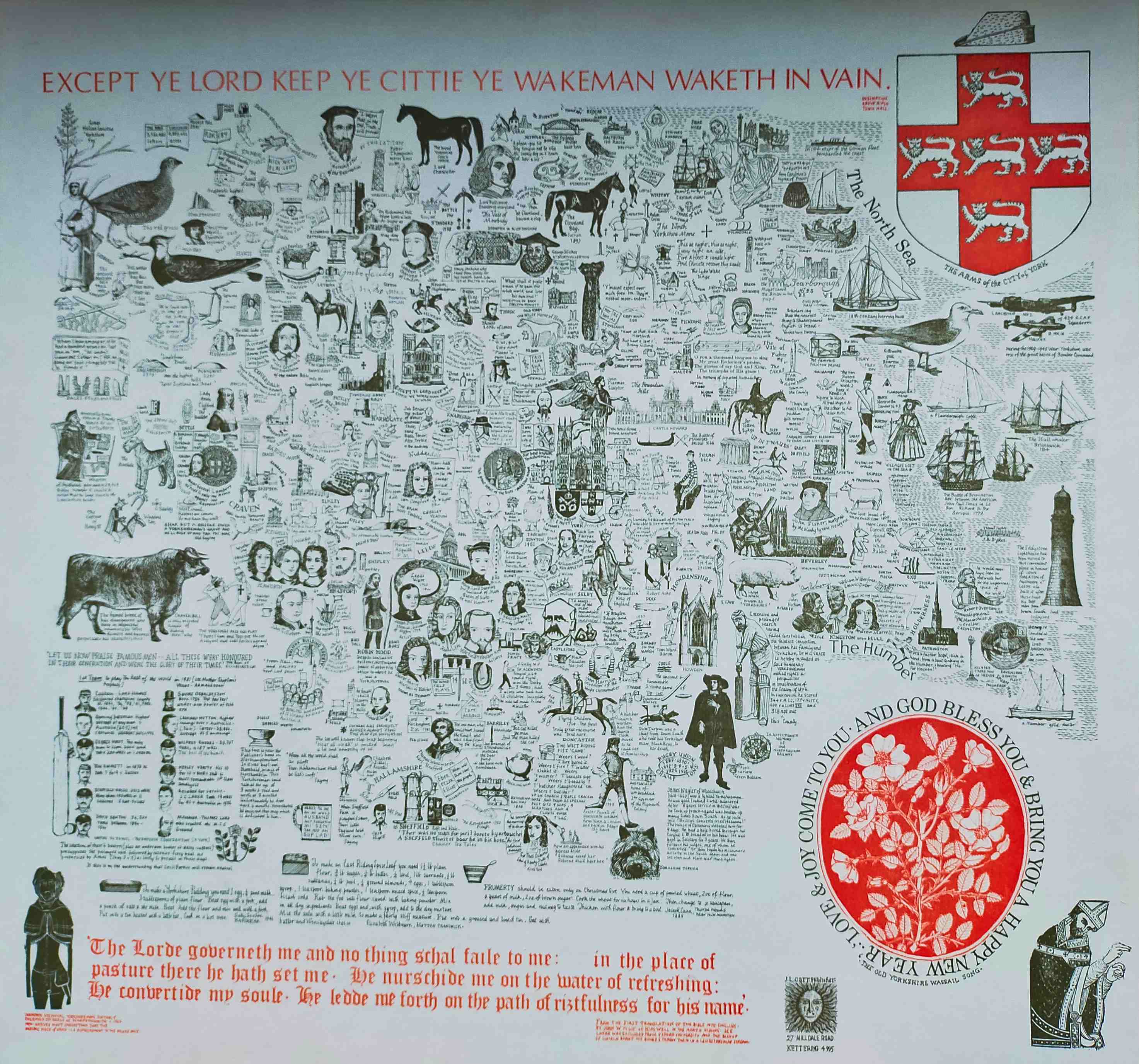
Image of map
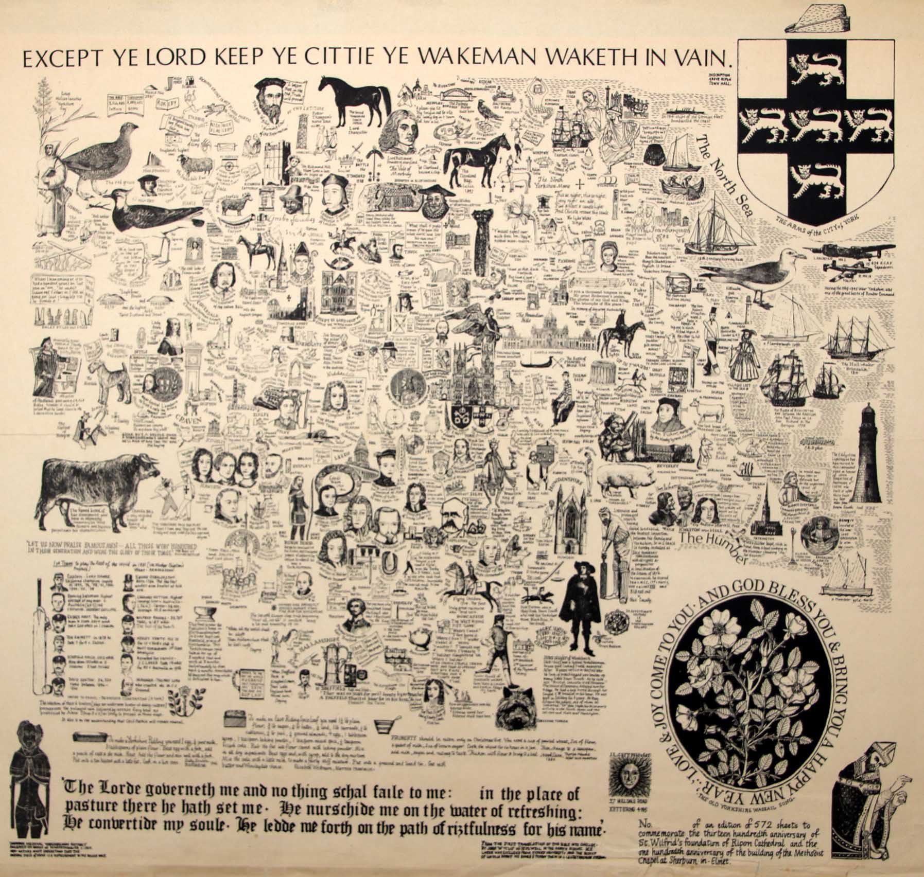
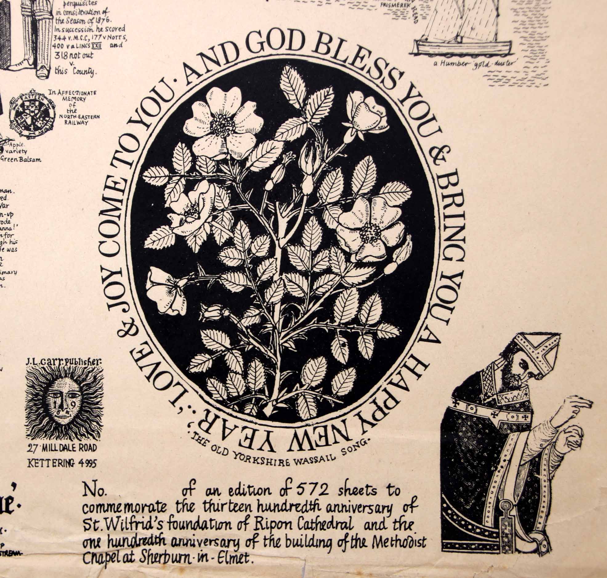
MAP-YOR4.2: Fourth edition, 2nd impression?
Publisher: J.L. Carr, 27 Mill Dale Road, Kettering
Year: 1972 (but ISBN registered in 1975)
Limitation: 572 sheets
Size: 520 x 570 mm (rough proof)
Paper: no information
Colophon: no information
Signed: no information
Proofs where: AH (proof)
Notes: The map illustrated is a proof.
This version was issued in an edition of 572 sheets to commemorate the thirteen hundreth anniversary of the foundation of Ripon Cathedral and the one hundredth anniversary of the building of the Methodist Chapel at Sherburn-in-Elmet.
Carr spent much of his childhood in Sherburn-in-Elmet, in the former Brittonic Kingdom of Elmet. The Methodist chapel, which opened on 27th April 1872, was demolished in 1986 and a new Methodist Church was built behind shops and a car park on Chapel View off Low Street.
Full proof map
Detail of limitation on proof
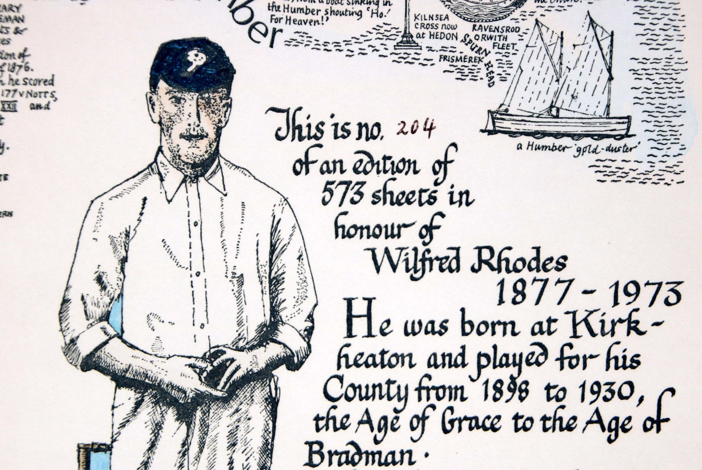
MAP-YOR5: Fifth edition
Publisher: J.L. Carr, 27 Mill Dale Road, Kettering
Year: 1973
Limitation: 573 sheets
Size: 520 x 570 mm
Paper: no information (proof laid down on card)
Colophon: sun face with address to left of figure of Wilfred Rhodes
Signed: Yes, below colophon
Proofs where: AH (map)
Notes: An edition of 573 sheets in honour of Wilfred Rhodes, 1877-1973. The text below this has been corrected: 200 wickets has been changed in pen to 100.
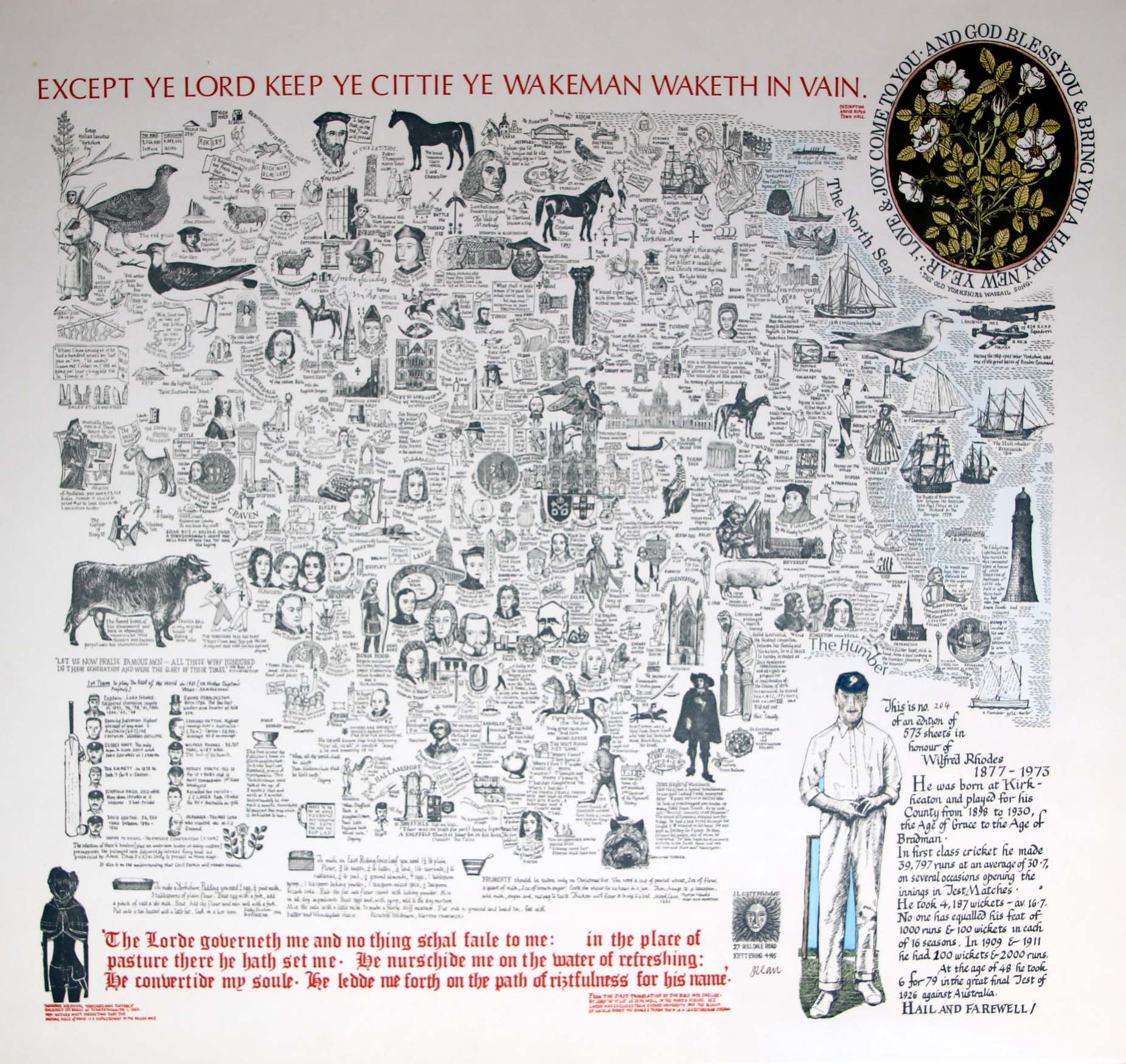
Image of map (click to enlarge)
Detail of limitation (click to enlarge)
MAP-YOR6: Sixth edition
Publisher: J.L. Carr, 27 Mill Dale Road, Kettering
Year: 1976
Limitation: 776
Size: 520 x 570 mm
Paper: no information
Colophon: no information
Signed: no information
Proofs where: TD
Notes: Commemorating the bi-centenary of John Harrison of Foulby whose chronometer made possible accurate measurements of longitude at sea.
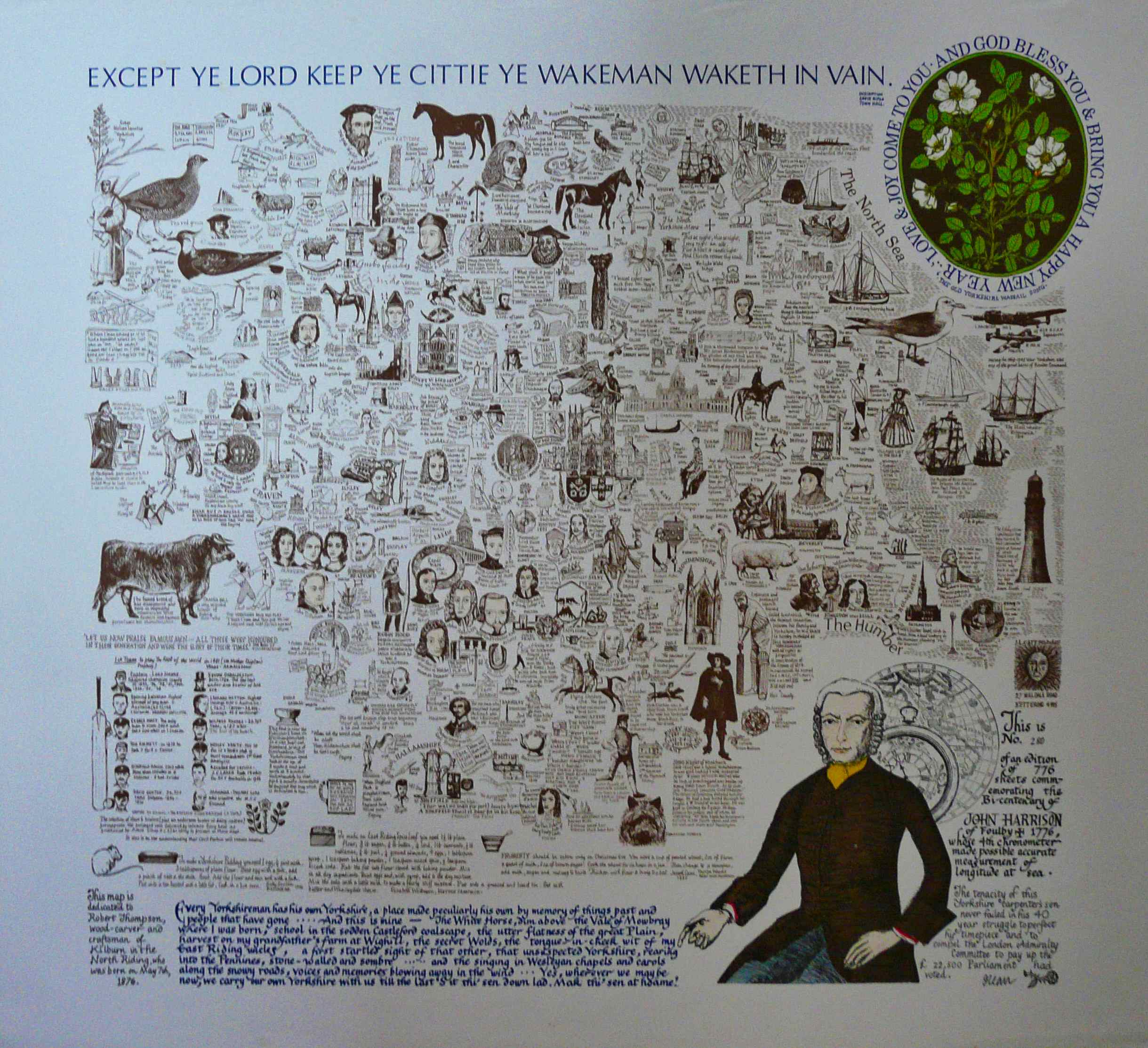
Image of map (click to enlarge)
MAP-YOR7: Seventh edition
Publisher: J.L. Carr, 27 Mill Dale Road, Kettering
Year: 1978
Limitation: 778
Size: xxx x xxx mm
Paper: no information
Colophon: no information
Signed: no information
Proofs where: no information
Notes:
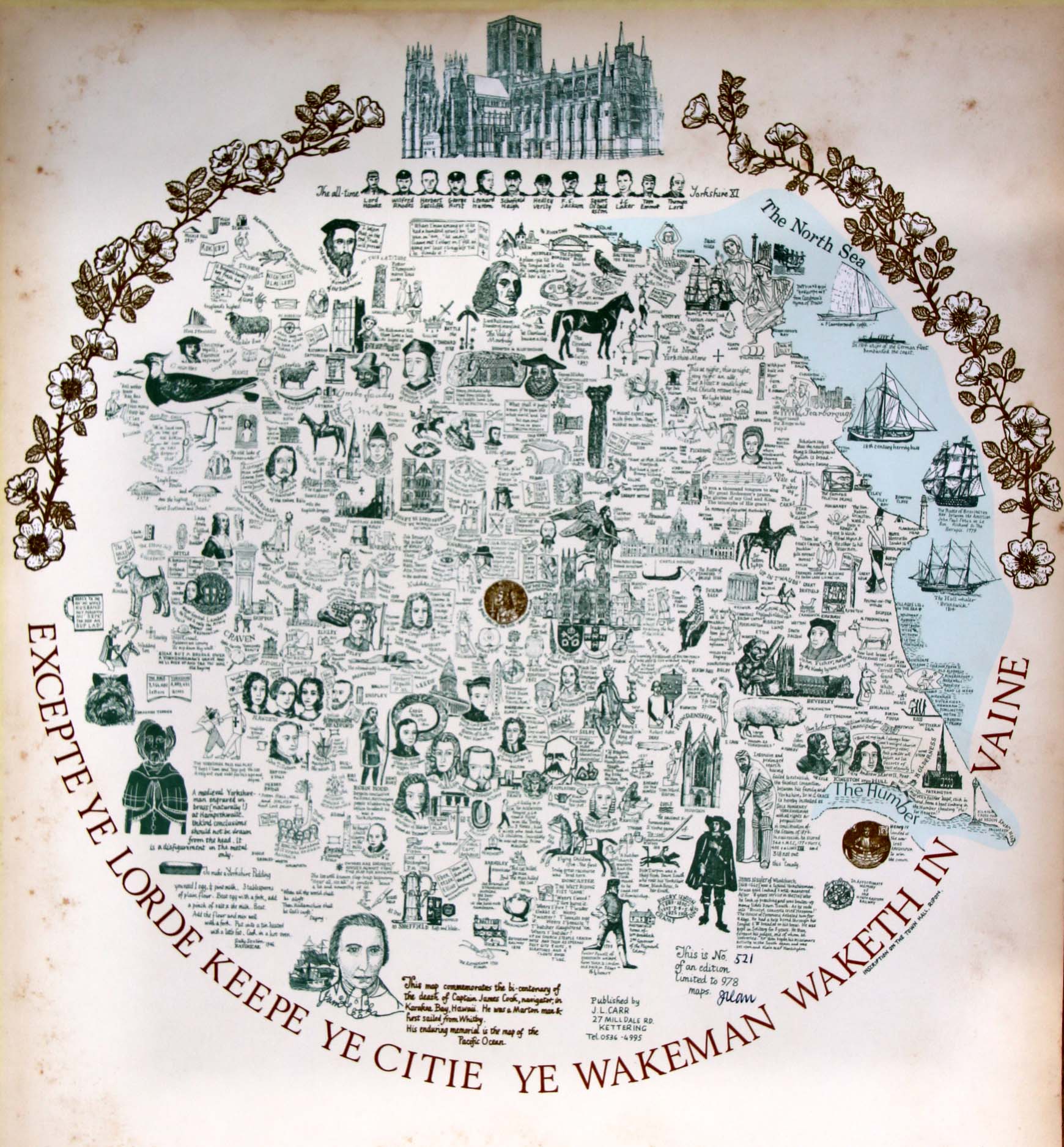
Image of map (click to enlarge)
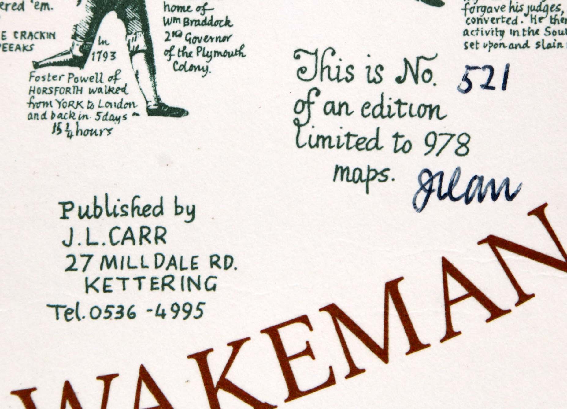
Detail of limitation (click to enlarge)
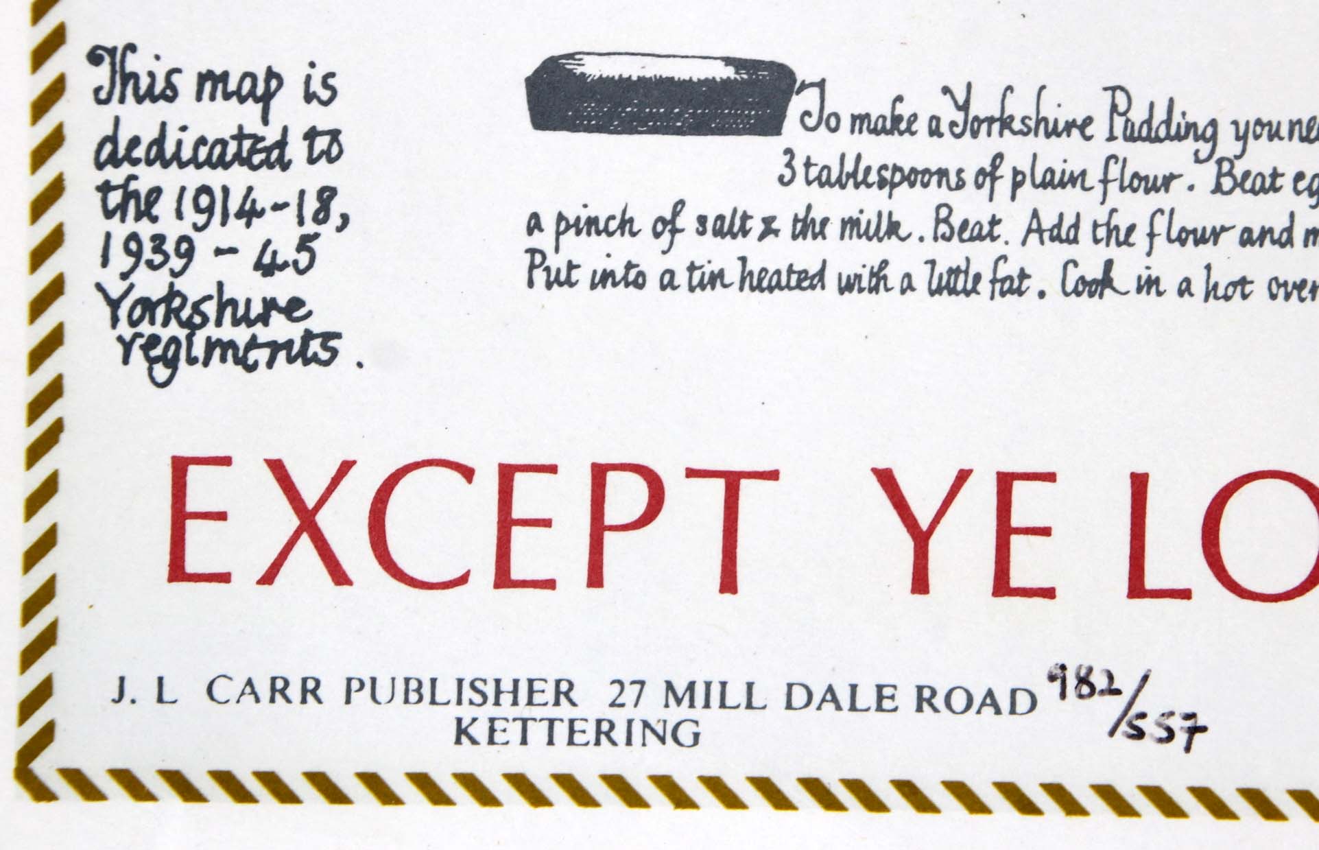
MAP-YOR8: Eighth edition
Publisher: J.L. Carr, 27 Mill Dale Road, Kettering
Year: 1982
Limitation: 982 sheets
Size: 455 x 530 mm
Paper: white card
Colophon: none
Signed: no
Proofs where: AH (map)
Notes: This map commemorates the bi-centenary of the death of Captain James Cook, navigator, in Karakea Bay in Hawaii. The limitation is written by hand but it is not signed. Another proof has been seen, also not signed.
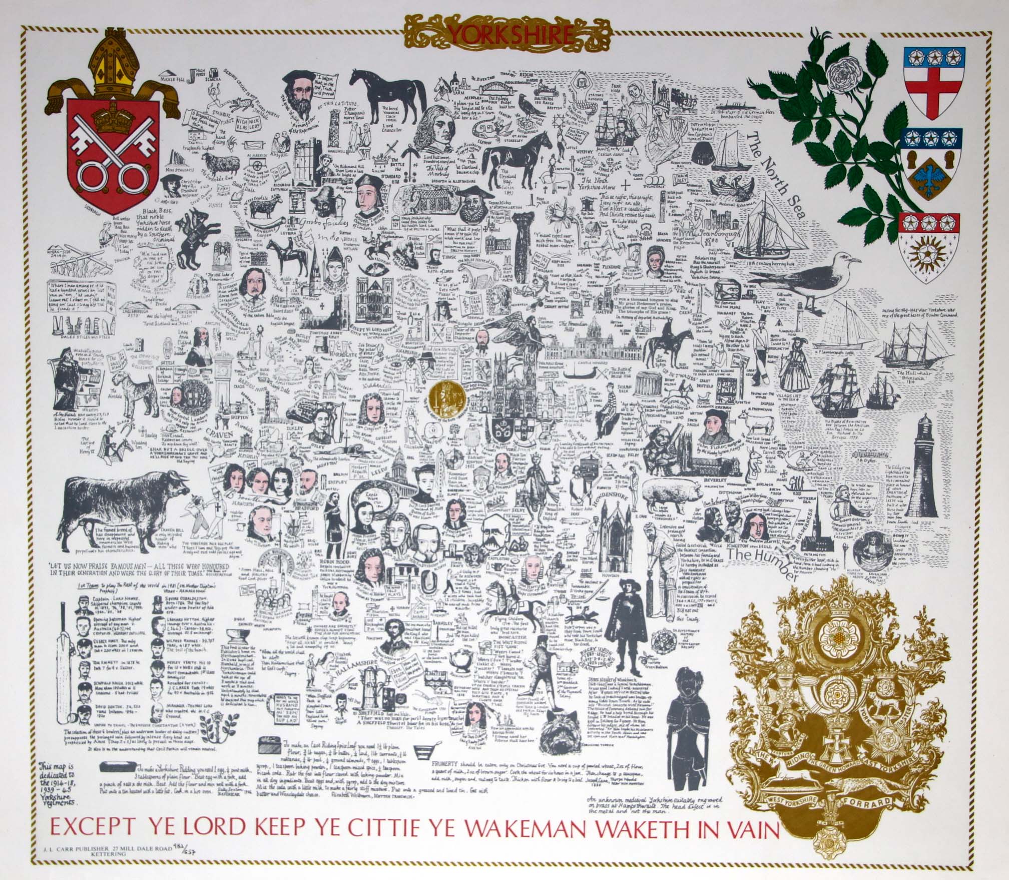
Image of map (click to enlarge)
Detail of limitation (click to enlarge)