Worcestershire
In his History of the QTP (1987) Carr reported that he had published two maps of Worcestershire. It is unusual in that they are identical except for the limitation, so the second map should be considered as a second impression.
(Last updated on 14/2/2026)
MAP-WOR1.1: First edition
Publisher: J.L. Carr, 27 Mill Dale Road, Kettering, Northamptonshire
Year: 1972
ISBN: 0900847336
Limitation: 572 sheets
Size: 577 x 445 mm (proof map)
Paper: thick white card
Colophon: sun face with address, bottom left, next to shields
Signed: yes, in middle below the two shields at the base
Proofs where: AH (map & proof)
Notes: This map is identical to the second impression, except for the limitation. The map is Dedicated to Bernard Acton, a true Worcestershire man. The shield at the top of the map has been decorated in silver paint. The sheilds at 10 o'clock and 4 o'clock are also decorated by hand. They have been seen in red on different backgrounds.
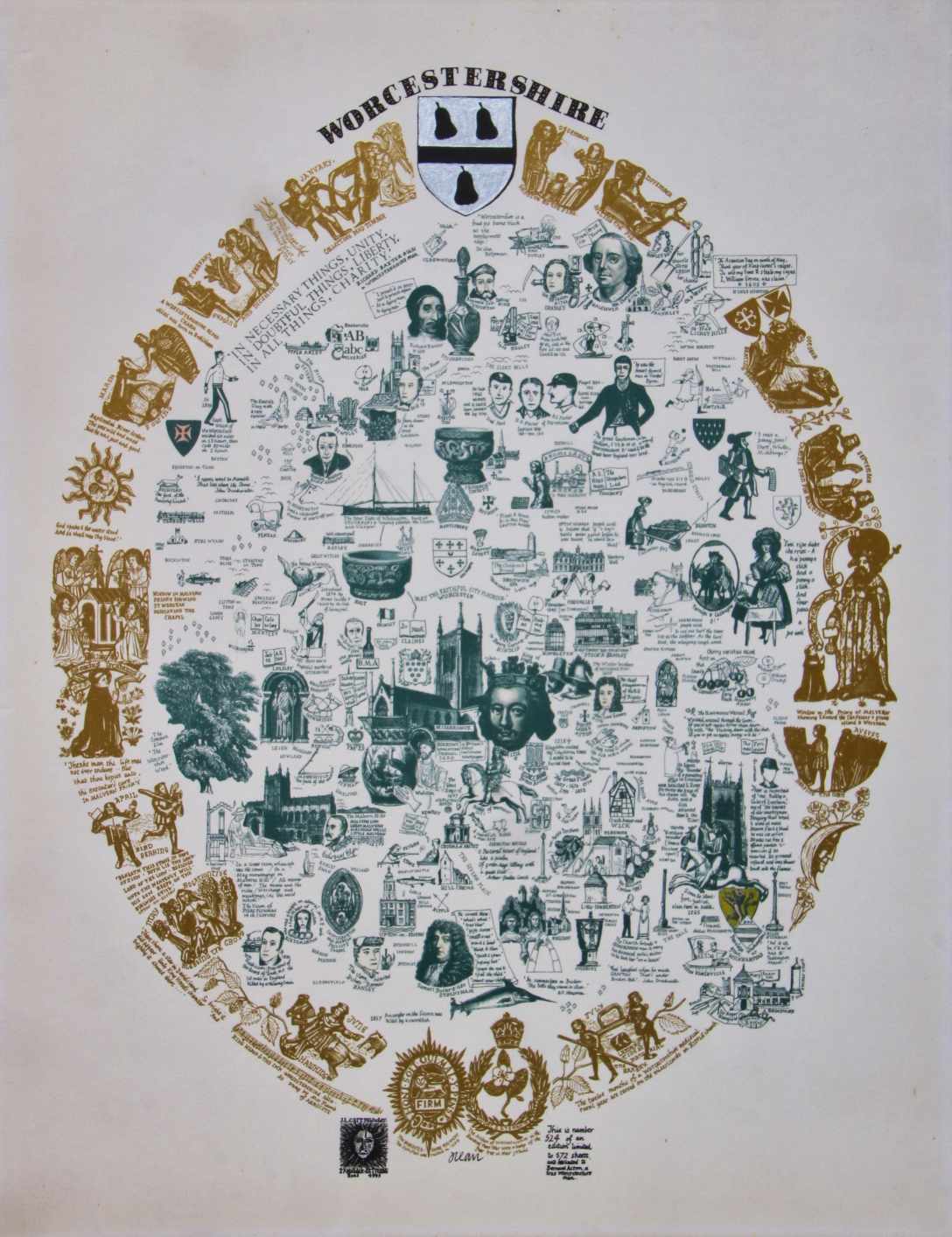
Full map (click to enlarge)
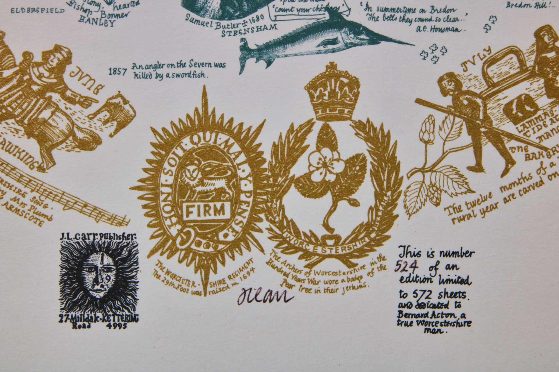
Detail of limitation (click to enlarge)
MAP-WOR1.2: Second impression
Publisher: J.L. Carr, 27 Mill Dale Road, Kettering, Northamptonshire
Year: 1976 (presumed from limitation)
ISBN: none
Limitation: 776 sheets
Size: 575 x 447 mm
Paper: no information as sheet laid down on card
Colophon: sun face with address, bottom left, next to shields
Signed: yes, below limitation to lower right margin
Proofs where: Kettering Public Library (map); AH (map)
Notes: This map is identical in design to the first edition, except for the limitation and dedication.
In 2026 the Quince Tree Press were selling unsigned, numbered proofs of the same map with the same limitation for £15.
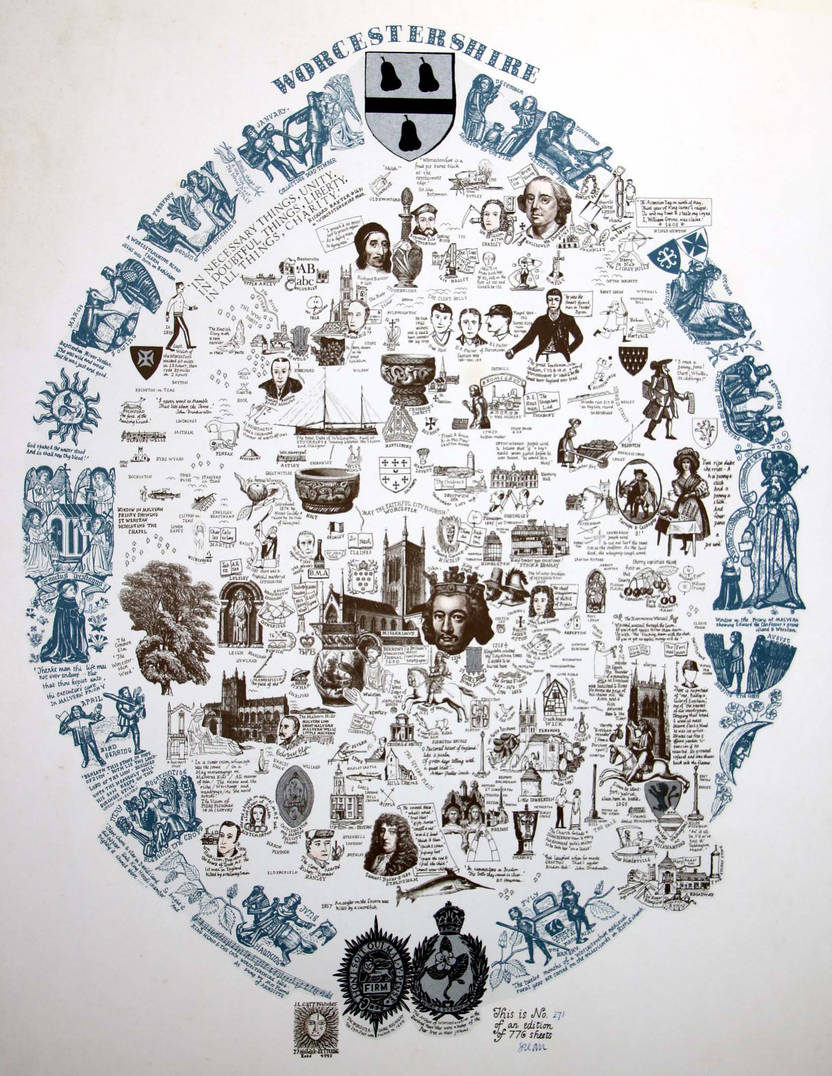
Full map (click to enlarge)
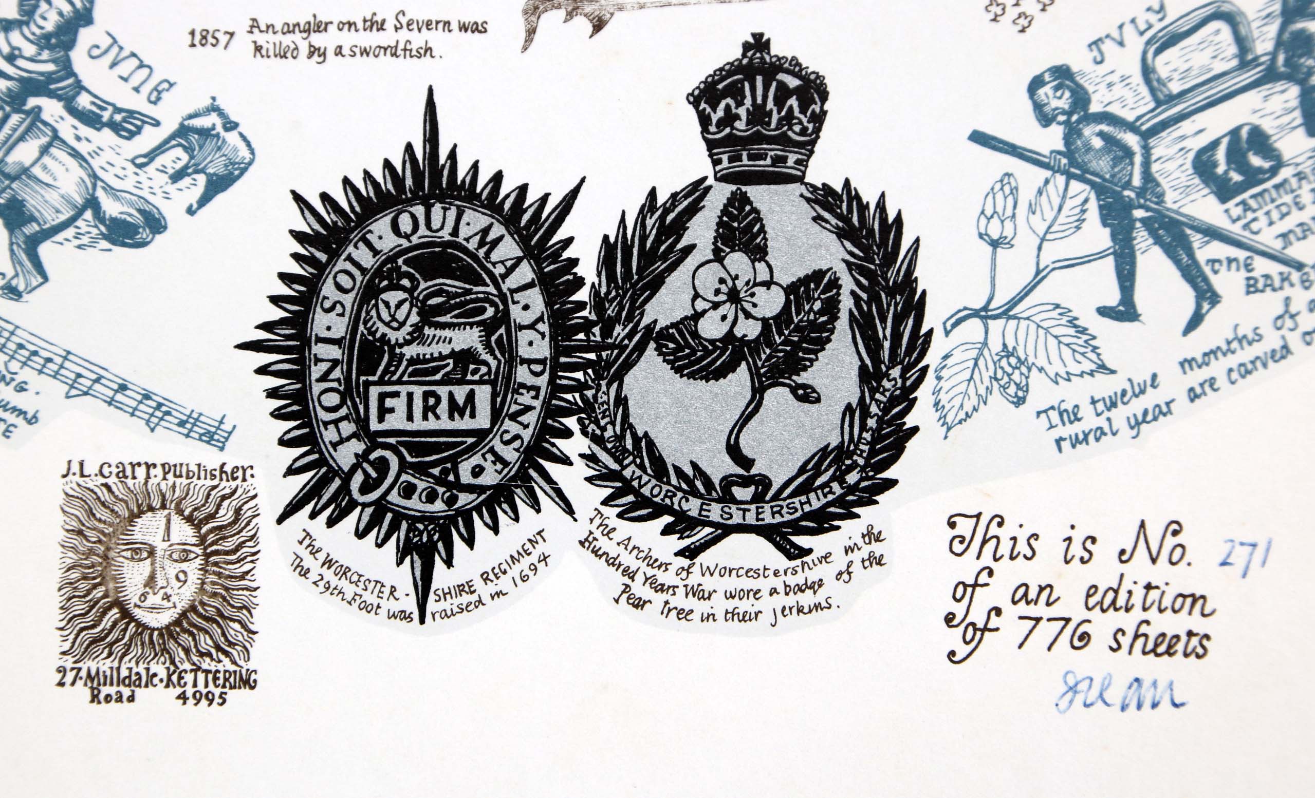
Detail of limitation (click to enlarge)