Wales - Cymru
There are three maps of the Wales: one published in an edition of 569 sheets in 1969; one published in an edition of 980 sheets in 1980; and a map entitled Cymru am byth!
(Wales Forever), with no limitation or date. The second map has not been seen.
The National Library of Wales has a map entitled Gwisg genhinen yn dy gap a gwisg o yn dy galon which translates as Wear a leek in your hat and also in your heart
. It is a pictorial map of Wales in red ink on green wrapping paper, 500 x 370 mm, dated [1969].
(Last updated on 13/9/2021)
MAP-WAL1: First edition
Publisher: J.L. Carr
Year: 1969
ISBN: 0900847042
Limitation: 569 sheets
Size: 500 x 370 mm
Signed: Yes
Proofs where: Kettering (proof only); National Library of Wales
Notes: The map reproduces the heads of 13 men and the following text: Let us praise famous men. All those were honoured in their generations and were the glory of their times.
There are two copies of this map in the National Library of Wales. Carr donated a copy which he sent with a manuscript note:
Presented to the National Library of Wales by James Lloyd Carr, a Welsh patriot by proxy, who alone and without allies defended the land of his fathers (by baptism) on many a bloody-nosed Yorkshire playground (whilst) scarcely knowing Wales existed. Whilst gazing at the Monument of misinformation, honour the child-that-was martyred on your behalf. That reward will be almost enough. May 20th 1969.
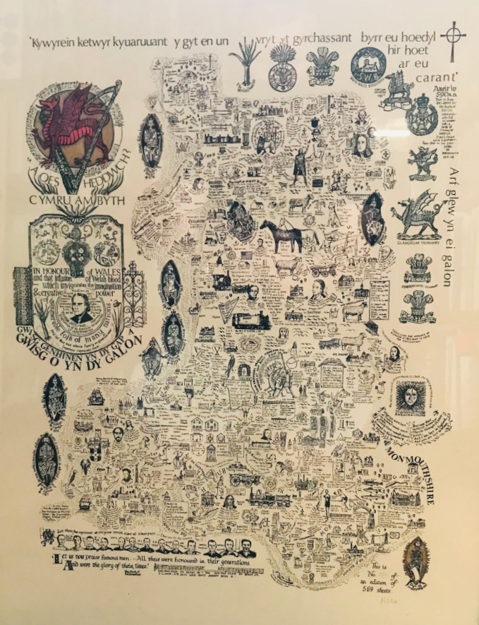
Image of map (click to enlarge)
The limitation according to the ISBN on Amazon is 500 sheets. However the two copies in the National Library of Wales listed here both have a limitation of 569 sheets and the photo above shows 569 too.
Thanks to Mike Goodenough for the photo of the map.
MAP-WAL2: Second edition
Publisher: J.L. Carr
Year: 1980
ISBN:
Limitation: 980 sheets
Size: xxx x xxx mm
Signed:
Notes:

Image needed
MAP-WAL3: Third edition
Publisher: J.L. Carr
Year: not known
ISBN: none
Limitation: none
Size: 417 x 316 mm
Signed: no
Notes: This is an unlimited edition of a map of Wales, produced perhaps to meet constant demand, rather like the blue
map of England & Wales.
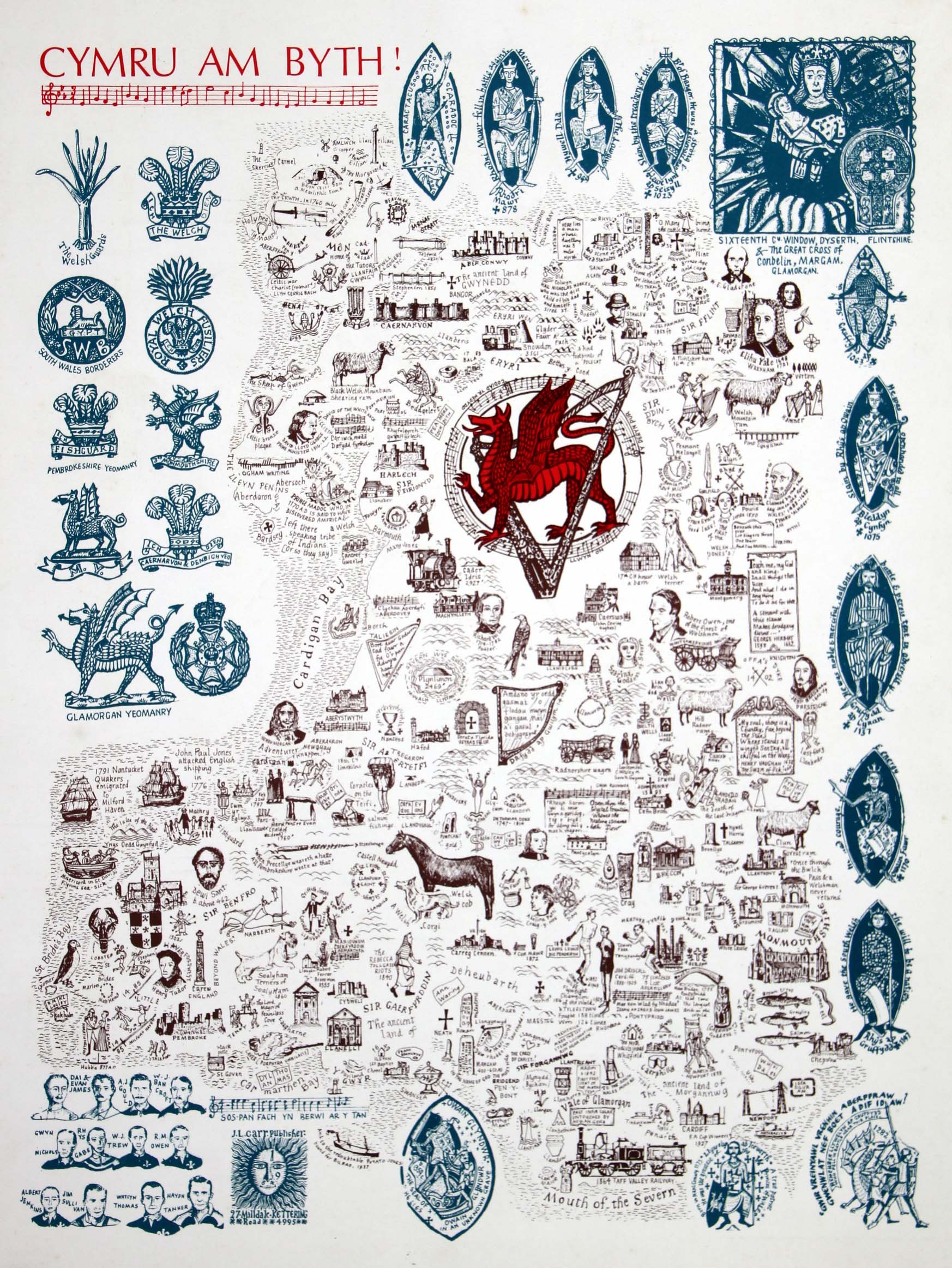
Image of map (click to enlarge)
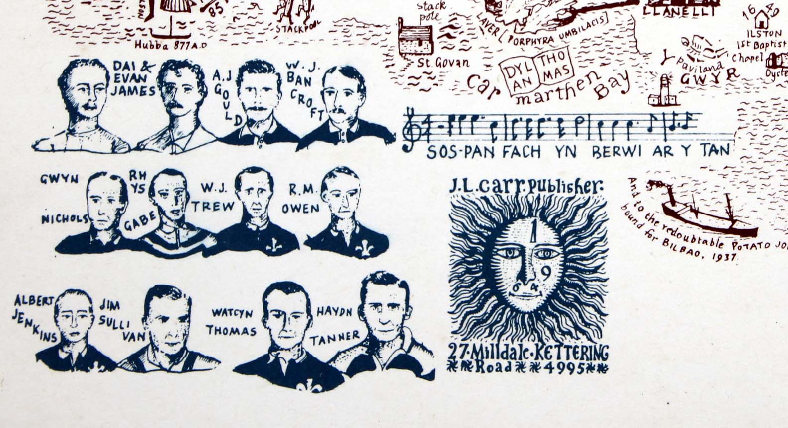
Detail of map (click to enlarge)