Sussex
In his History of the QTP (1987) Carr reported that he had published two editions of a map of Sussex. Three have been seen, including one that seems unfinished, while the first edition may have been reissued in a second, numbered, impression after a first, unnumbered impression.
(Last updated on 22/5/2025)
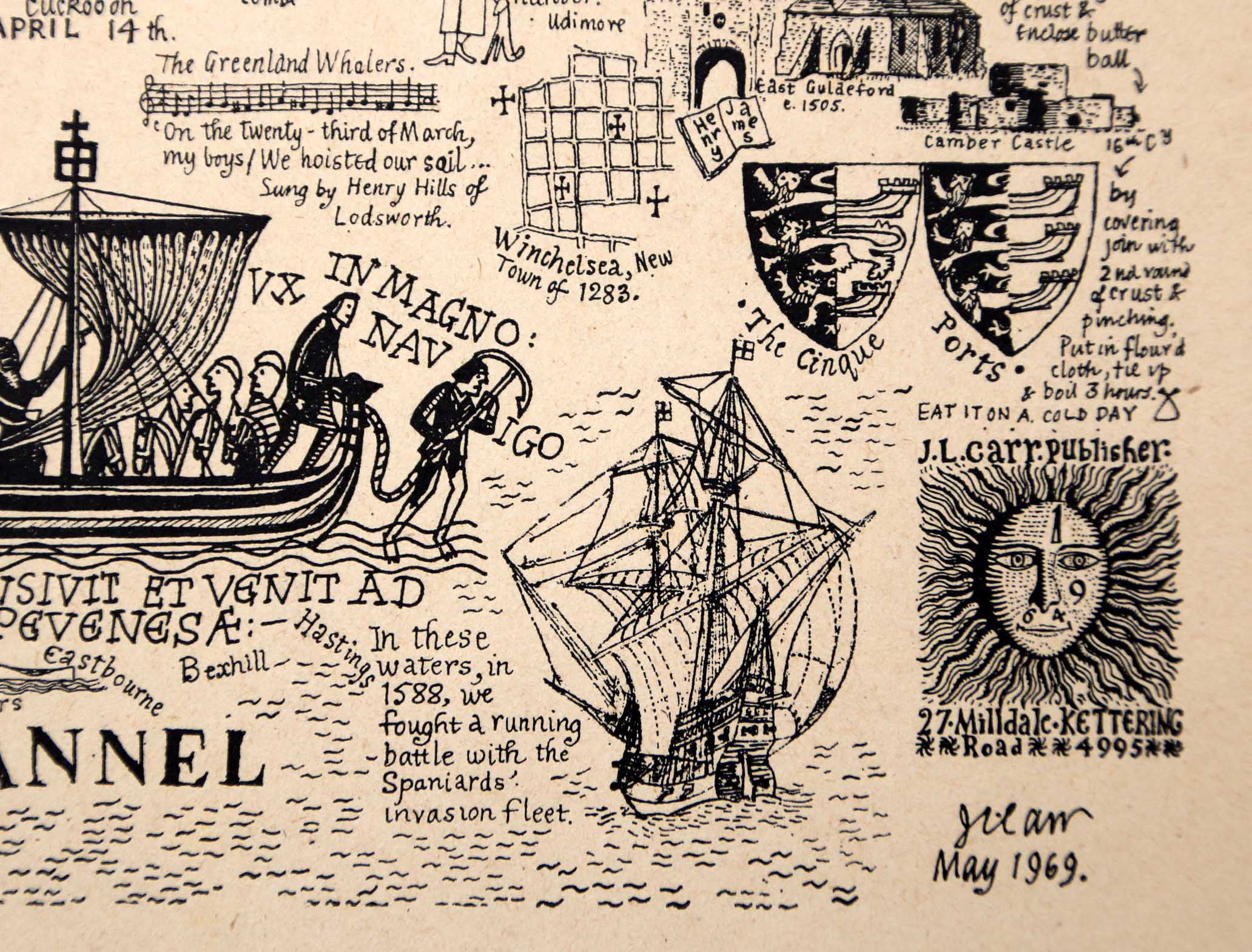
MAP-SUS1: First edition
Publisher: J.L. Carr, 27 Mill Dale Road, Kettering, Northamptonshire
Year: May 1969 (dated on map) or June 1969 (according to ISBN)
ISBN: 0900847050
Limitation: none specified on one proof, but a map has been seen limited to 560 sheets (see below) and this number is listed on Amazon.co.uk under the ISBN
Size: 440 x 573 mm (proof sheet)
Paper: no information
Colophon: sun face and address, lower right corner
Signed: signed in proof, lower right and dated May 1969
Proofs where: Kettering Public Library (proof); AH (proof)
Notes: Two versions of this map have ben seen: one without a limitation and one with a limitation of 560 'prints', written by hand. It is unusual that Carr used the term 'prints' rather than the usual 'sheets'.
Thanks to Tim Dean for a photograph of a map.
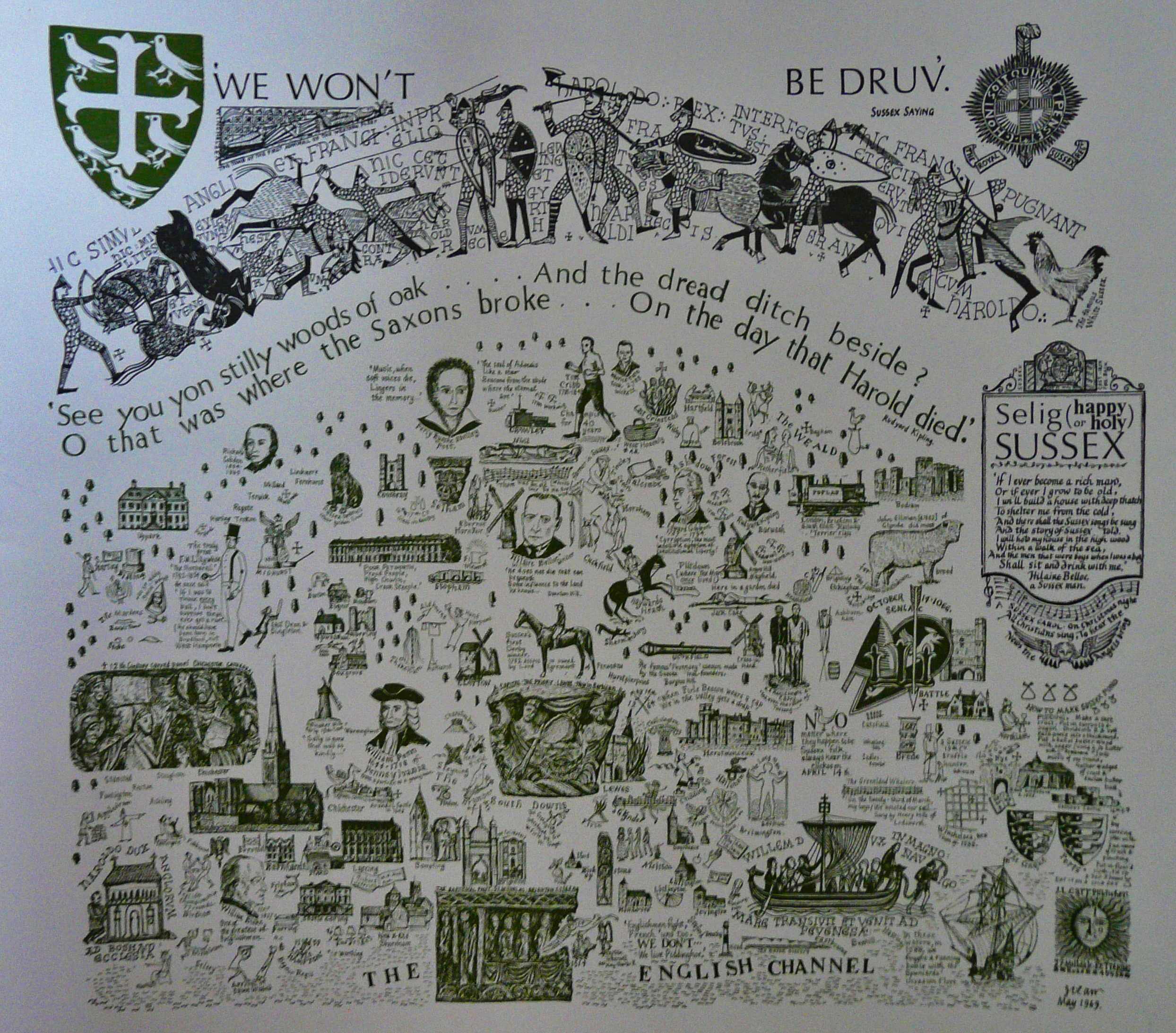
Photograph of full map
Detail of limitation on rough proof map
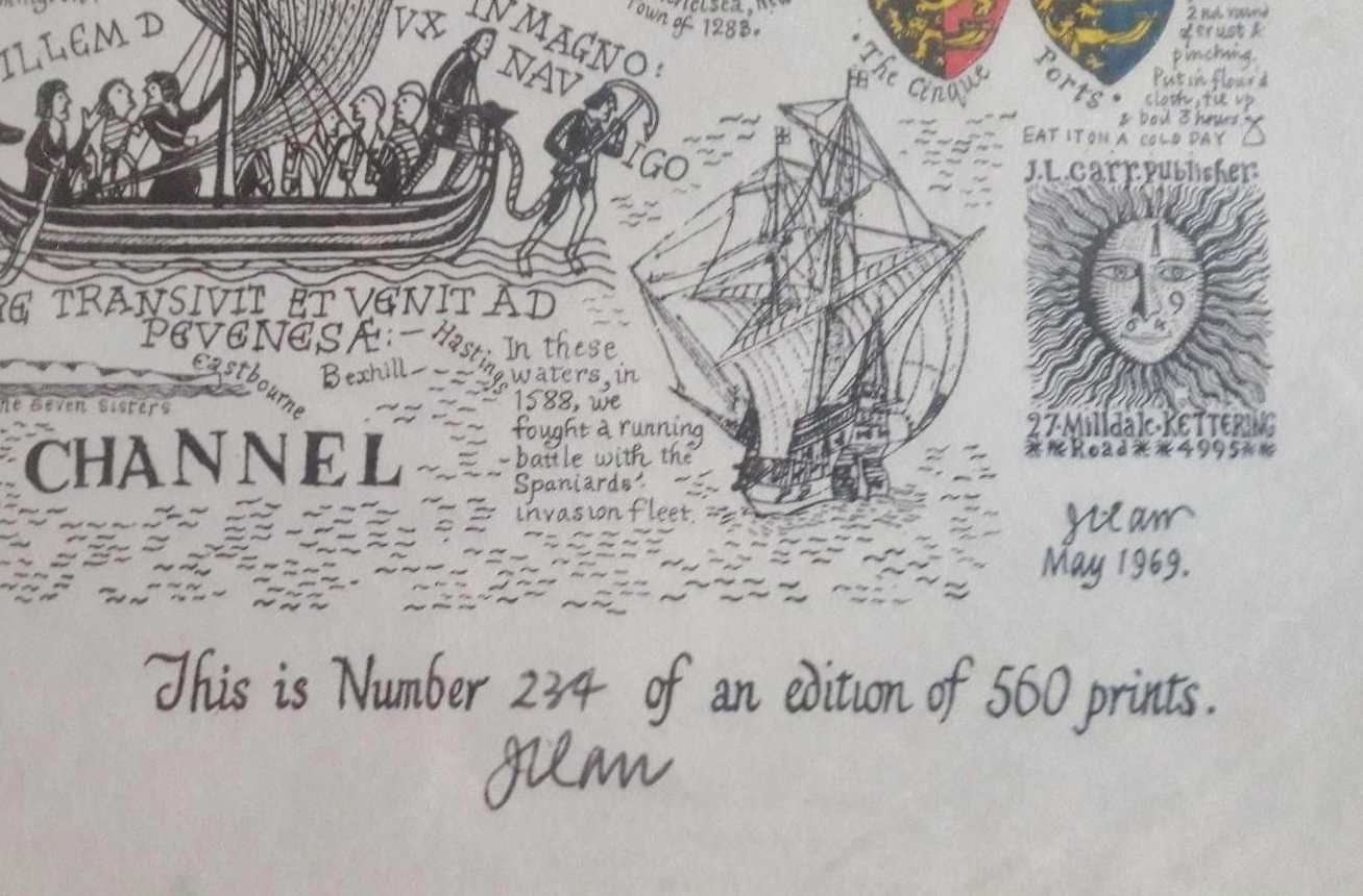
Detail of limitation on a map
MAP-SUS2: Second edition
Publisher: J.L. Carr, 27 Mill Dale Road, Kettering, Northamptonshire
Year: unknown
ISBN: none
Limitation: none
Size: 316 x 481 mm
Paper: card
Colophon: sunface with address and telephone number
Signed: not on proof seen
Proofs where: AH copy
Notes: This is assumed to be a second edition as the first is dated 1969, which is quite early. This map seems unfinished as it has a lot of white space at the bottom, which is unusual. Perhaps Carr was going to add some text? There is also no limitation, which was usually handwritten at the bottom, often under the colophon. Perhaps this is a trial proof, though Carr probably wouldn't have liked the extra expense involved of printing a trial in colour, on card. The copy shown is also printed only in brown and gold, there is no hand colouring.
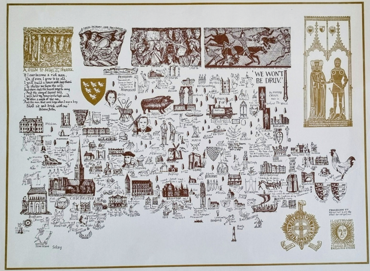
Image of map (click to enlarge)
MAP-SUS3: Third edition
Publisher: J.L. Carr, 27 Mill Dale Road, Kettering, Northamptonshire
Year: 1978
ISBN: none
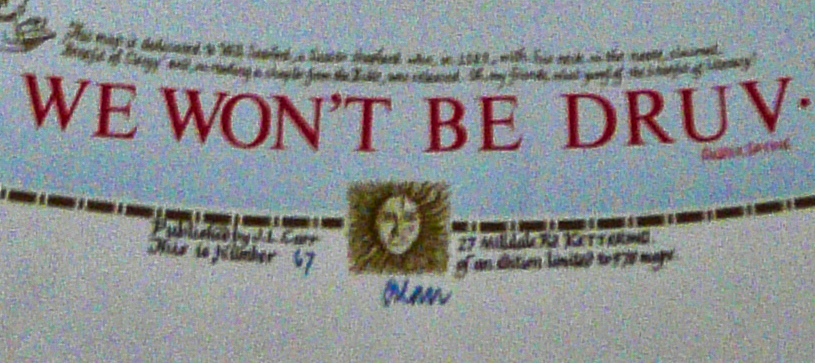
Limitation: 978 longsheets
Size: 578 x 451 mm
Paper: no information
Colophon: sunface only, with name to left and address to right
Signed: at lower margin, below colophon
Proofs where: Kettering Public Library (map)
Notes: Dedicated to Will Seaford, a Sussex shepherd who, in 1583, with his neck in the noose claimed benefit of clergy.
Thanks to Tim Dean for a photograph of a map.
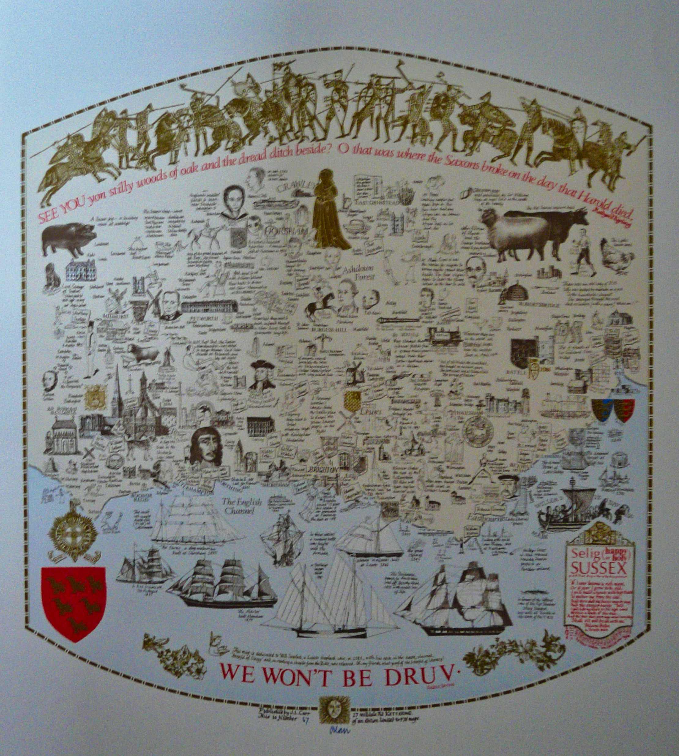
Image of map (click to enlarge)
Detail of limitation (click to enlarge)