Staffordshire
In his History of the QTP (1987) Carr reported having published two editions of a map of Staffordshire; two have been seen.
(Last updated on 14/2/2026)
MAP-STA1: First edition
Publisher: J.L. Carr, 27 Mill Dale Road, Kettering, Northamptonshire
Year: 1975
ISBN: 0900847573
Limitation: 750 sheets
Size: 630 x 450 mm
Paper: thin white card
Colophon: sun face with address, lower left corner
Signed: Yes, below limitation, lower right margin
Proofs where: Kettering Public Library (proof); AH (map & proof)
Notes: Celebrating the centenary of Sidney Barnes...
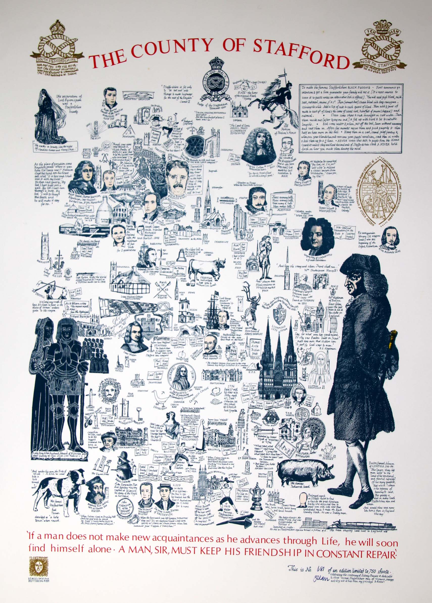
Image of map
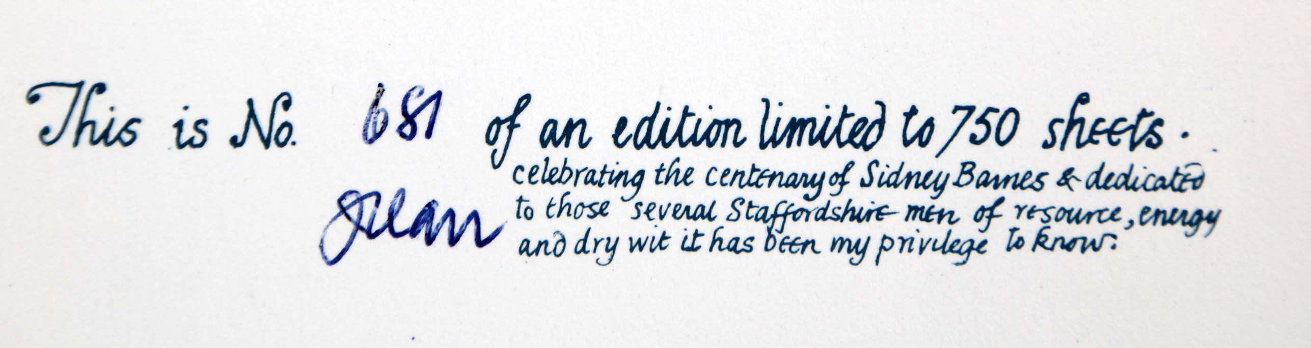
Detail of limitation (click to enlarge)
MAP-STA2: Second edition
Publisher: J.L. Carr, 27 Mill Dale Road, Kettering, Northamptonshire
Year: 1982
ISBN: none
Limitation: 982 sheets
Size: 598 x 396 mm
Paper: no information
Colophon: no information
Signed: no information
Proofs where: Kettering Public Library (map)
In 2026 the Quince Tree Press were selling unsigned, numbered proofs of the same map with the same limitation for £15.
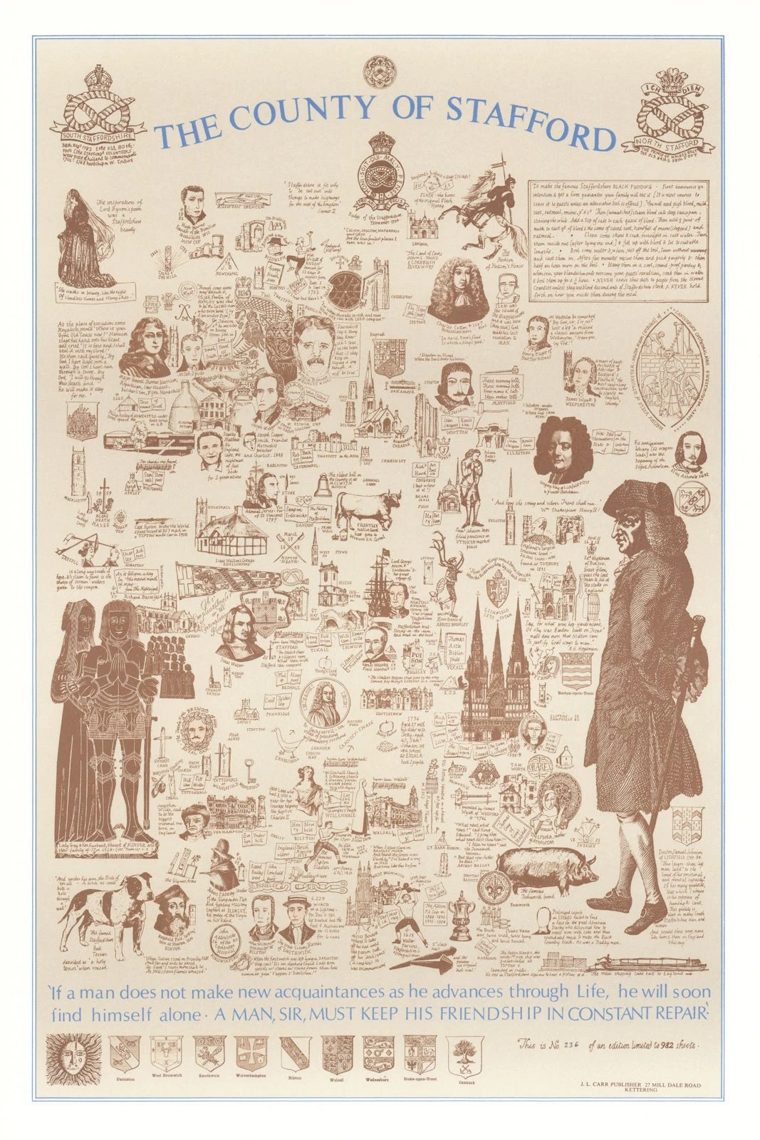
Image of map