Somerset
In his History of the QTP (1987) Carr reported having published two editions of a map of Somerset. Two editions have been seen, one of 500 sheets the other of 502 sheets. I suspect that Carr may have changed the number of sheets slightly when he issued a second edition, so I have assumed that the edtion of 500 came first.
(Last updated on 8/6/2025)
MAP-SOM1: First edition
Publisher: J.L. Carr, 27 Mill Dale Road, Kettering
Year: May 1971 (date ISBN registered)
ISBN: 0900847158
Limitation: 500 sheets
Size: 456 x 521 mm
Signed: Yes
Proofs where: AH proof
Notes: The red highlights are probably added by hand in watercolours
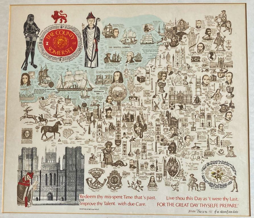
Image of map (click to enlarge)
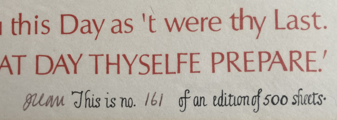
Detail of limitation (click to enlarge)
MAP-SOM2: Second edition
Publisher: J.L. Carr, 27 Mill Dale Road, Kettering, Northamptonshire
Year: September 1975 (date ISBN registered)
ISBN: 0900847484
Limitation: 502 sheets
Size: 521 x 583 mm
Paper: thin white card
Colophon: sun face with address and Northamptonshire, lower right corner
Signed: No
Proofs where: Kettering Public Library (map); AH (map & proof)
Notes: The figures either side of the title and the carving below have been hand-painted in a brown wash (see detail below). The flower, lower right, may also have been decorated in water colours as the colours are different from anywhere else on the map.
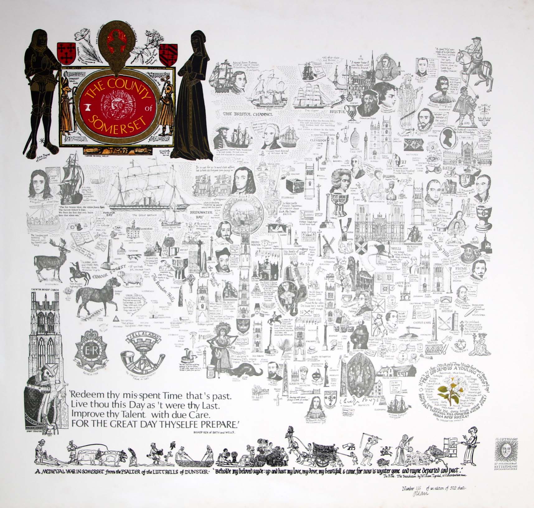
Image of map (click to enlarge)
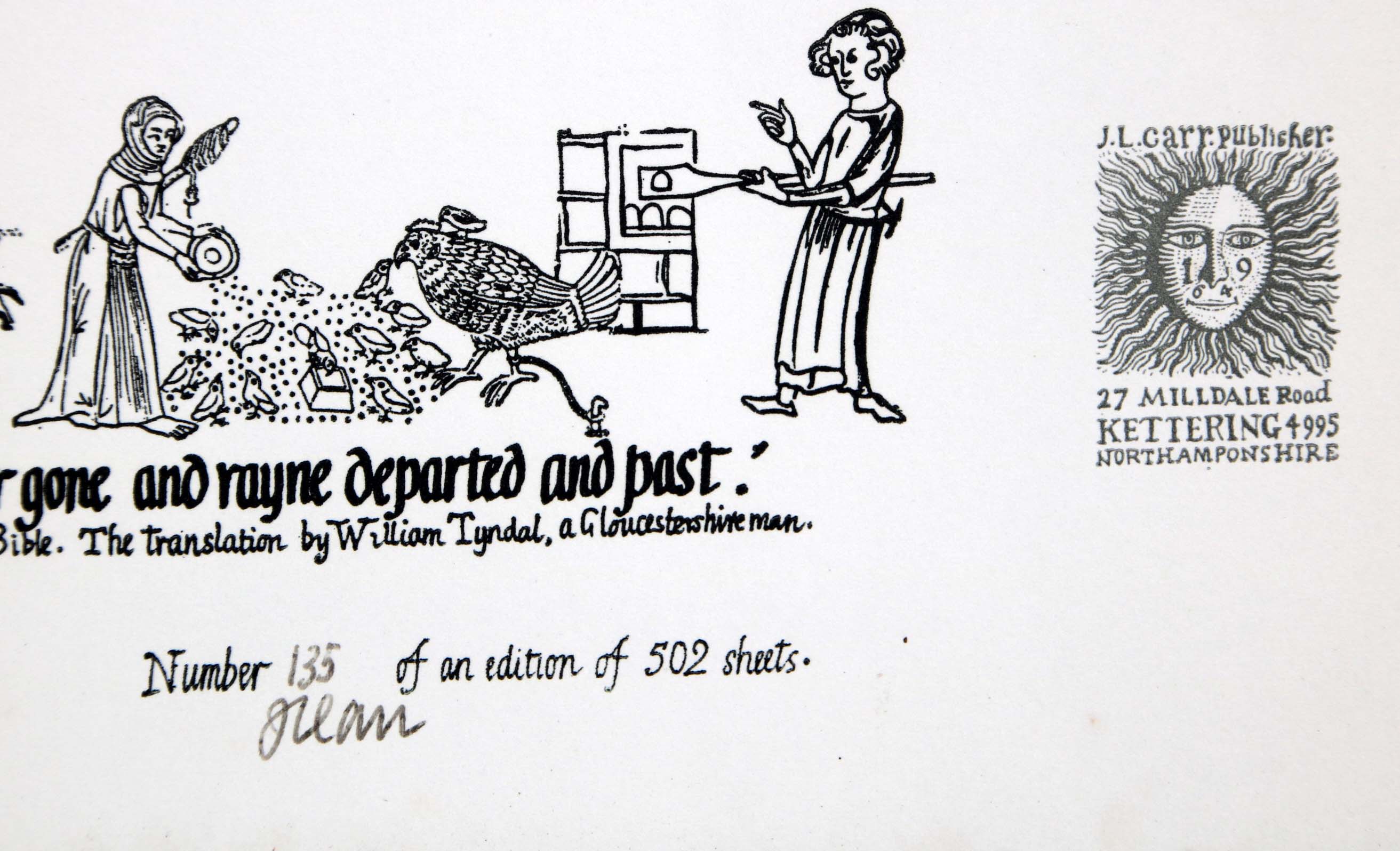
Detail of limitation (click to enlarge)