Rutland
In his History of the QTP (1987) Carr reported three maps of Rutland. Rutland is one of the old English counties that was lost in 1974 when it became a non-metropolitan district of Leicestershire, but it was reinstated in 1994 as a unitary authority and as a ceremonial county.
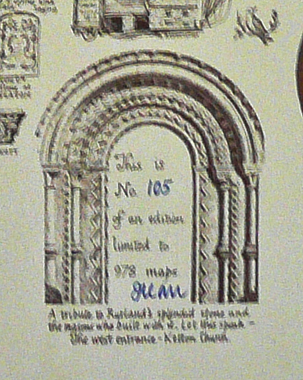
Two different versions of a map in an edition of 500 sheets have been seen: one printed on white paper with the horseshoe in yellow, and an edition on grey paper with the horseshoe printed in red. The colophons and main circle of text are also printed in different colours. A second, different edition, of 978 sheets was issued in 1978.
(Last updated on 14/2/2026)
MAP-RUT1.1: First edition, first impression
Publisher: J.L. Carr, 27 Mill Dale Road, Kettering
Year: 1972
ISBN: 0900847271
Limitation: 500 sheets
Size: 531 x 452 mm
Signed: Yes, to right of limitation, underneath colophon
Paper: thick white card
Colophon: sun face with address at lower margin, centre
Proofs where: AH (two maps & proof)
Notes: This is presumed to be the first edition of this map, printed on quite thick white card with the circle of text and the two ploughs and colophon printed in black. The background of the horseshoe is printed in yellow.
Unlike other proof maps, which are printed only in black ink, the proof of this map is printed in three colours: blue for the decorations within the circle; black for the text in upper case letters around the and the ploughs; and brown for the horse shoe at the bottom and the plants at the top. The map is labelled in red: ROUGH PROOF ONLY. This colouring is the same as the map illustrated to the left. The drum and crwon have been coloured by hand.
On both copies of his map that I own a feature at the top, centre has been edited by hand. It shows a man on skis and states 'In 1940 Police Sgt. Codd ski'd to he aid of A1 motorists'. The zero has been changed to 7, so to 1947.
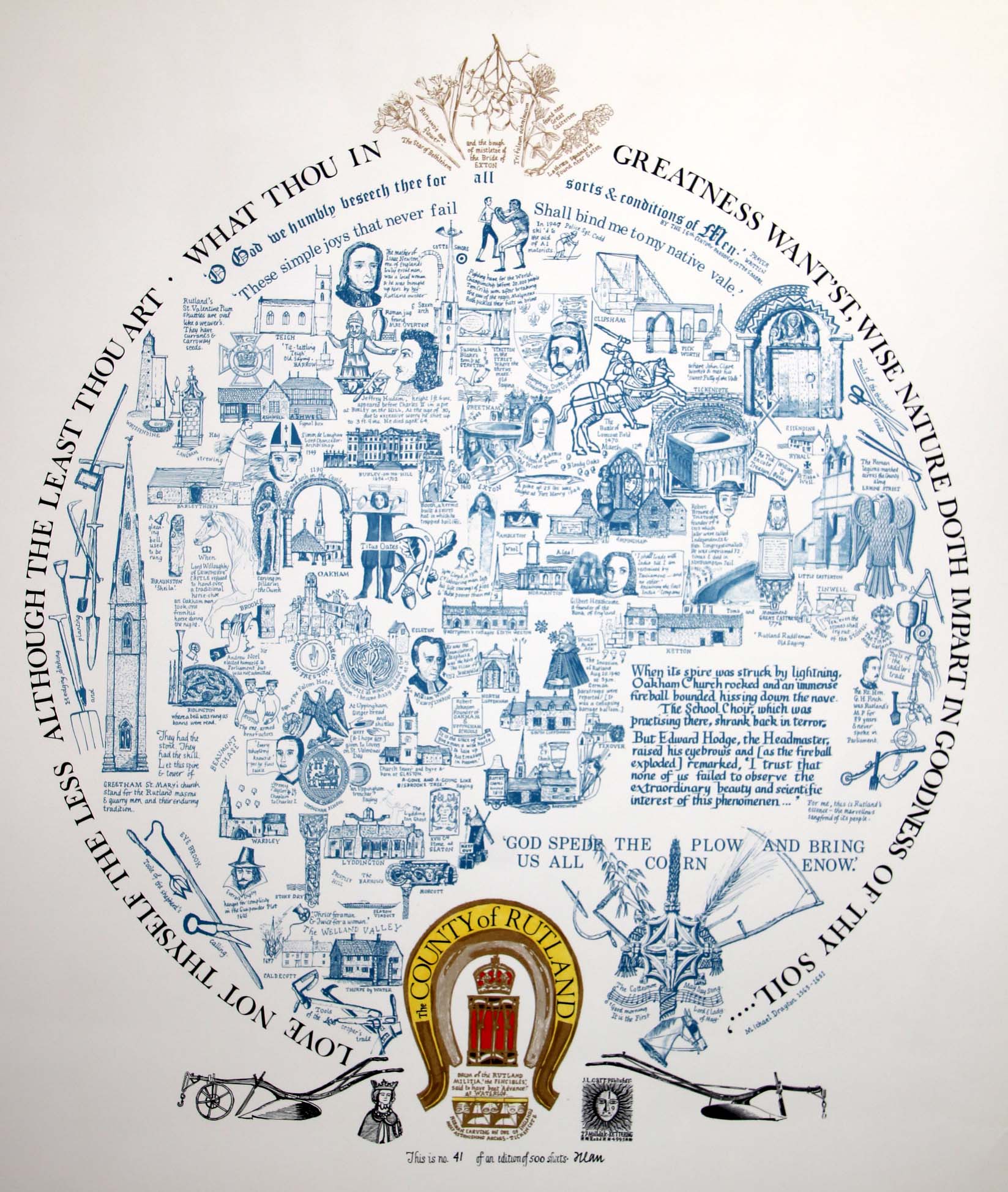
Full map, version on white paper
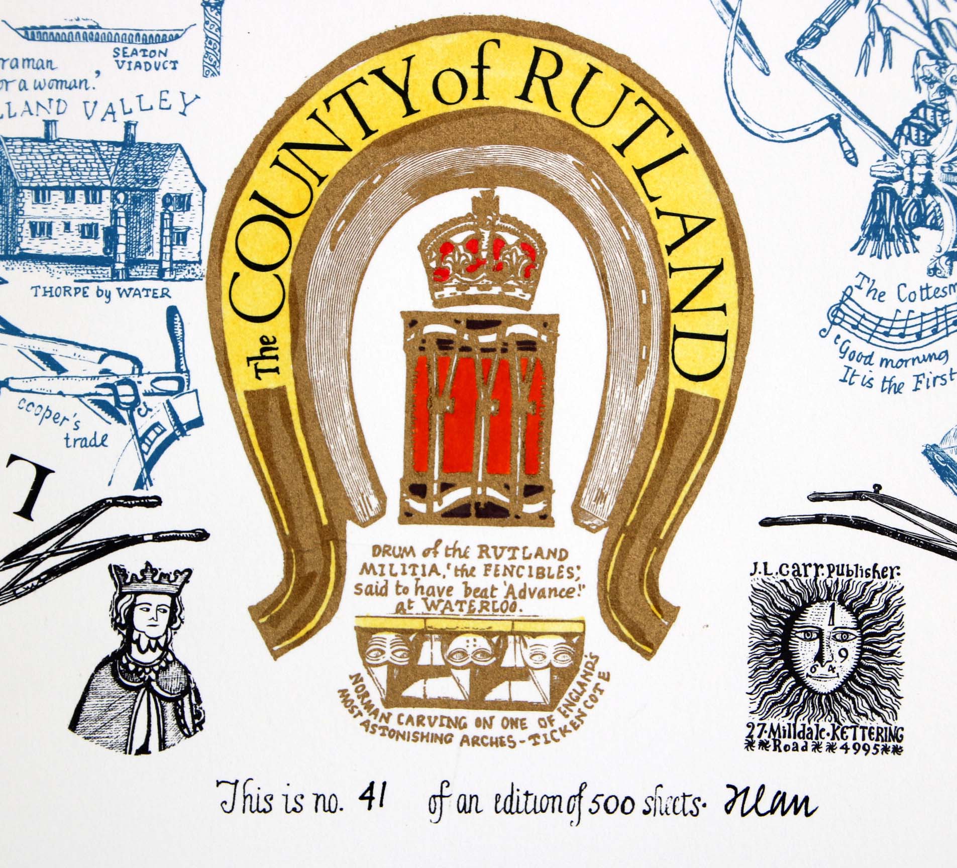
Detail of limitation, on white paper
MAP-RUT1.2: First edition, second impression
Publisher: J.L. Carr, 27 Mill Dale Road, Kettering
Year: 1972
ISBN: 0900847271
Limitation: 500 sheets
Size: 555 x 450 mm
Signed: Yes, to right of limitation, underneath colophon
Paper: thin grey card
Colophon: sun face with address at lower margin, centre
Proofs where: AH (map & proof)
Notes: This is the second of two versions of this map, printed on thin grey card with the circle of text and the two ploughs and colophon are printed in gold. The background of the horseshoe is printed in red, rather than yellow. It has the same limitation as the first impression. The date next to Sgt. Codd (see above) has not been changed.
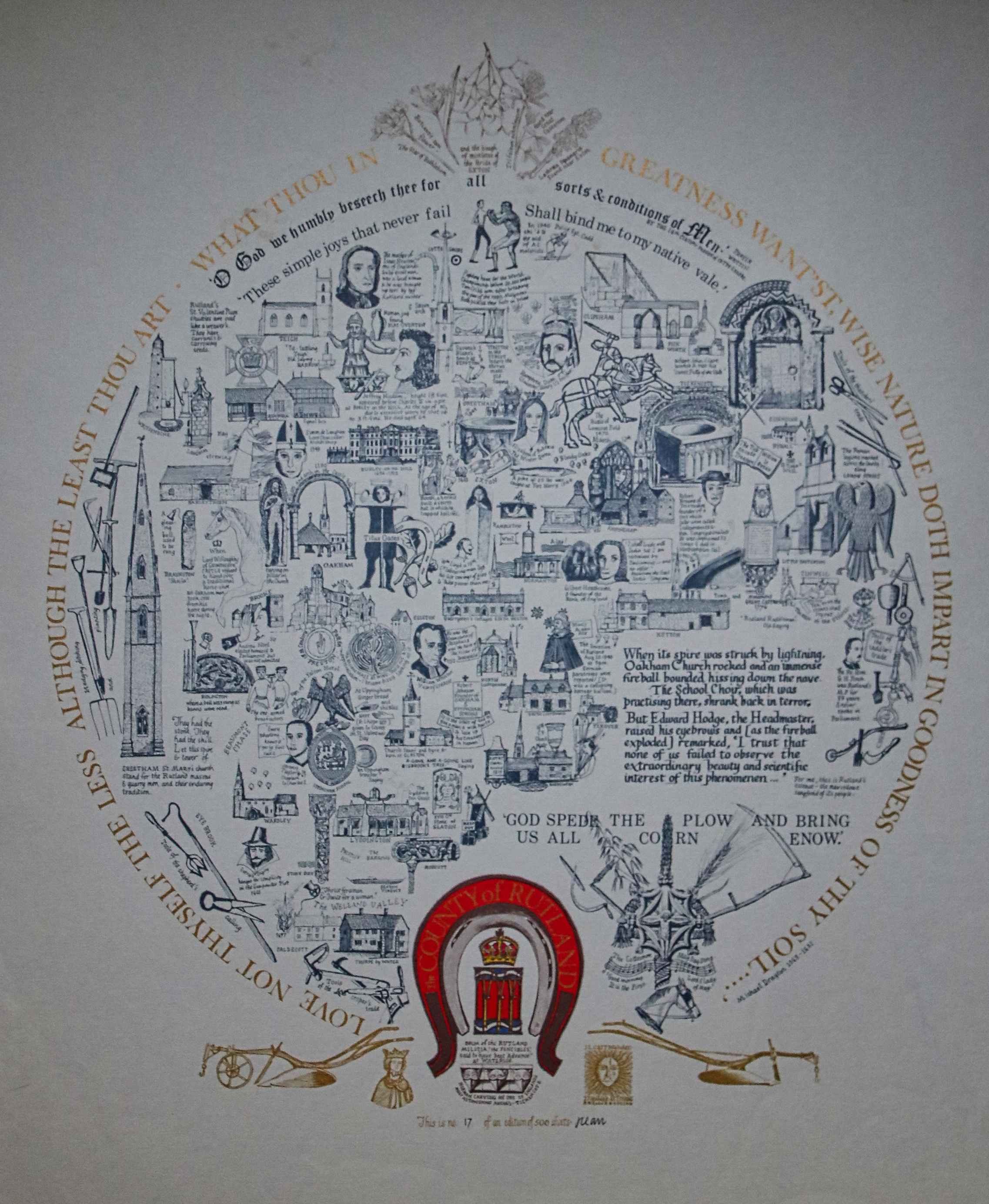
Full map, version on white paper
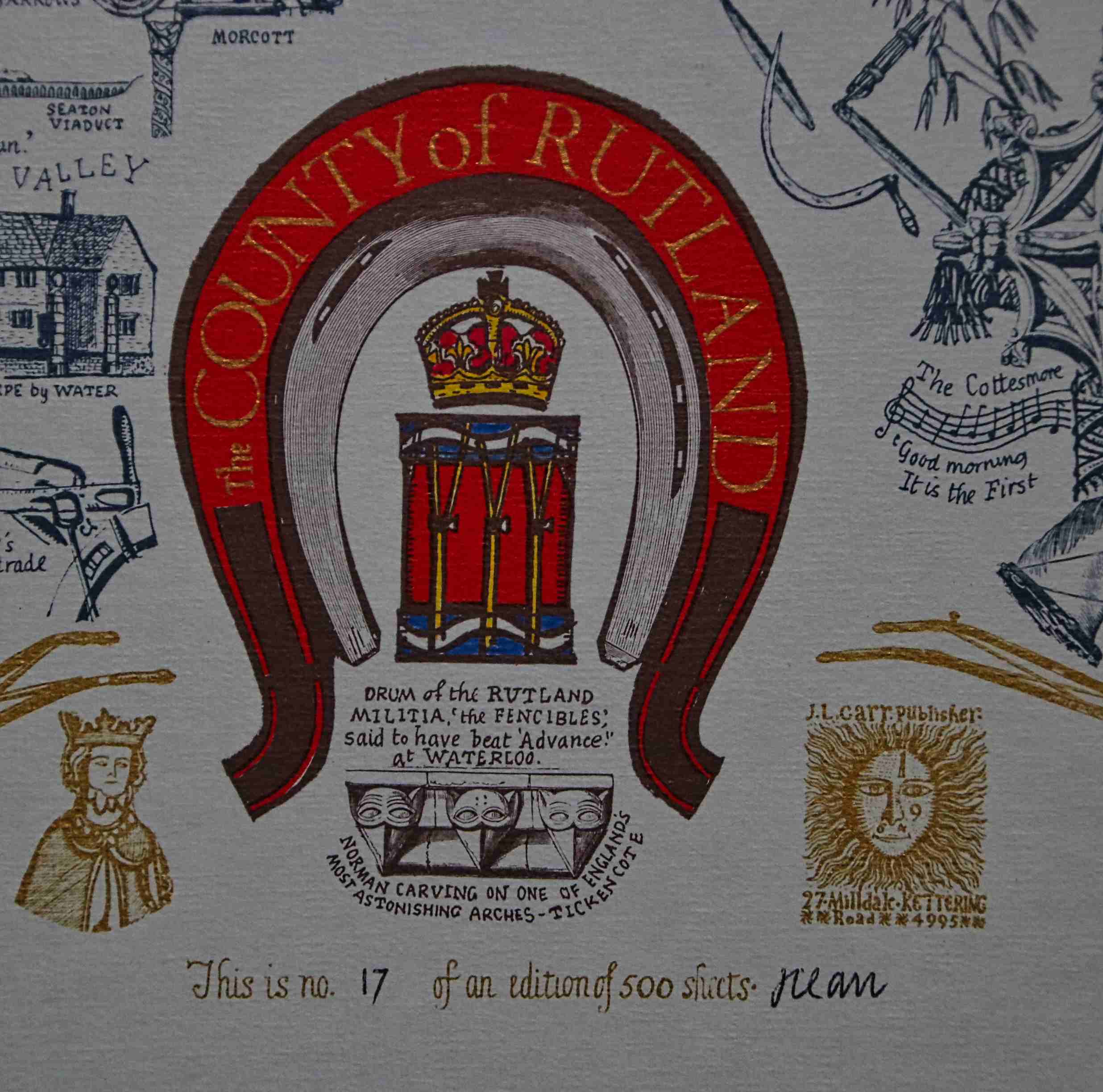
Detail of limitation, on white paper
MAP-RUT2: Second edition
Publisher: J.L. Carr, 27 Mill Dale Road, Kettering
Year: 1978
ISBN: none
Limitation: 978 sheets
Size: xxx x xxx mm
Signed: yes, below limitation within the arch, lower centre
Paper:
Colophon: sun face with address written by hand, below, underneath inverted horseshoe
Proofs where: Kettering Public Library (map)
Notes: The limitation is within a drawing of the west entrance to Ketton Church.
Thanks to Tim Dean for a photograph of the map.
In 2026 the Quince Tree Press were selling unsigned, numbered proofs of the same map with the same limitation for £15.
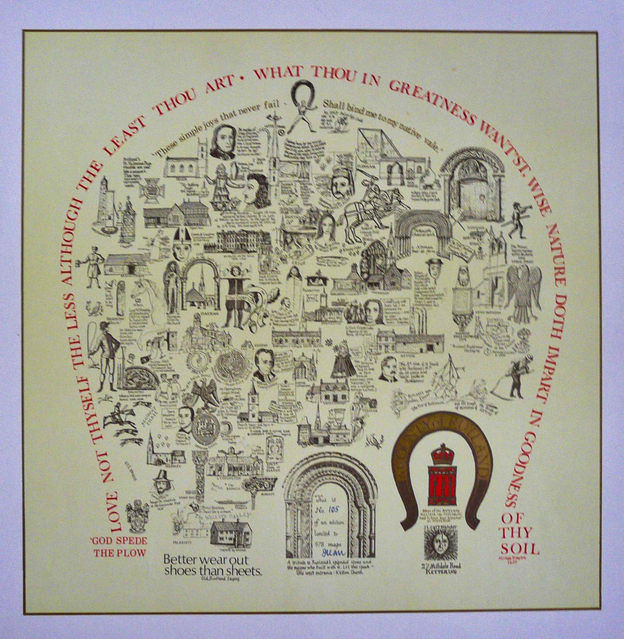
Image of map (click to enlarge)
Detail of limitation (click to enlarge)