Northamptonshire
Carr reported in his History of the QTP (1987) that he had issued three maps of Northamptonshire but six, perhaps seven, may exist. Carr sent his first map of Northamptonshire to the British Library which was accessioned in January 1966, so the map had probably been designed in 1965.
(Last updated on 14/1/2023)
MAP-NORTHA1: First edition
Publisher J.L. Carr, 27 Mill Dale Road, Kettering
Year: 1965
ISBN: none
Limitation: no limitation
Size: 523 x 193 mm
Paper: textured wove
Price: 2/6d (written in Carr's hand on proof in British Library)
Signed: no
Proofs where: Kettering Public Library (framed); British Library
Notes: This map is what Carr described as a 'longsheet', because of its shape. At the base is written: Travellers are warned that the use of this map for navigation will be disastrous.
Kettering is in the middle of the map, with Newton in the Willows immediately above. Carr tried to save the Church in this village from demolition. It is the physical model of the church described in A Month in the Country
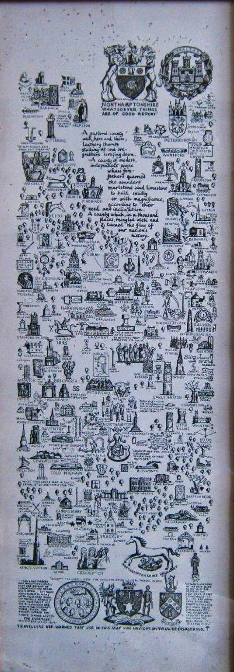
Longsheet
MAP-NORTHA2: Second edition
Publisher: J.L. Carr, 27 Mill Dale Road, Kettering
Year: 1970
ISBN: 0900847468
Limitation: 550 sheets
Size: 583 x 417 mm (size of proof sheet)
Signed: not seen
Proofs where: AH (map and proof)
Notes: This map has the same limitation as the third edition below, and is almost the same design except the base shows carvings on the 13th century west doorway at Higham Ferrers and the four sides of East Hadden font, while the shield above the running horse on the left shows five figures, probably brass rubbings. It might be the third edition, I'm just guessing. It is dated 1970 below the colophon. It was reproduced in miniature in red and black ink on yellow paper inside the cover of the last issue of The Northants Campaigner, published in 1970.
In 2026 the Quince Tree Press were selling unsigned, numbered proofs of the same map for £15.
Proof map
Detail of limitation on proof map
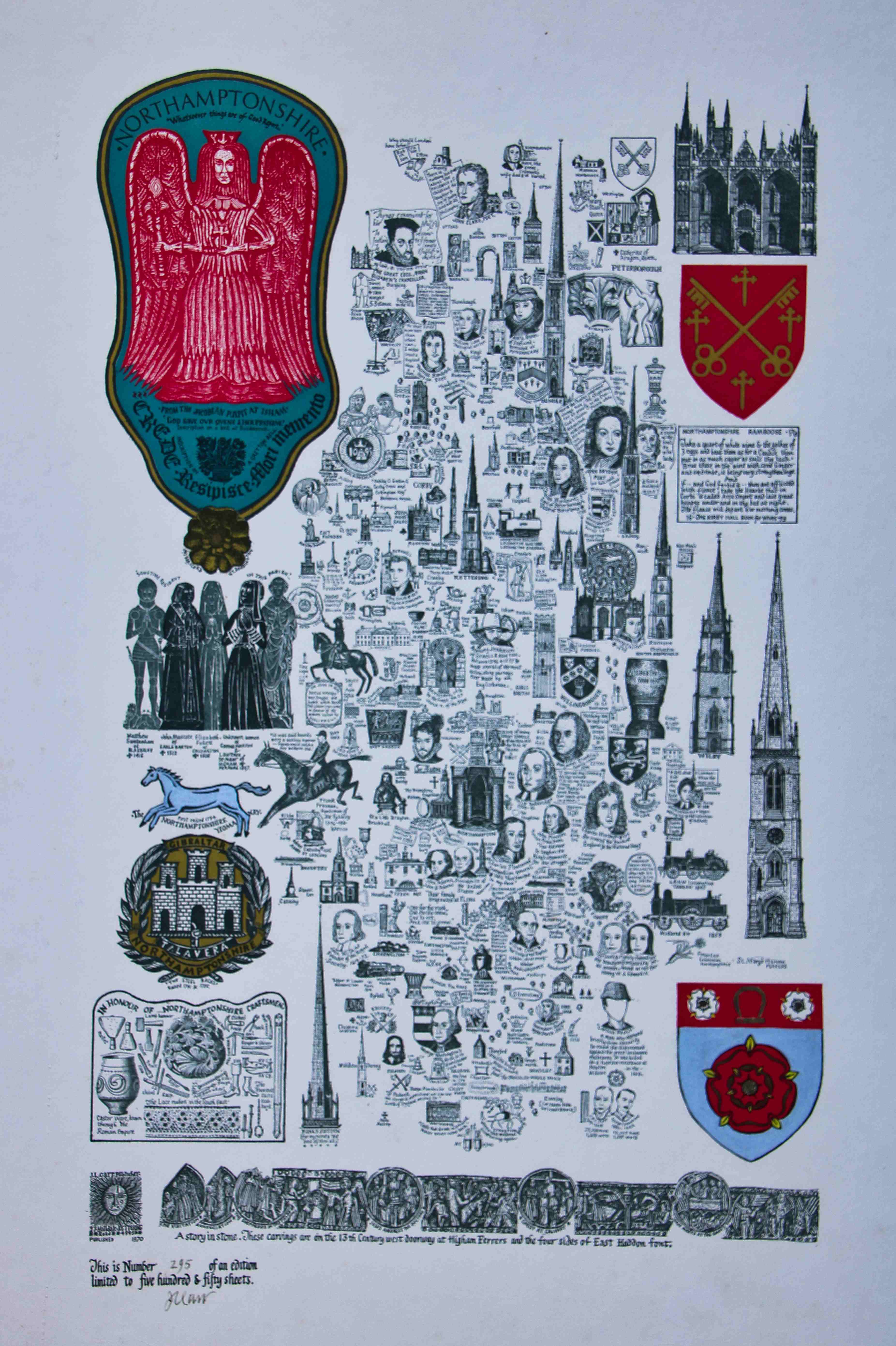
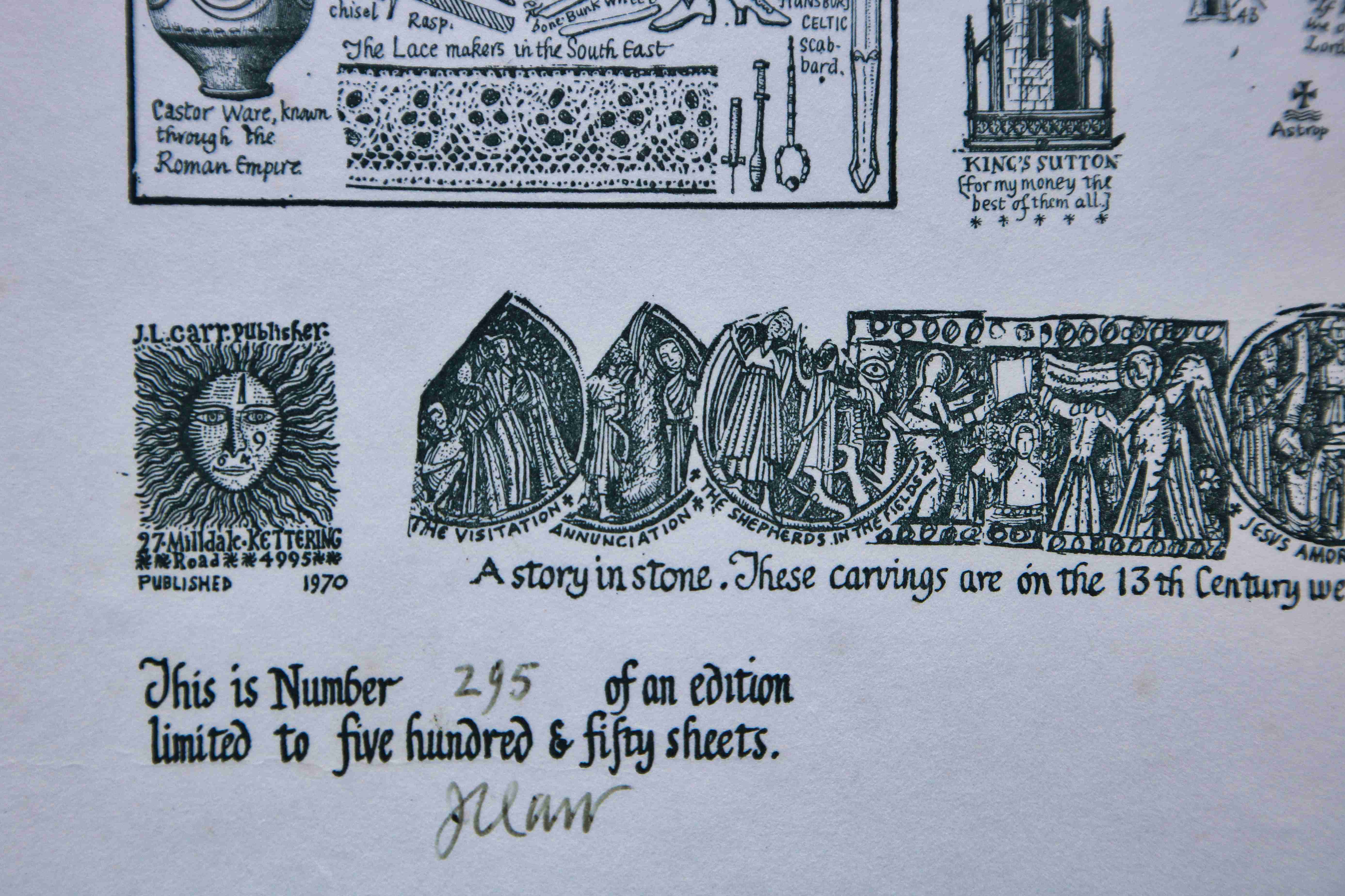
MAP-NORTHA3: Third edition
Publisher: J.L. Carr, 27 Mill Dale Road, Kettering
Year: 1970
ISBN: 0900847123
Limitation: 550 sheets
Size: 580 x 415 mm
Signed: Yes, under colophon
Proofs where: Kettering Public Library (proof), AH (proof)
Notes: A few changes have been made to the design: the row of figures under the angel has been replaced with a shield, and the strip of drawings of carvings along the base has been replaced with Norman capitals on arcades at Peterborough Cathedral. The colophon and limitation are now separate at the bottom of the map.
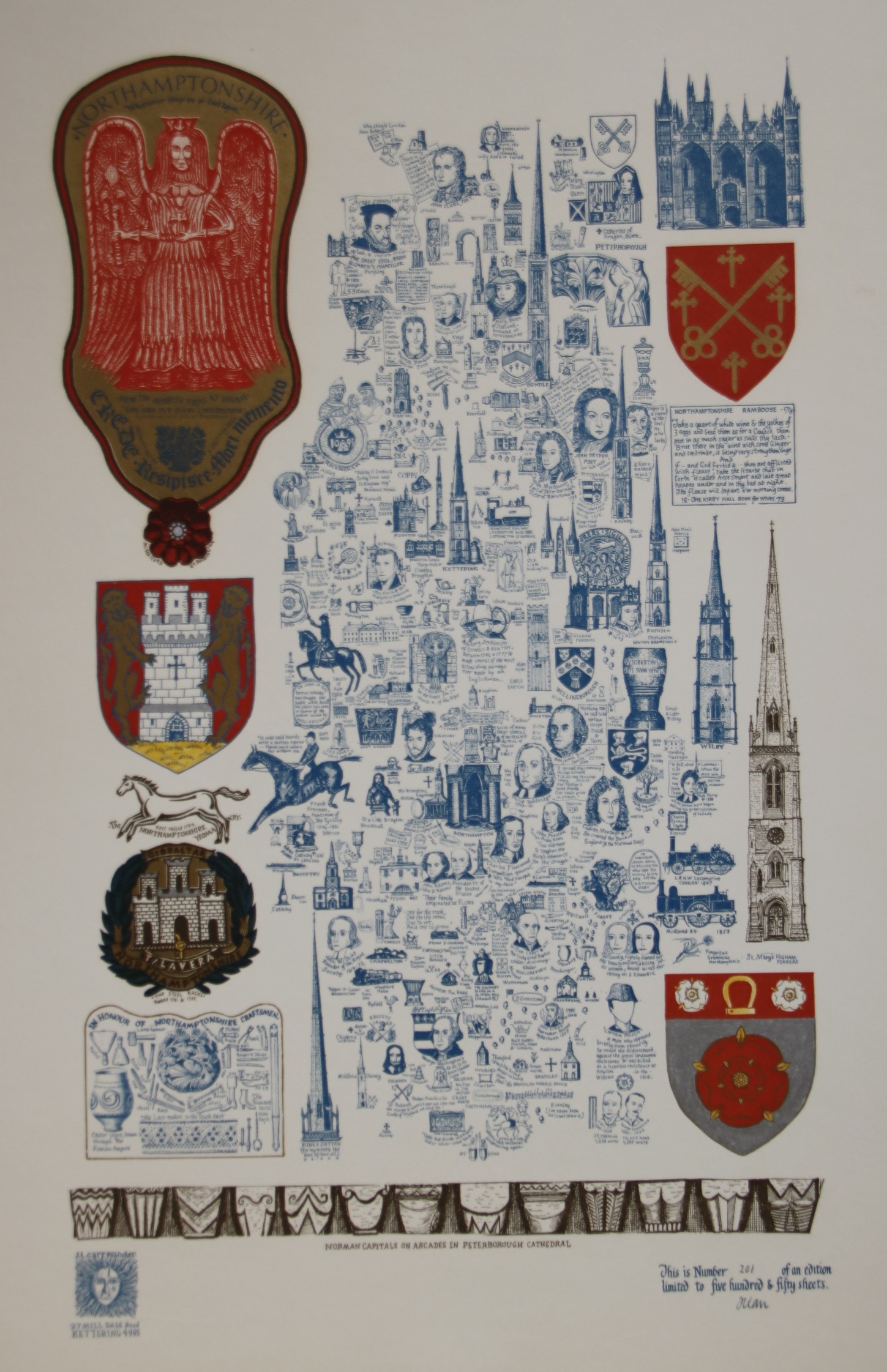
Image of map (click to enlarge)
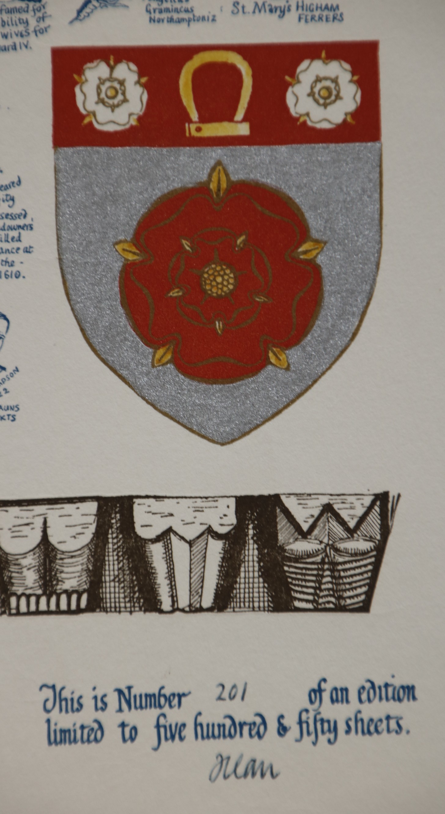
Detail of limitation on proof map
MAP-NORTHA4: Fourth edition
Publisher: J.L. Carr, 27 Mill Dale Road, Kettering
Year: 1976
ISBN: no
Limitation: 776 sheets
Size: 621 x 417 mm
Signed: below dedicated to left
Proofs where: AH (two maps)
Notes: The map is also similar to the second edition (if that is correct) except the base shows a quotation from Benjamin Franklin, the arms of the family of Washington to the left, and a brass rubbing of George Catesby to the right. The rest of the map is the same. The sheilds are coloured by hand and may vary in colours between sheets. The map is dedicated: To the forefathers of George Washington, Ben Franklin & John & John Q. Adams of Sulgrave, Ecton and Flore in this county.
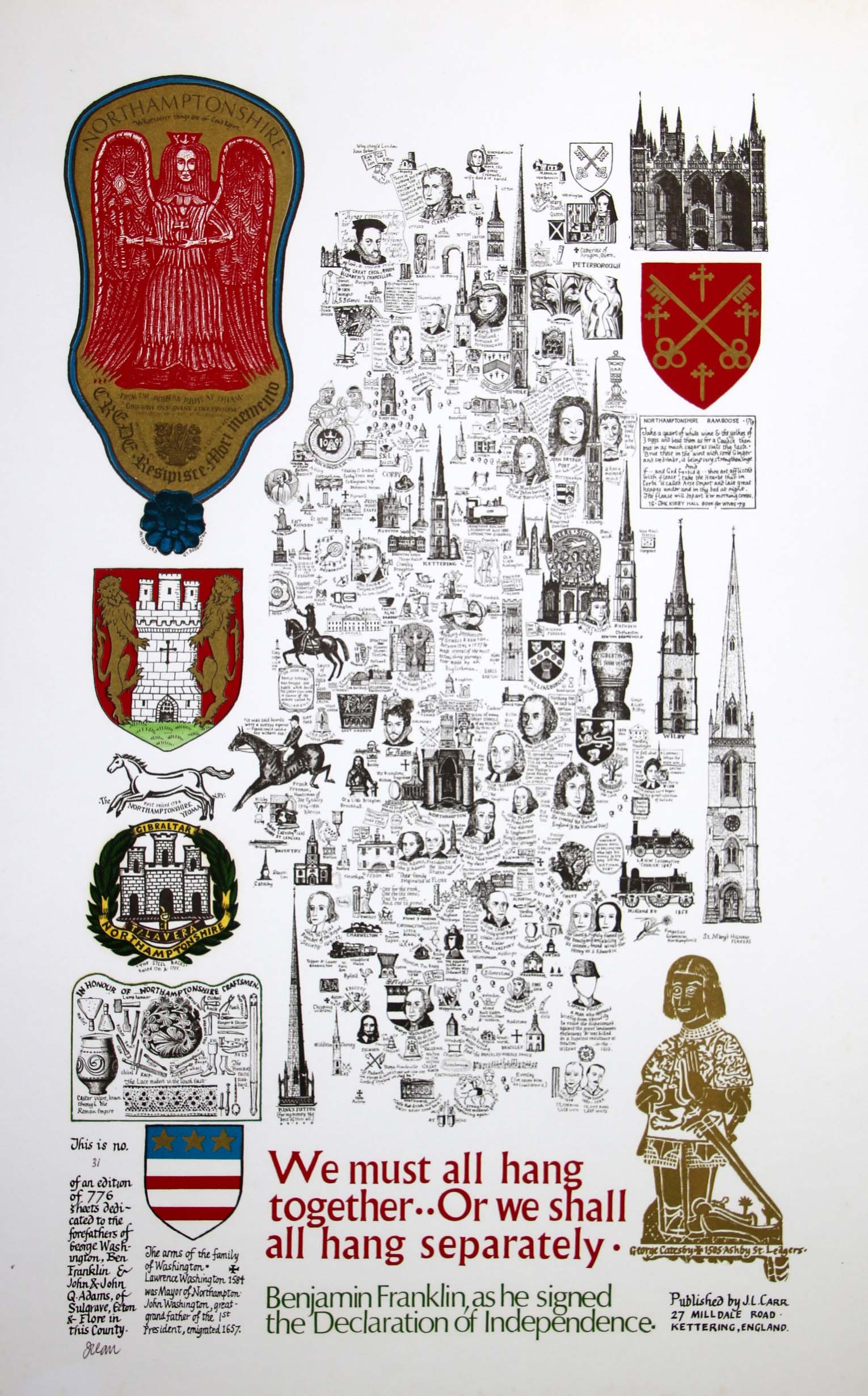
Image of map (click to enlarge)
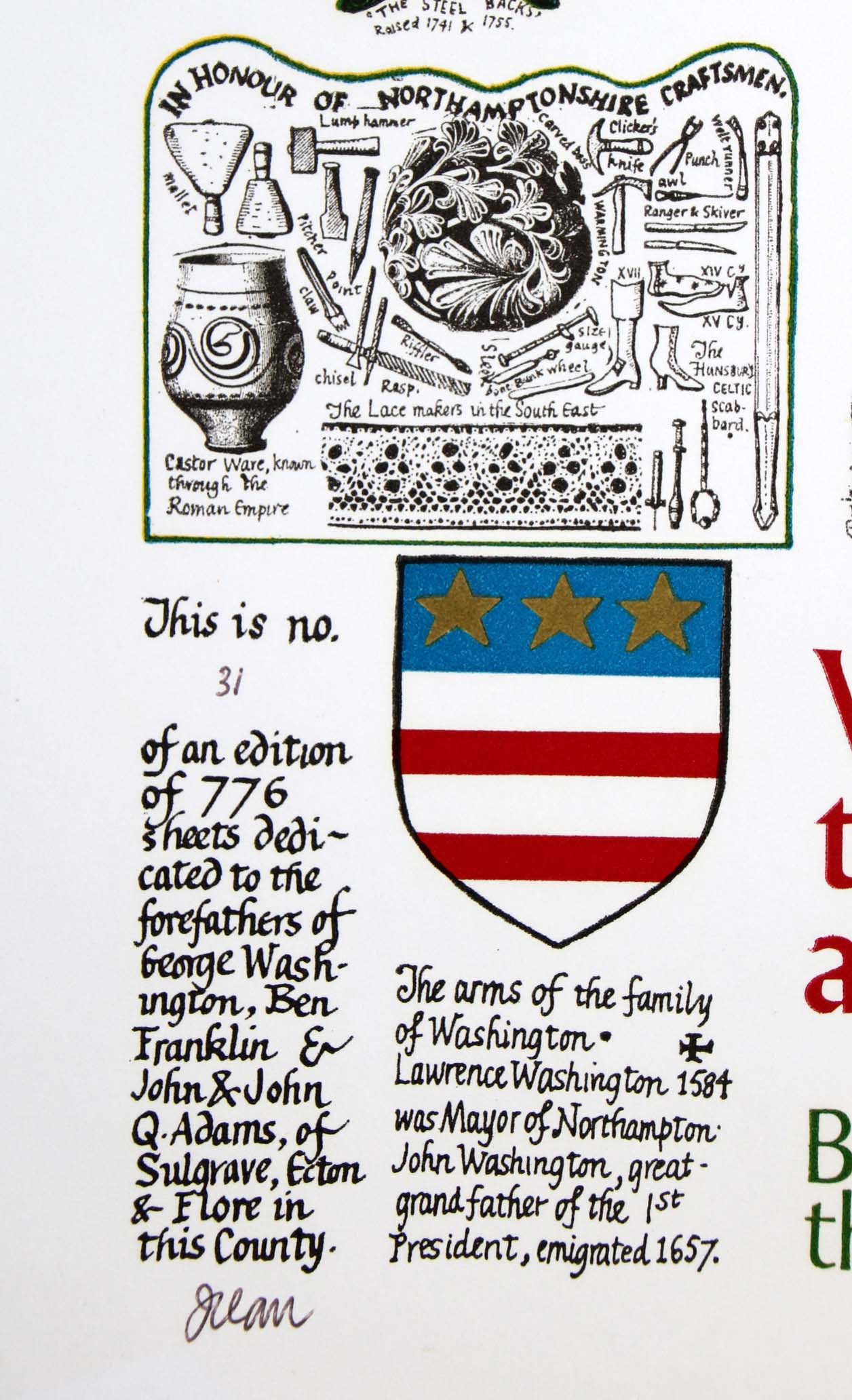
Detail of limitation (click to enlarge)
MAP-NORTHA5: Fifth edition
Publisher: J.L. Carr, 27 Mill Dale Road, Kettering
Year: 1978
ISBN: no
Limitation: 978 sheets
Size: xxx x xxx mm
Signed: not seen
Proofs where: Kettering Public Library (proof)
Notes: Thanks to Tim Dean for the photograph of the map.
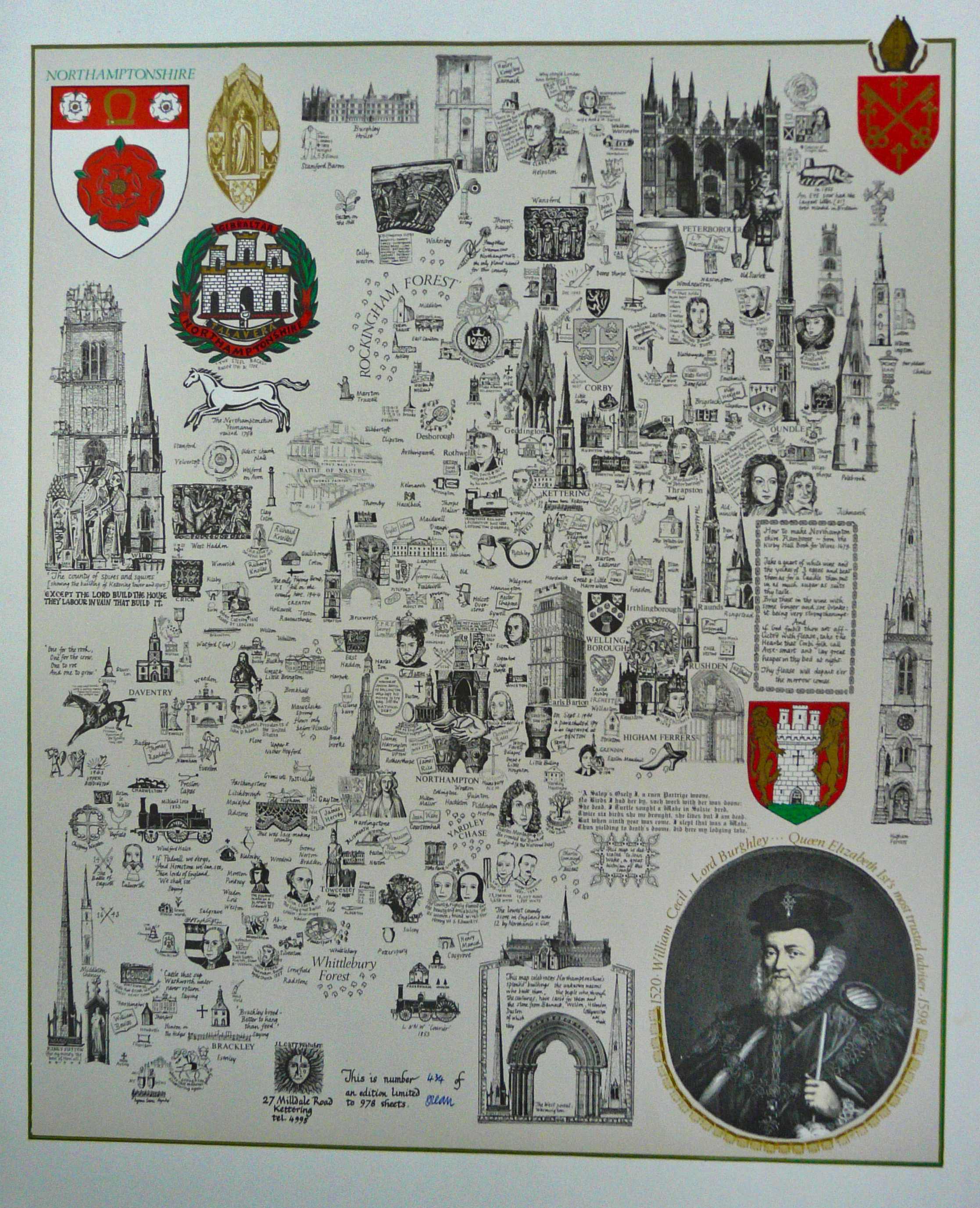
Image of map (click to enlarge)

Detail of limitation (click to enlarge)
MAP-NORTHA6: Sixth edition
Publisher J.L. Carr, 27 Mill Dale Road, Kettering
Year: 1980
ISBN: no
Limitation: 980 sheets
Size: xxx x xxx mm
Signed: not seen
Proofs where:
Notes: This map celebrates Northamptonshire's splendid buildings and the unknown masons who built them.

Image of map (click to enlarge)
Detail of limitation (click to enlarge)
MAP-NORTHA7: Seventh edition
Publisher J.L. Carr, 27 Mill Dale Road, Kettering
Year: 1987
ISBN: no
Limitation: unknown
Size: 570 x 380 mm
Signed: no
Proofs where: Northampton County Record Office; VADS.ac.uk
Notes: In the lower right corner is a donation proforma to raise money for parishes that had repair bills.
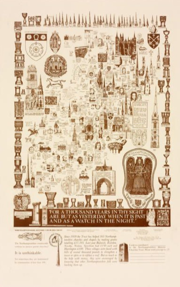
Image of map (click to enlarge)