Middlesex
There was only one edition of the map of Middlesex, a county that no longer exists except in sport and the names of institutions such as hospitals and a university.
(Last updated on 14/2/2026)
MAP-MID1: First and only edition
Publisher: J.L. Carr, 27 Mill Dale Road, Kettering
Year: 1975
ISBN: 0900847506
Limitation: 775 sheets
Size: 632 x 352 mm
Paper: thin white card
Colophon: sun face
Signed: Yes, underneath limitation
Proofs where: Kettering Public Library (map)
Notes: This map is dedicated to Mr Frank Trumper of Harefield who, with his Yorkshire sheep-dog, Owd Wat, in 1827, beat Two Gentlemen of Middlesex.
The buildings in the map were drawn by Roger Hall, RIBA, during Architectural Heritage Year 1975.
In the narrow box on the left, Carr wrote this:
MIDDLESEX C.C. Infuriatingly [I admit it] to a Yorkshireman the County exists chiefly as a cricket club and so homage to: B.I.J. Bosanquet, the inventor of the googly; I.A.R. Peebles, for his initials; P.F. Warner, the parallel to our Lord Hawke;
C.T. Studd because my father said he was better employed in the missionary field than on the cricket field; E. Hendren in respect of 119 centuries and 40,060 runs; J.T. Hearne for a mammoth 18,582 overs and an av. of 18; D. Compton, av. 57; W.J. Edrich, av. 55;
J.W. Hearne 27,562 runs; Jim Smith for his sixes; G.O. Allen because he supported Jardine; Albert Trott
because he sounds a Yorkshireman; And A.J. Webbe because a Finchley friend says he won't buy a map unless he is included.
If you don't understand much of that, follow the links within the text.
In 2026 the Quince Tree Press were selling unsigned, numbered proofs of the same map with the same limitation for £15.
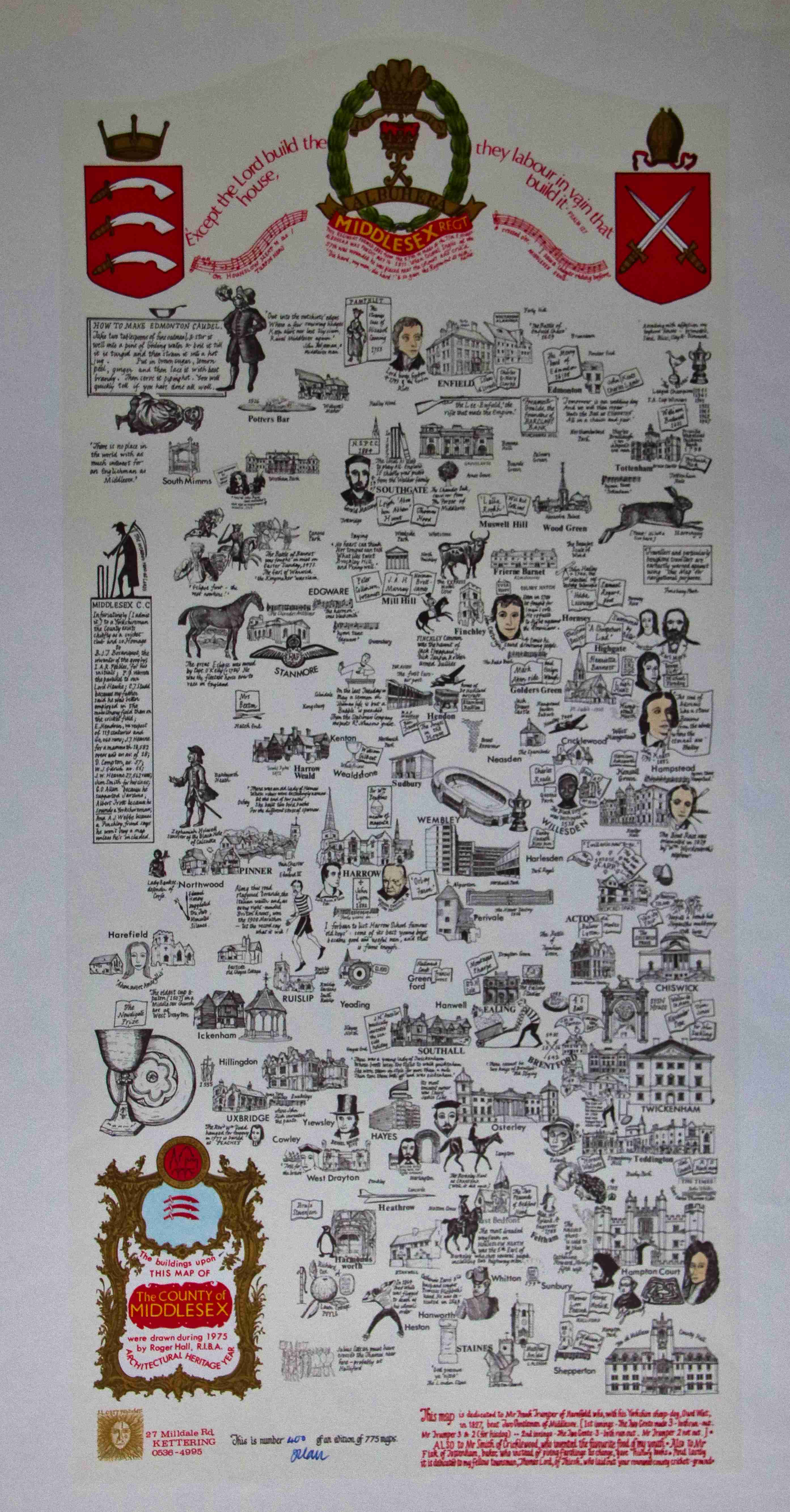
Image of map (click to enlarge)
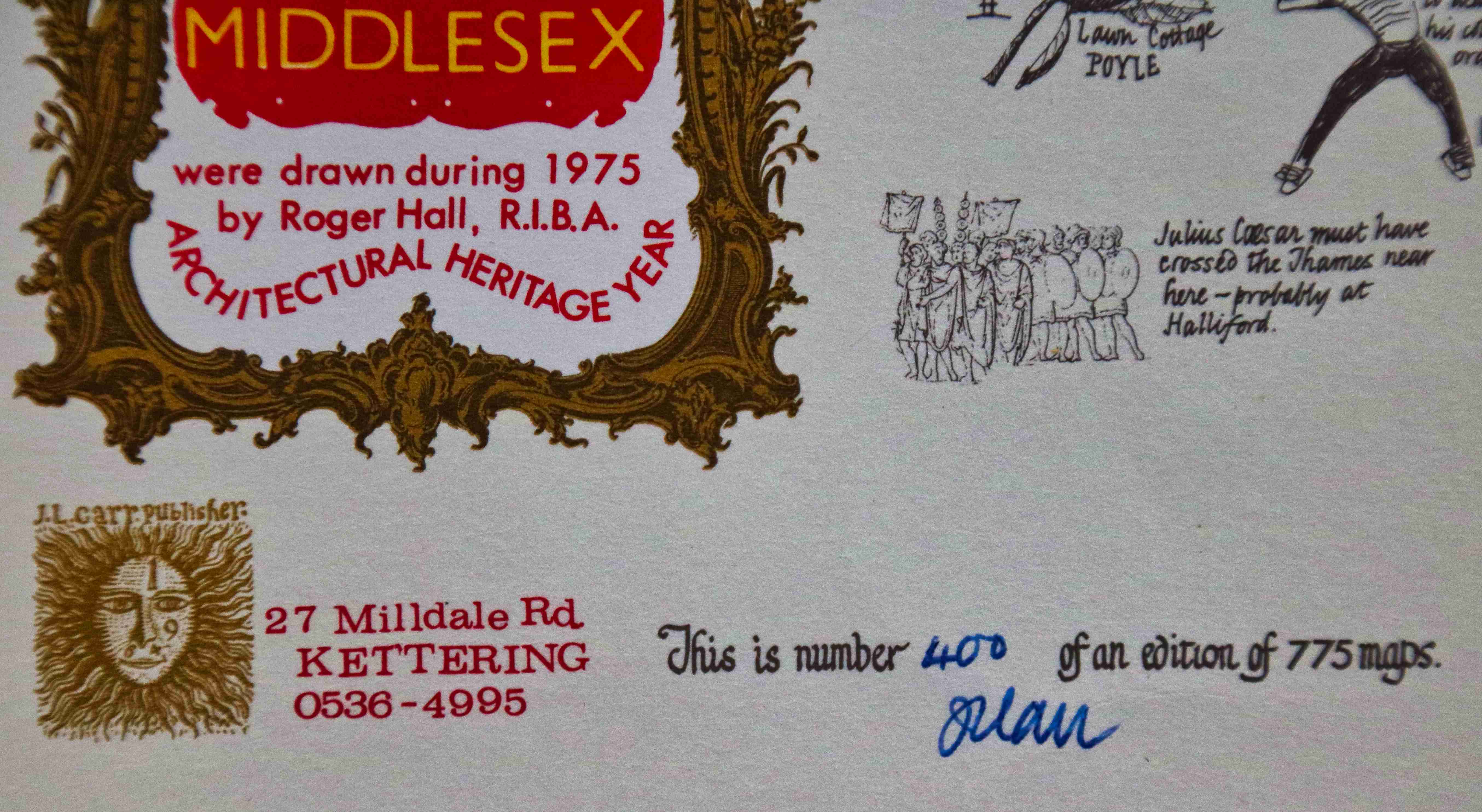
Detail of limitation (click to enlarge)