Leicestershire
In his History of the QTP (1987) Carr reported three editions of a map of Leicestershire; all three have been seen.
(Last updated on 14/2/2026)
MAP-LEI1: First edition
Publisher: J.L. Carr, 27 Mill Dale Road, Kettering
Year: 1970
ISBN: none
Limitation: 503 sheets
Size: 580 x 480 mm?
Signed: yes, lower right margin, below limitation
Proofs where:
Notes: Thanks to Tim Dean for the photograph of the map.
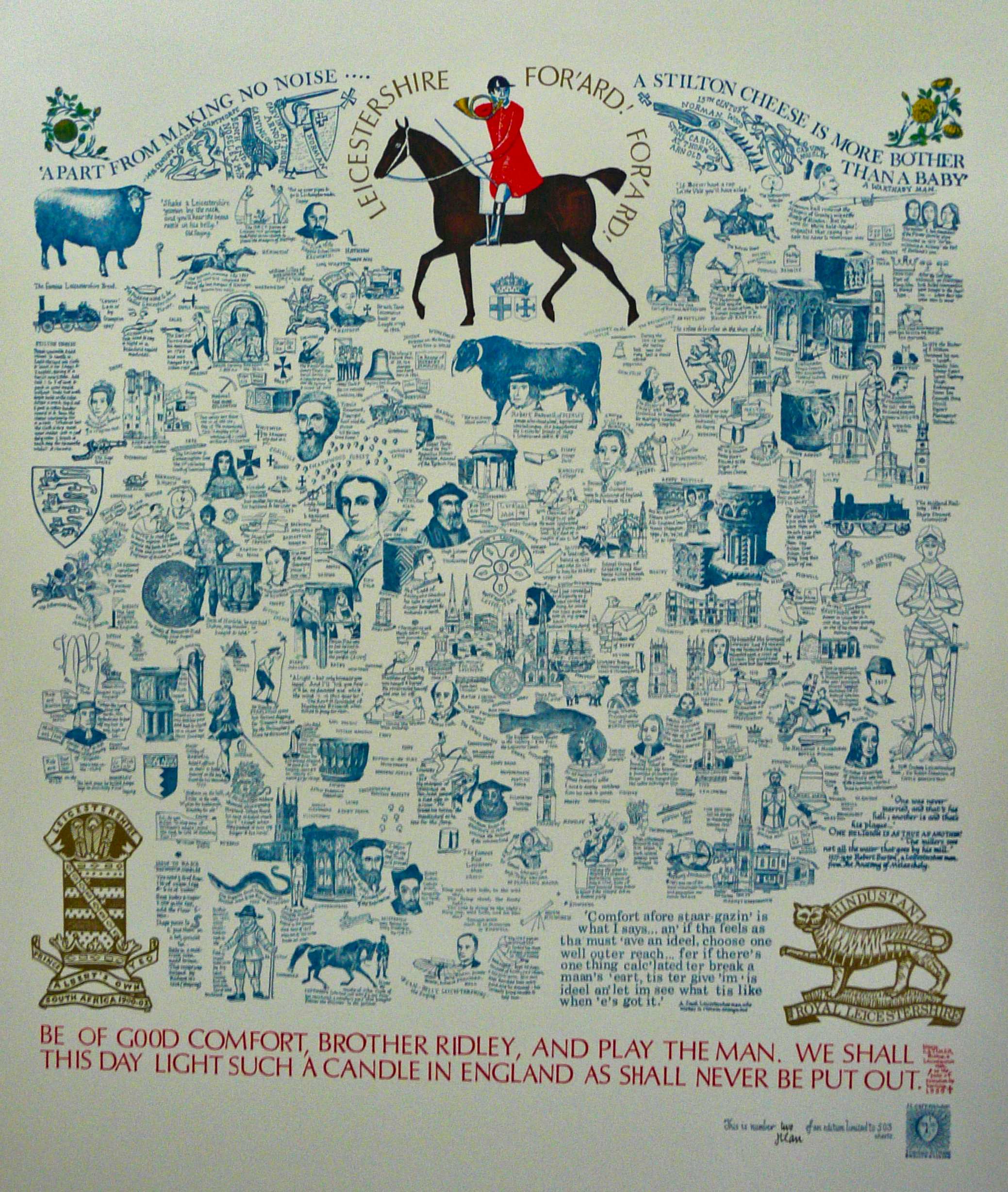
Image of map (click to enlarge)
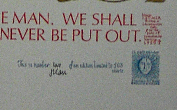
Detail of limitation (click to enlarge)
MAP-LE2: Second edition
Publisher: J.L. Carr, 27 Mill Dale Road, Kettering
Year: 1972
ISBN: 0900847298
Limitation: 572 sheets
Size: 577 x 483 mm
Paper: thin white card
Colophon: sun face with address, lower right corner to right of limitation
Signed: Yes
Proofs where: AH (map and proof)
Notes: This map has the same main design as the first edition except for the lines of text at the base; the lines of text about Stilton cheese at the top, either side of the huntsman; the ink colour; and the limitation: 572 sheets compared with 503 sheets. It is assumed that the impression with the larger limitation is the second edition, and the date of issue is assumed from the limitation to be 1972. The ISBN was registered in 1972, so is presumably applied to this edition.
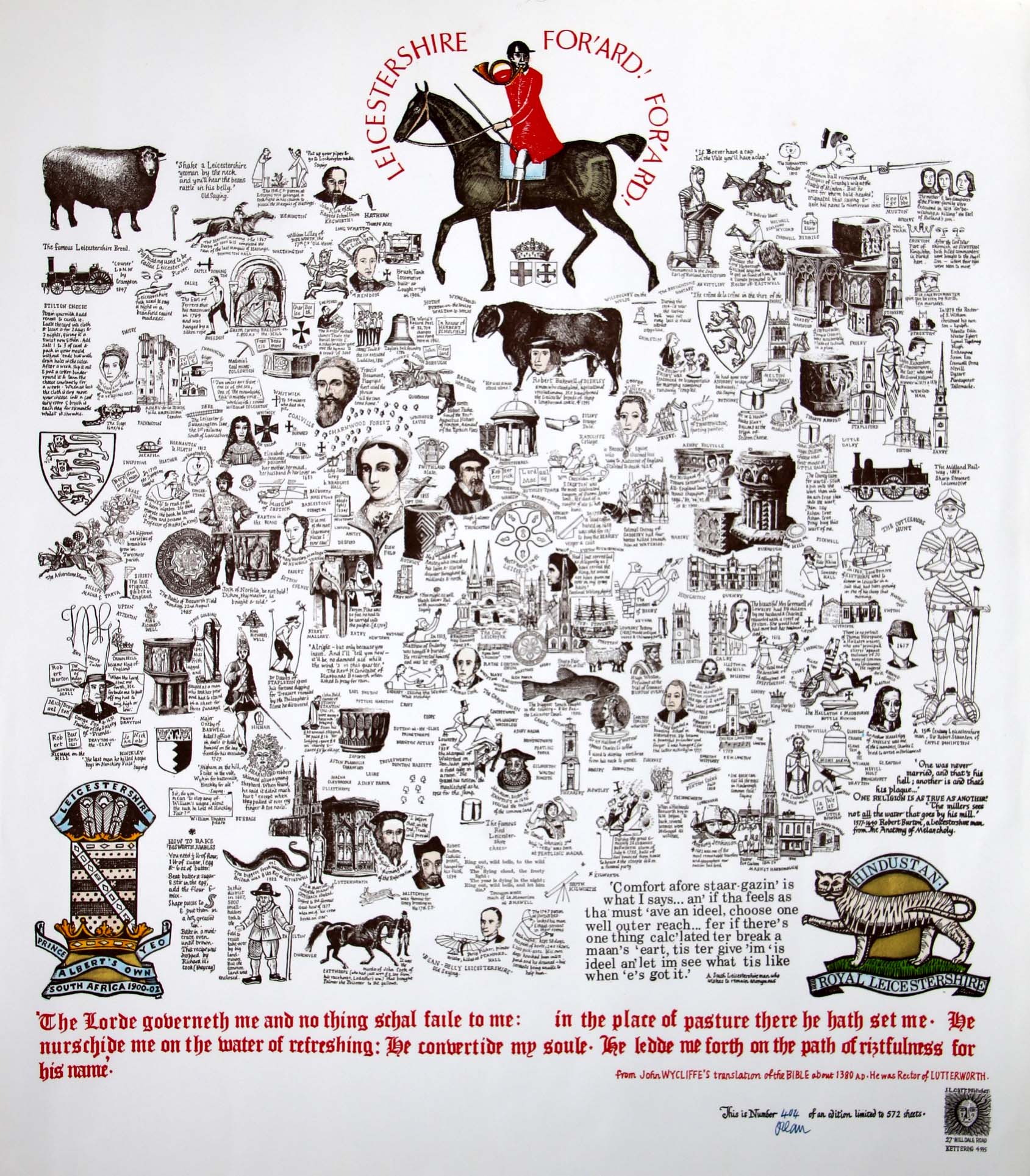
Image of map (click to enlarge)
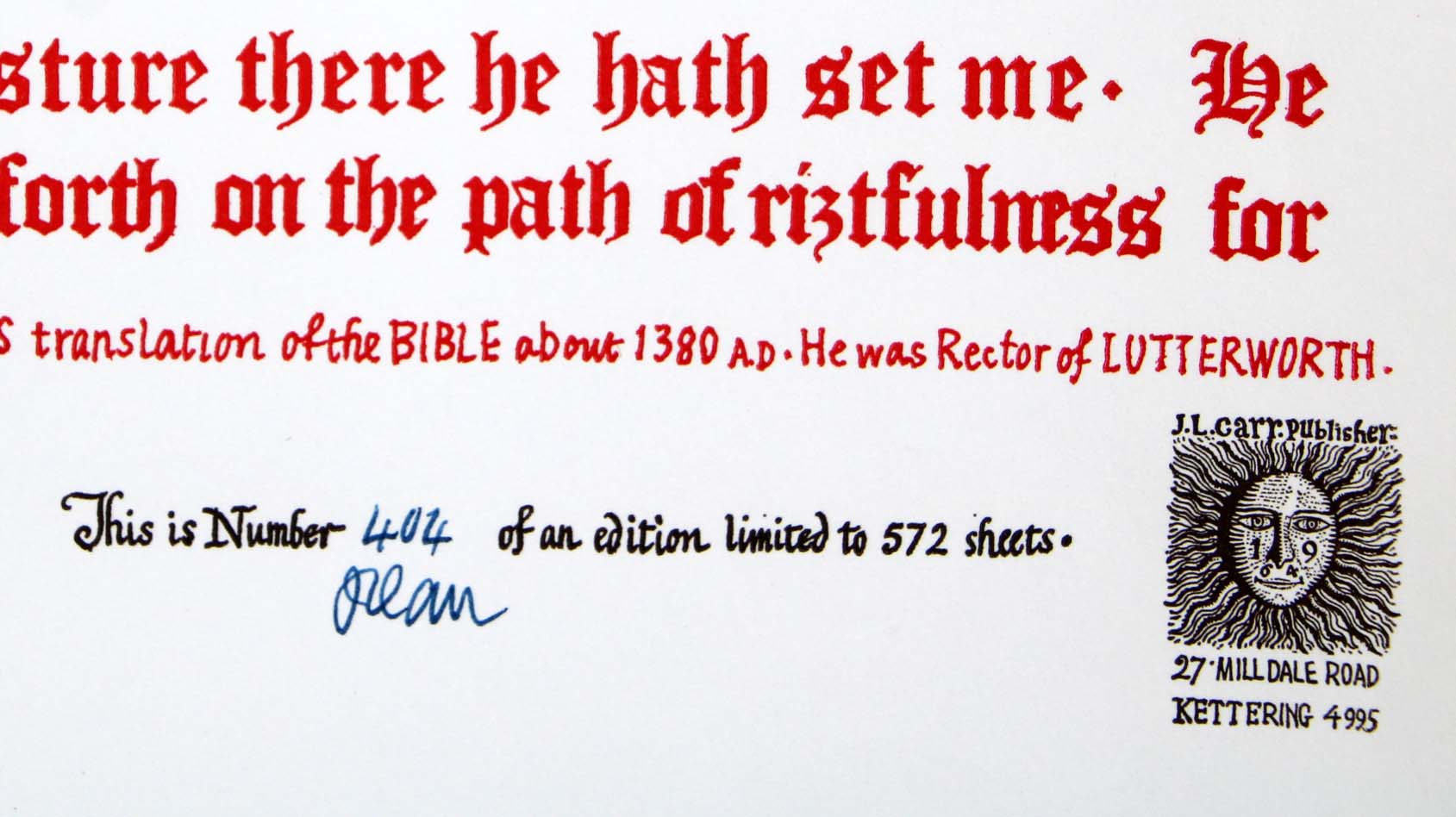
Detail of limitation (click to enlarge)
MAP-LEI3: Third edition
Publisher: J.L. Carr, 27 Mill Dale Road, Kettering
Year: 1982
ISBN: none
Limitation: 982 sheets
Size: 489 x 447 mm
Paper: thin white card
Colophon: sun face, lower centre edge, to left of limitation
Signed: Yes
Proofs where: Kettering Public Library (map); AH (map)
Notes: The number of sheets indicates that this was issued in 1982, so it is the third edition. An unsigned sheet has been seen (no 181) so this may have been in the stock that J.L. Carr passed over to his son, Robert, to sell when he gave up selling maps directly from his house in Kettering in the late 1980s. If maps after No. 181 are unsigned, then signed maps may be less common than usual.
In 2026 the Quince Tree Press were selling unsigned, numbered proofs of the same map with the same limitation for £15.
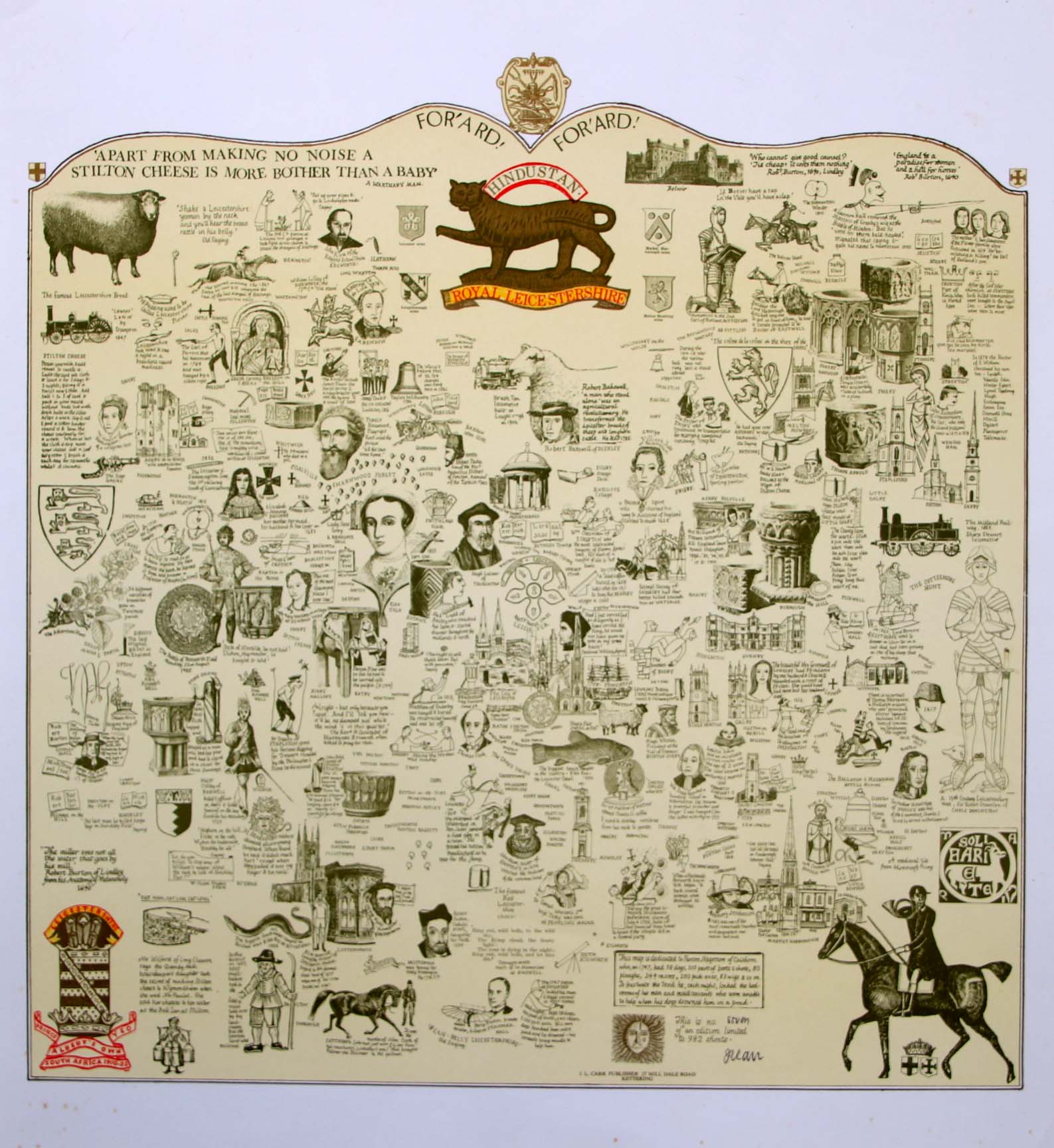
Image of map (click to enlarge)
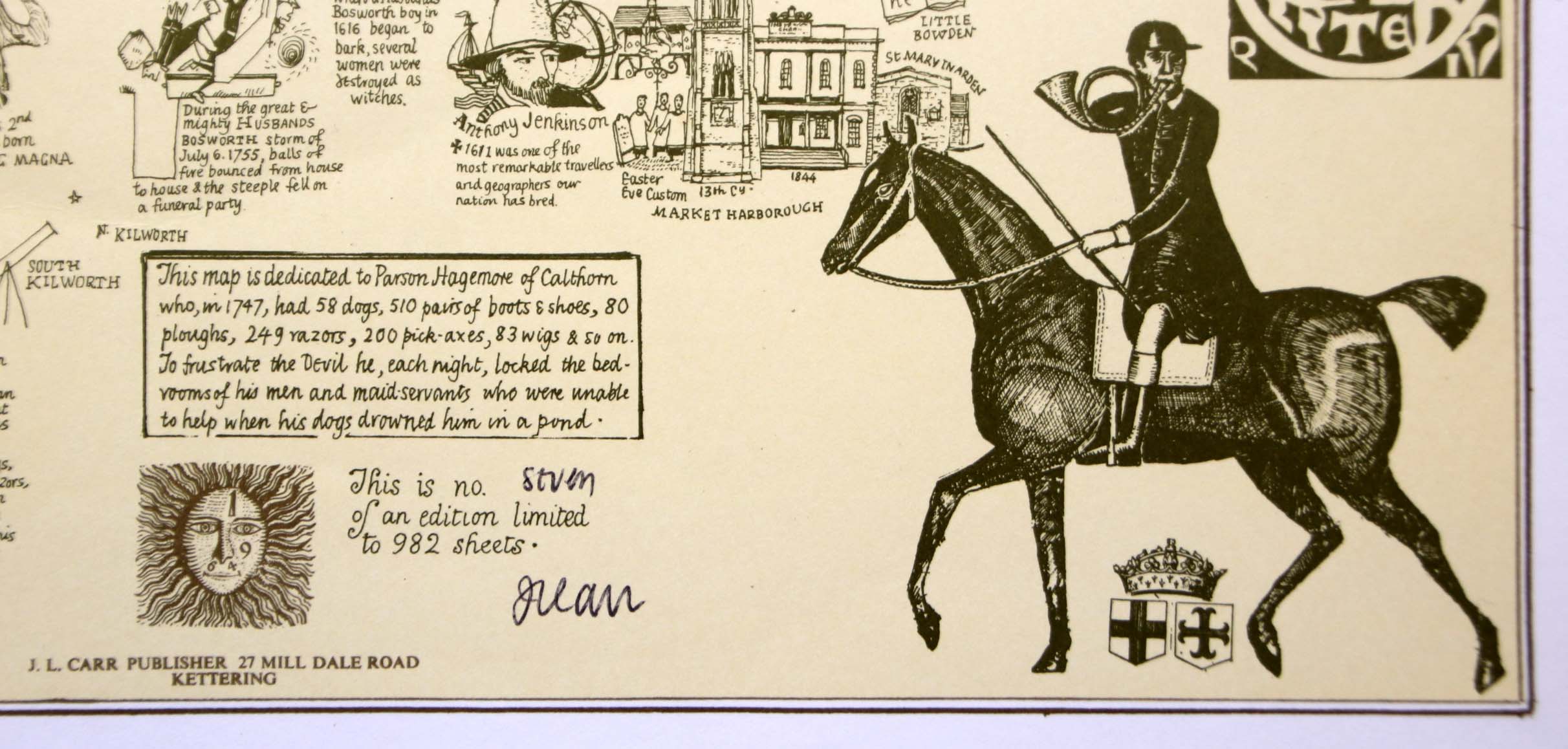
Detail of limitation (click to enlarge)