County Palatine of Lancaster or Lancashire
In his History of the QTP (1987) Carr reported two editions of maps of Lancashire. Three maps are known: one of the County Palatine of Lancaster and two of the County Palatine of Lancashire. The maps published in 1977 and 1980 are unusual in that they are the same design, only the limitation has been changed.
(Last updated on 14/2/2026)
MAP-LAN1: First edition: County Palatine of Lancaster
Publisher: J.L. Carr, 27 Mill Dale Road, Kettering
Year: 1971 or 1972
ISBN: 090084728X
Limitation: 572 sheets
Size: 549 x 375 mm
Paper: thin white card
Colophon: sun face with address, lower right corner
Signed: Yes
Proofs where: Kettering Public Library (proof); AH (map)
Notes: The ISBN was registered in 1971 but the number of sheets (572) suggest that it was published in 1972.
This map is dedicated to those Lancashire men and women known to its designer.
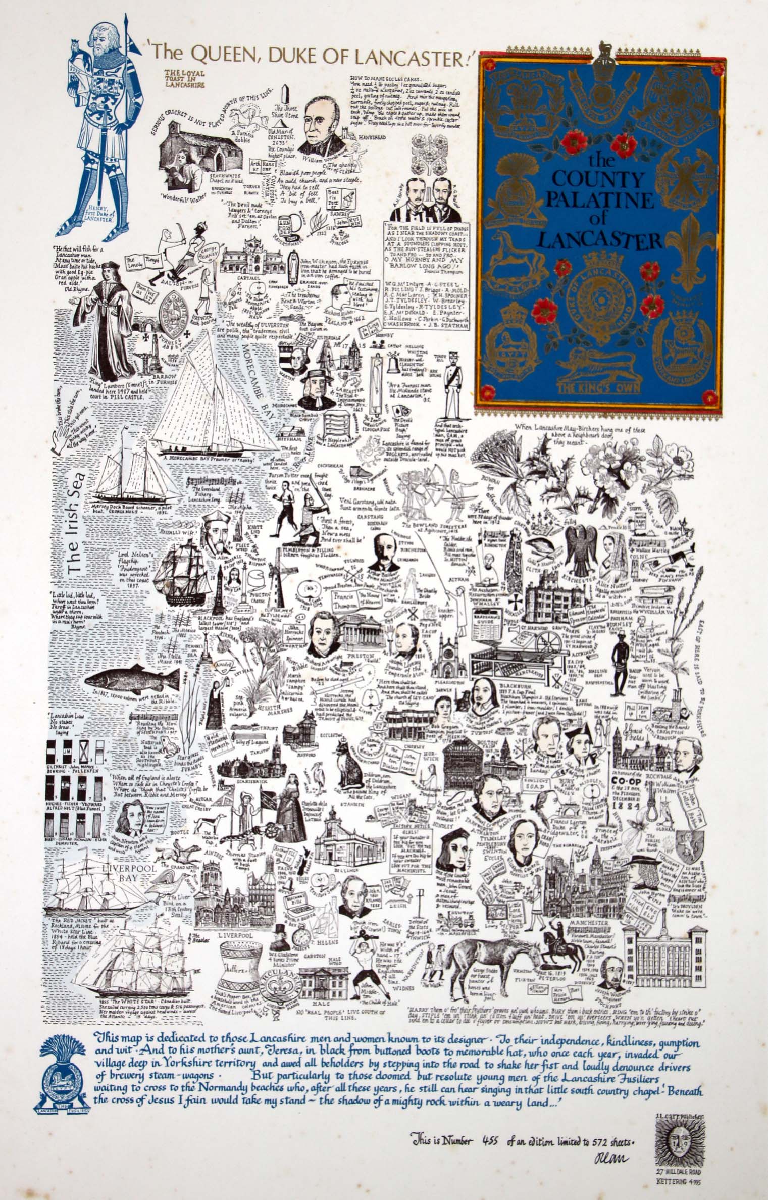
Image of map (click to enlarge)
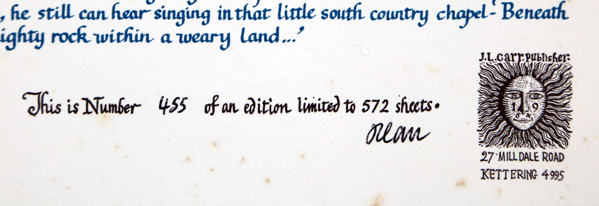
Detail of limitation (click to enlarge)
MAP-LAN2.1: Second edition, first impression: Lancashire
Publisher: J.L. Carr, 27 Mill Dale Road, Kettering
Year: 1977
ISBN: none
Limitation: 777 sheets
Size: 632 x 446 mm
Colophon: sun face next to address, lower left, to right of limitation
Signed: Yes
Proofs where: AH (map)
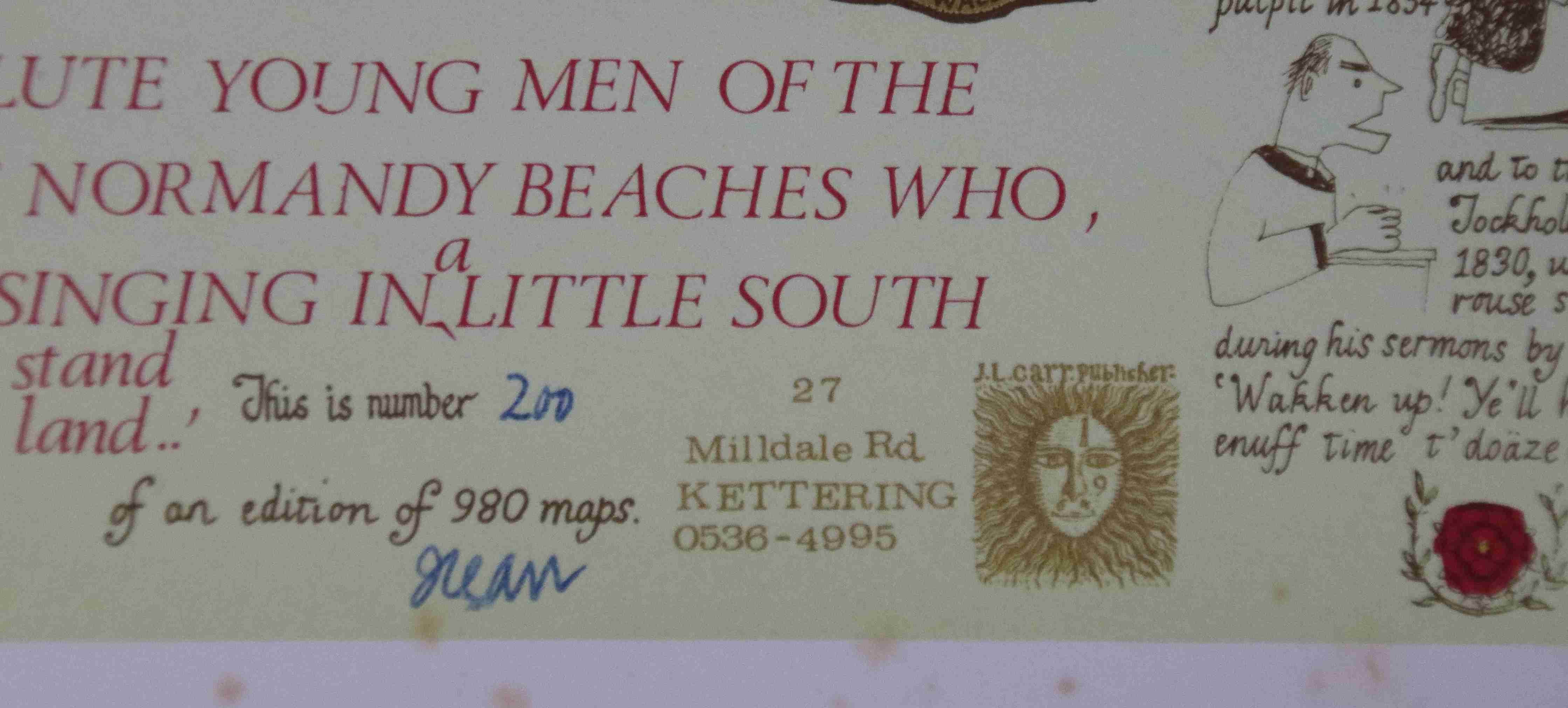
Notes: This map is dedicated to those resolute young men of the Lancashire Fusileers waiting to cross to the Normandy beaches who, after these many years, I seem still to hear singing in a little south coast chapel.
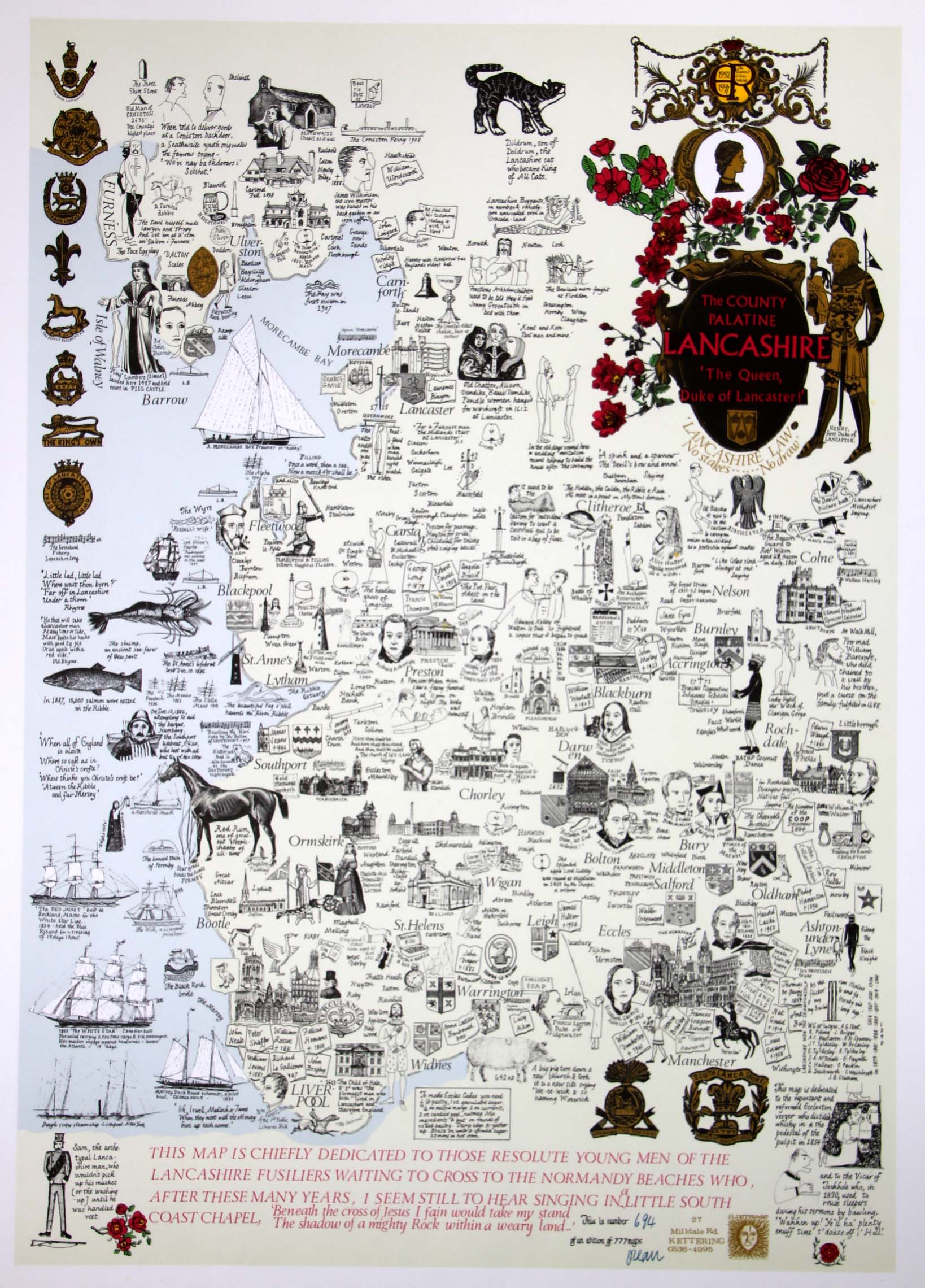
Image of map (click to enlarge)
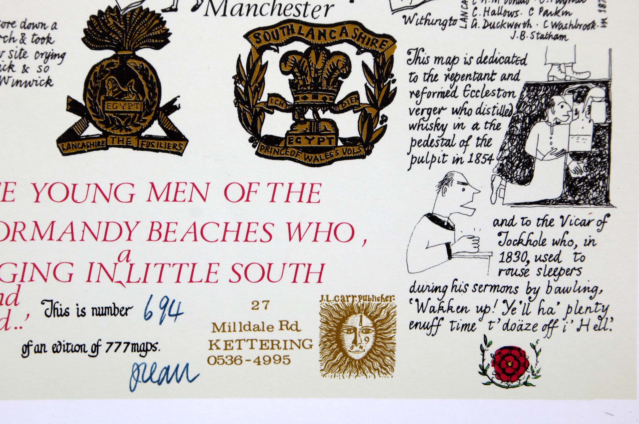
Detail of limitation (click to enlarge)
MAP-LAN2.2: Second edition, second impression: Lancashire
Publisher: J.L. Carr, 27 Mill Dale Road, Kettering
Year: 1980
ISBN: none
Limitation: 980 sheets
Size: 605 x 445 mm
Signed: Yes
Proofs where: Kettering Public Library (map)
Notes: This is the same design as the map above except that the land is printed with a pale green background and the limitation has been changed.
An unsigned proof numbered 488, possibly not in Carr's hand, was advertised on eBay in February 2021.
In 2026 the Quince Tree Press were selling unsigned, numbered proofs of the same map with the same limitation for £15.
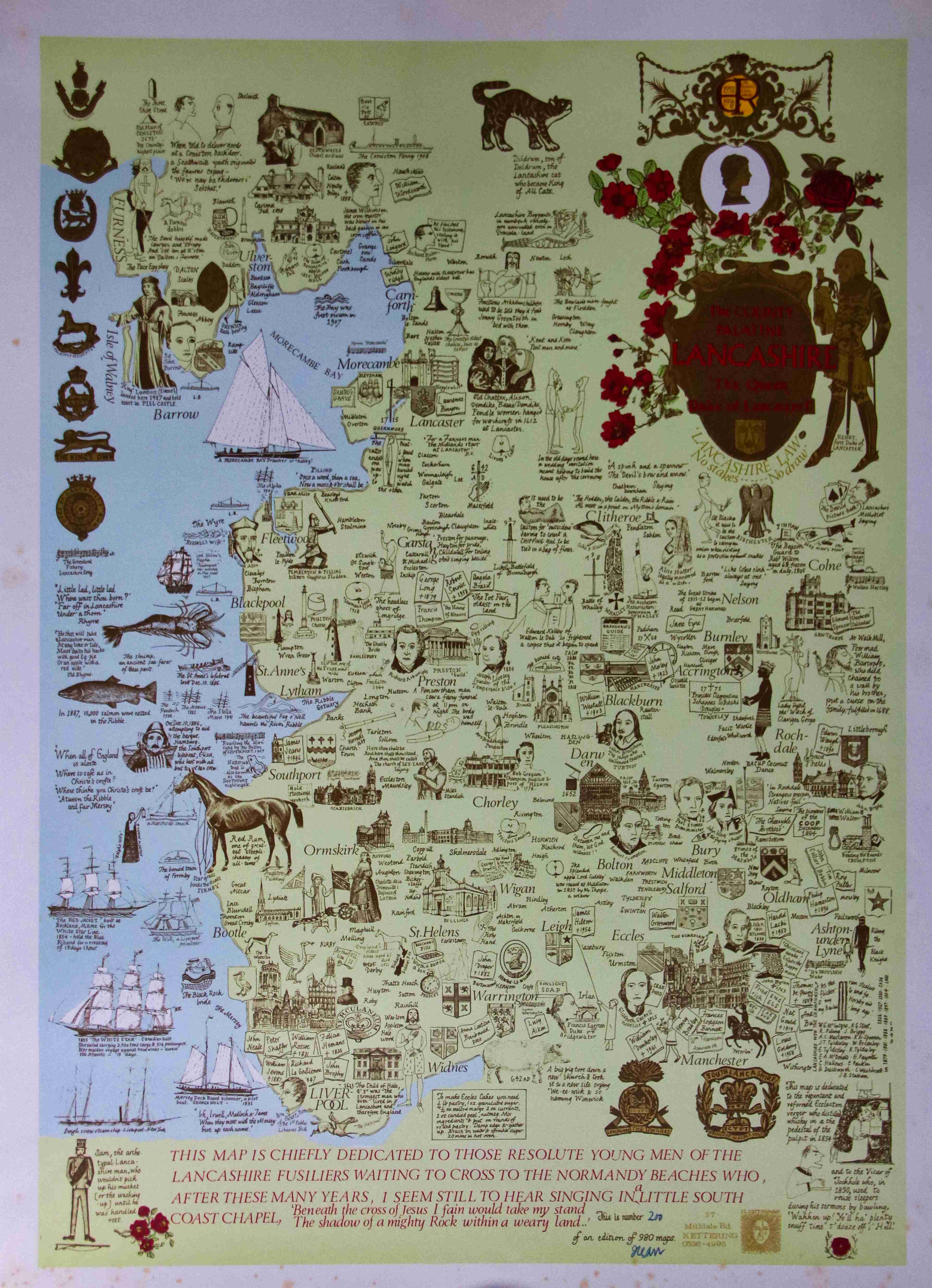
Image of map (click to enlarge)
Detail of limitation (click to enlarge)