Kent
Carr reported in his History of the QTP (1987) that there were four editions of maps of Kent. What I thought was the first map turns out to be the second, and someone has kindly sent me a photo of the proof of the third map, so I have recorded them all. If you have a coloured proof of the third map please let me know. I will acknowledge your contribution.
(Last updated on 21/7/2026)
MAP-KEN1: First edition
Publisher: J.L. Carr, 27 Mill Dale Road, Kettering
Year: 1967?
ISBN: none
Limitation: none stated, just the number
Size: 303 x 432 mm
Paper: thin white card
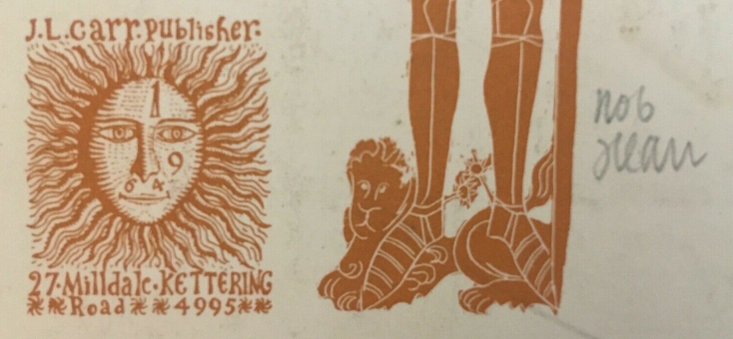
Colophon: sun face with address in lower right edge
Signed: Yes, pencil
Proofs where: AH
Notes: This map has no date and no limitation, just 'No 6' written in pencil to the right of the full colophon with Carr's address, which first appeared in about 1967, hence the presumed date of this map. In the lower left corner is a poem dated Manston and Swingfield 1944
, which is probably by J.L. Carr as he was stationed there soon after he joined the R.A.F. (see next version)
The camp is still, the dying fire
Flickers across your painted shire
This map we made with brush & pen
Memorial to some Englishmen.
They went their way: at rest they lie.
We dared not let their memory die,
For, in some fierce extremity,
We must match our destiny.
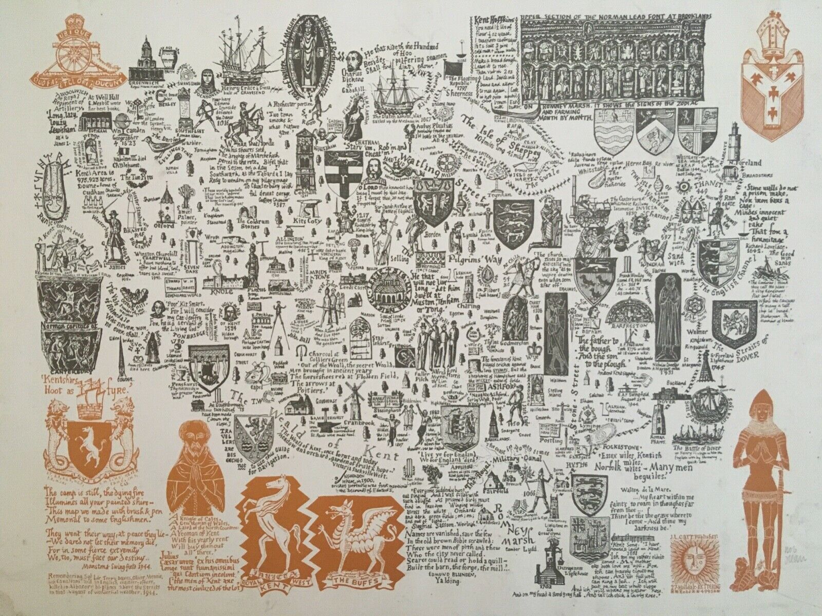
Image of map (click to enlarge)
Detail of limitation (click to enlarge)
MAP-KEN2: Second edition
Publisher: J.L. Carr, 27 Mill Dale Road, Kettering
Year: [September 1969 according to ISBN]
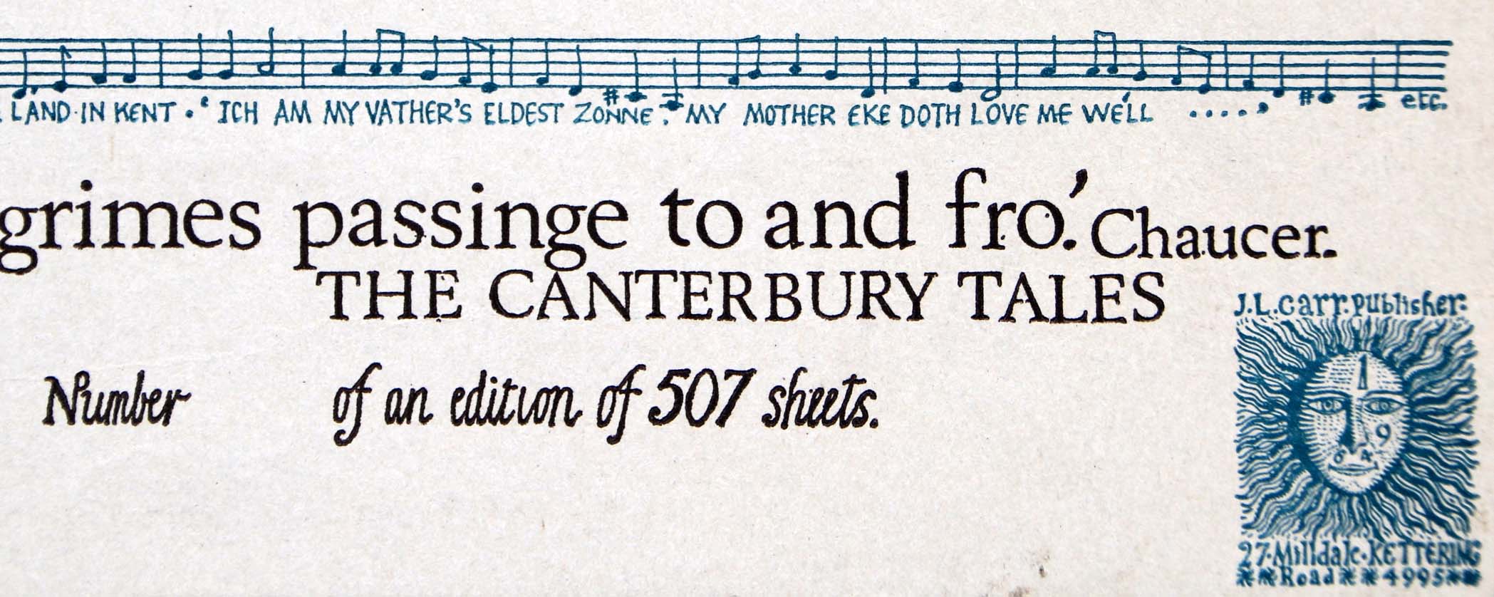
ISBN: 0900847018
Limitation: 507 sheets
Size: 434 x 418 mm (the sheet may have been trimmed)
Paper: thin grey card
Colophon: sun face with address in lower right hand corner
Signed: Not seen
Proofs where: Kettering Public Library (proof); AH (unsigned map)
Notes: In the lower left corner is the same poem by Carr that was reproduced on the first edition, but it is dated R.A.F Manston October 1941
, which is probably right as he was stationed there when he joined the R.A.F.
The green edge is the background on which the map was photographed. The map may have been trimmed unevenly to the edge and bits could be lost if I trimmed the image to create straight edges.
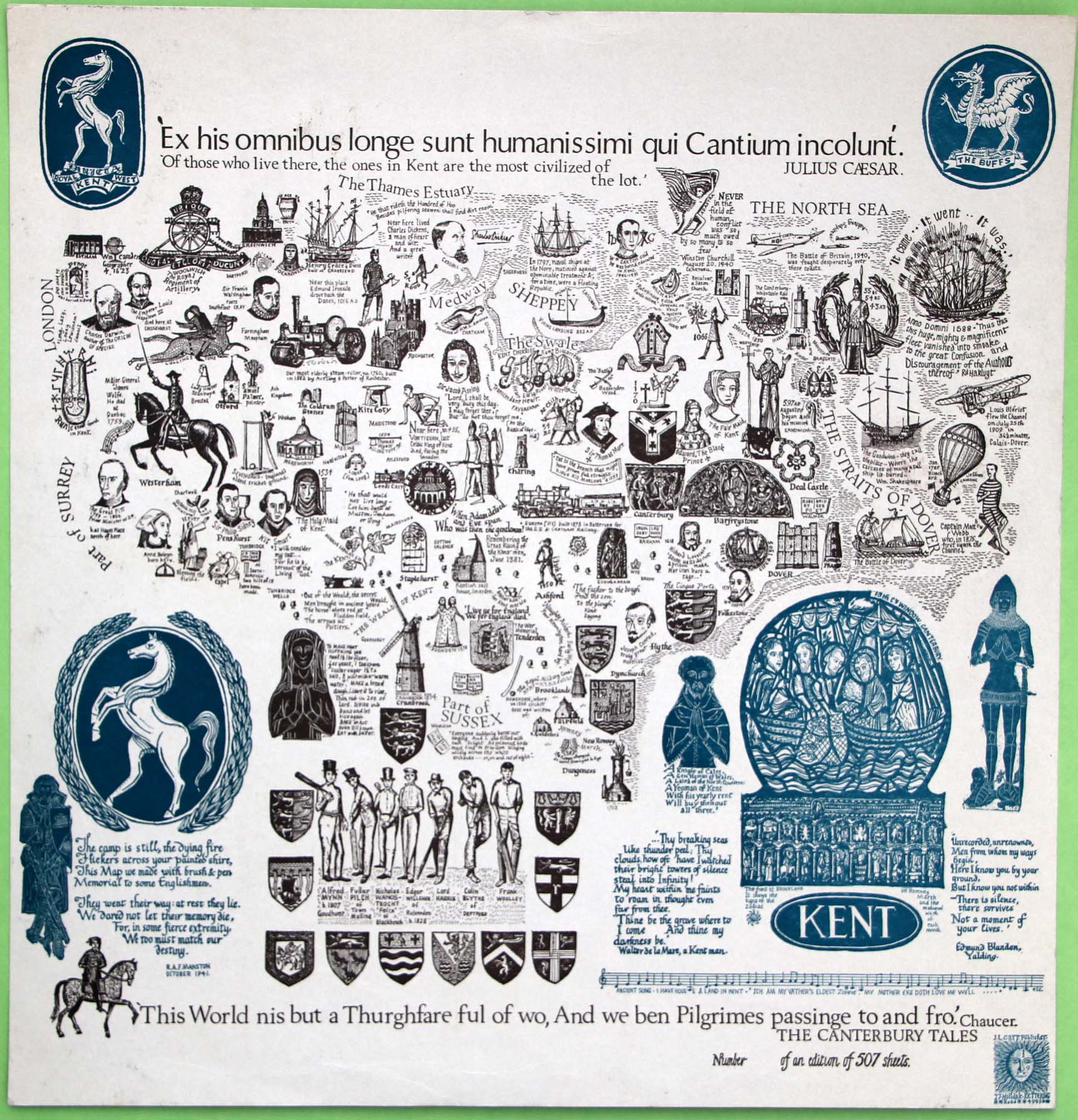
Image of map (click to enlarge)
Detail of limitation (click to enlarge)
MAP-KEN3: Third edition
Publisher: J.L. Carr, 27 Mill Dale Road, Kettering
Year: September 1975
ISBN: 090084745X
Limitation: 775 sheets
Size: 830 x 450 mm in proof; the final map was probably printed smaller
Signed: Not seen
Proofs where: None seen
Notes: Thanks to Tim Stubbings for sending me a photo of a proof of the map. The proof was postmarked Kettering 1st October 1975.
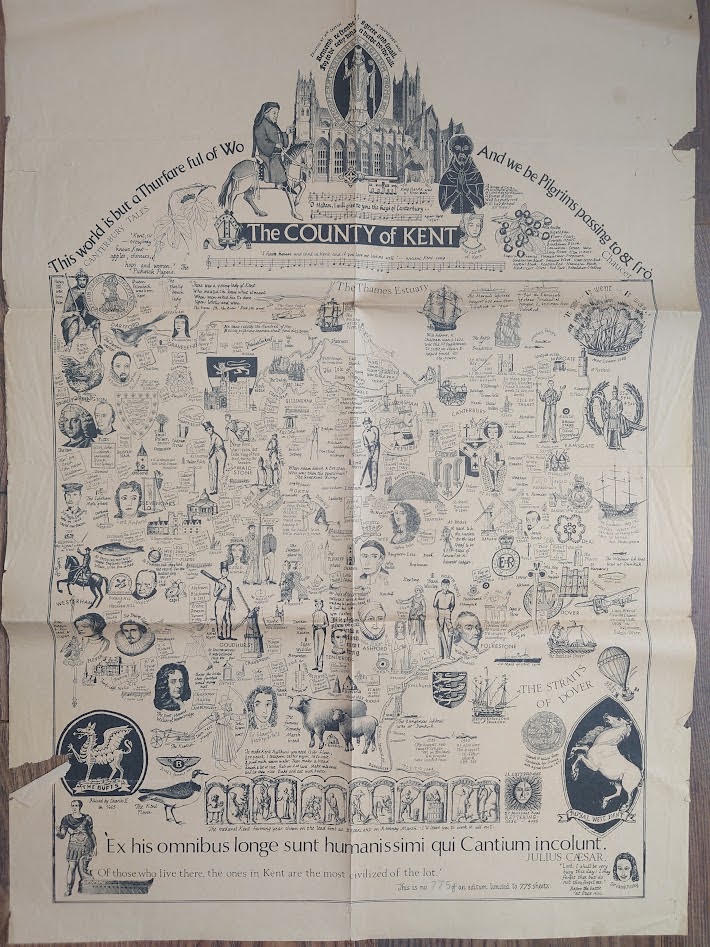
Image of map (click to enlarge)

Detail of limitation (click to enlarge)
MAP-KEN4: Fourth edition
Publisher: J.L. Carr, 27 Mill Dale Road, Kettering
Year: 1980
ISBN: none
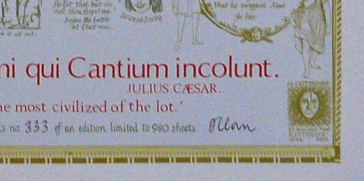
Limitation: 980 sheets
Size: 611 x 433 mm
Signed: Yes
Proofs where: Kettering Public Library
Notes: Quotation from Julius Caesar: Of those who live there, the ones in Kent are the most civilised of the lot.
Thanks to Tim Dean for the photograph of the map.
In 2026 the Quince Tree Press were selling unsigned, numbered proofs of the same map with the same limitation for £15.
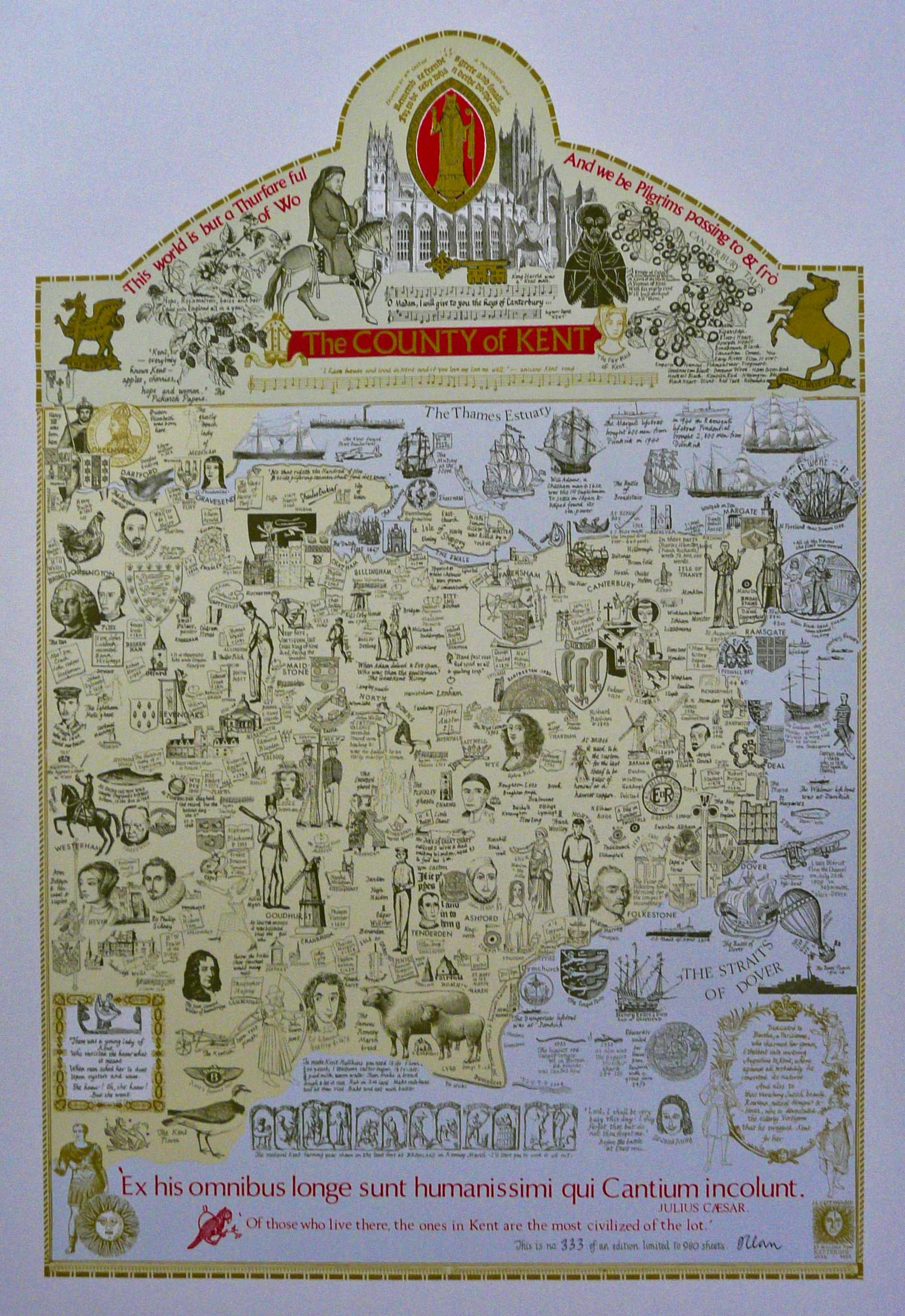
Image of map (click to enlarge)
Detail of limitation (click to enlarge)