England & Wales
This was the first map that Carr designed, while he was stationed in West Africa in 1943 with 270 Squadron of the R.A.F. during the Second World War (see title below, top right, for the locations where the map was drawn).
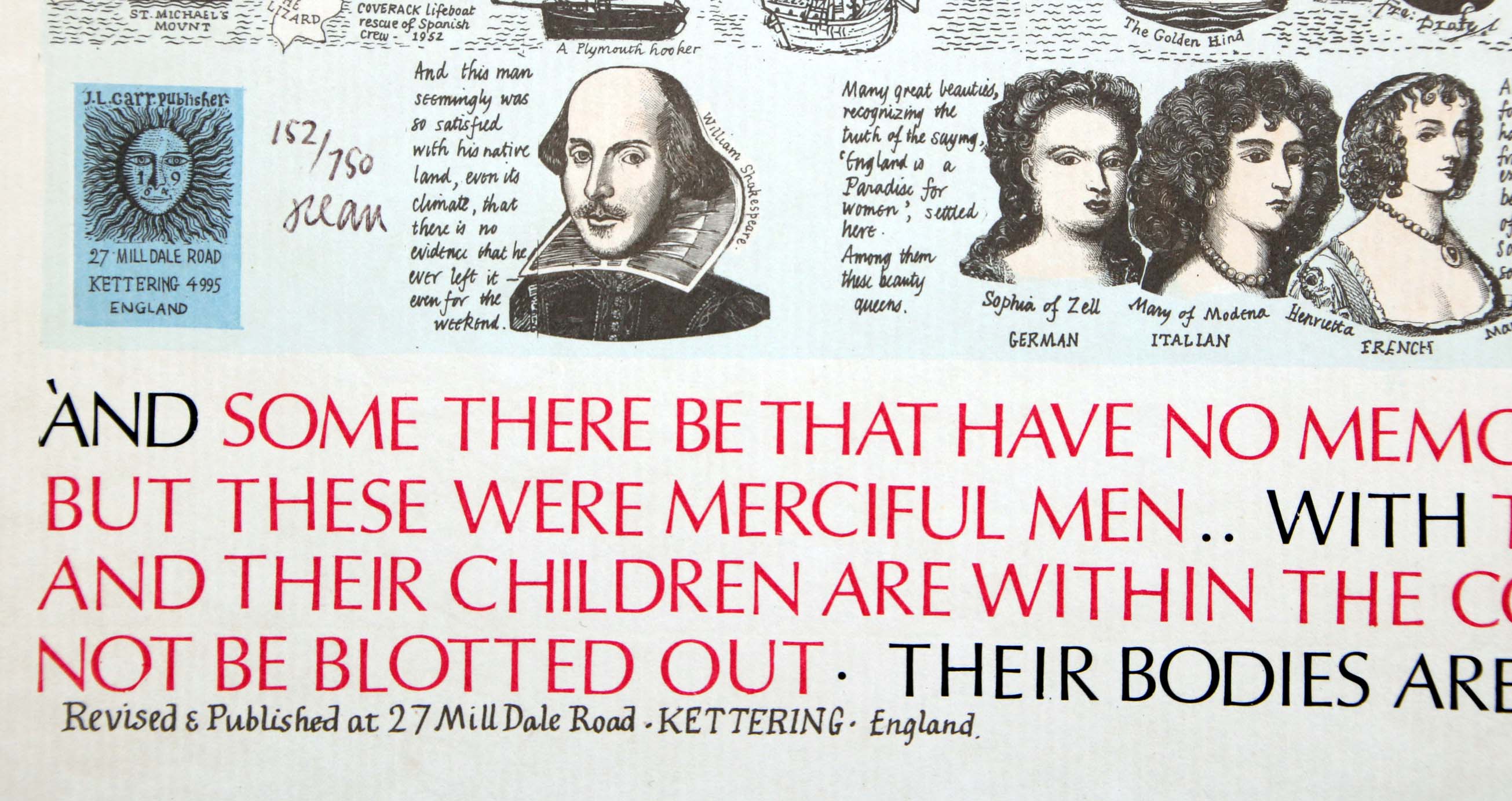
There seems to be only one edition, reprinted at least five times, all with the same basic design but with features printed in different colours. At least the first two impressions had a limitation of 750 copies hand-written next to the colophon, which makes 1,500 signed proofs in total. I'm not certain which came first, but I suspect the one shown first as it is extensively hand-coloured.
All the maps have a printed inscription at the lower margin: Revised and published by J.L. Carr at 27 Mill Dale Road, KETTERING, England
. The revision presumably refers to changes he made to the map he designed in West Africa.
However, the fact that Carr gave two ISBNs to this map, one registered in July 1972 and one in May 1973, suggests two different impressions, though it probably was not necessary to give two different numbers to what was efectively the same design. Carr applied three ISBNs to small books of the poems of William Blake, so perhaps he forgot that he had applied an ISBN to the map?
The blue
fifth impression, which was perhaps less expensive as it was printed in a single colour, may have been issued in large numbers, and uses the same design as the first impression. It has no limitation, the hand-writen text is in facsimile, and the map is usually not signed.
Carr placed an advertisement for his map of England and Wales in The Times' Christmas marketplace in November 1973. It is likely to be for the second impression, if that was issued in May 1973. According to a copy seen on eBay, this map was also originally sold by Heal's, an upmarket home furnishing company situated on Tottenham Court Road in London.
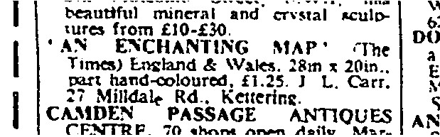
The Times, 27th November 1973, page 34
If you have a different map of England and Wales or a map with a different limitation or different printed colours, please contact me.
(Last updated on 16/2/2026)
MAP-E&W1.1: First edition, first impression
Publisher: J.L. Carr
Year: July 1972
ISBN: 090084731X
Limitation: 750 sheets
Size: 698 x 519 mm
Signed: Yes
Proofs where: Kettering Public Library; British Library; AH (map & proof)
Notes: This map is partially coloured by hand, notably the blue wash around the coastline and the green ring in the large detail, top right, above the title. It has a limitation of 750 copies and is signed. It may be the first impression of the first edition, but perhaps not, there is no clear dating evidence.
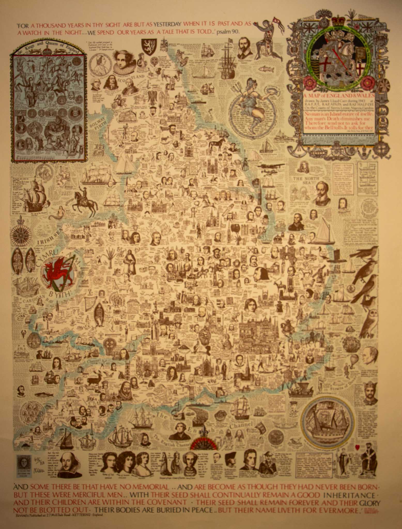
Image of map (click to enlarge)
MAP-E&W1.ii: First edition, second impression
Publisher: J.L. Carr
Year: May 1973
ISBN: 090084731X
Limitation: 750 sheets
Size: 698 x 519 mm ?
Signed: Yes
Proofs where:
Notes: This map, which is printed in different colours from the map shown above, with the sea printed in blue, is probably the second impression.
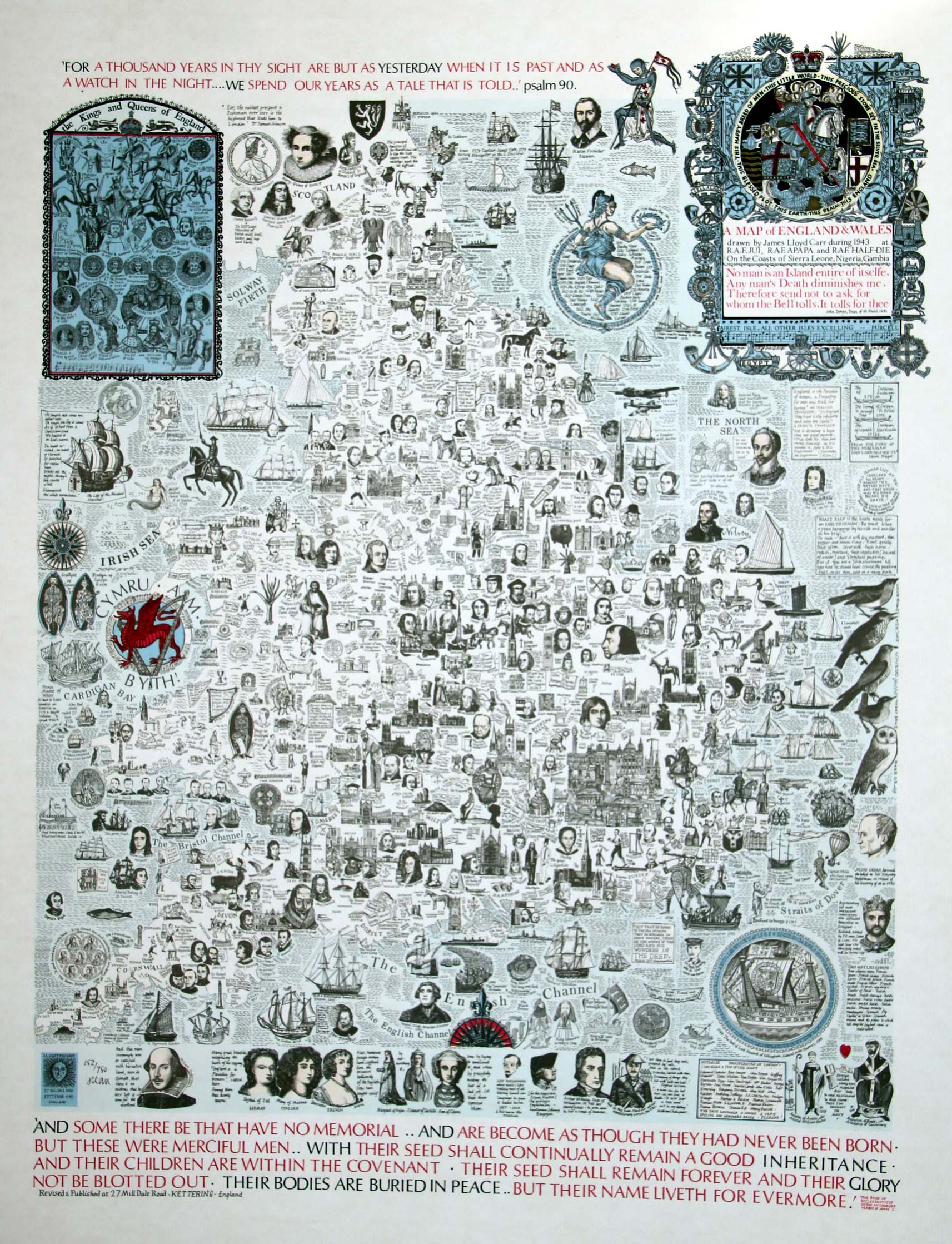
Image of map (click to enlarge)
Detail of limitation (click to enlarge)
MAP-E&W1.iii: First edition, third impression
Publisher: J.L. Carr
Year: May 1973
ISBN: 0900847344
Limitation: No limitation
Size: 700 x 520 mm
Signed: No
Proofs where:
Notes: This map has no limitation.
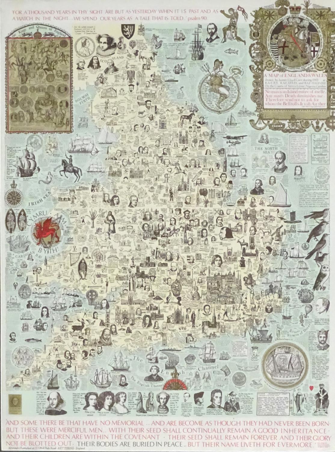
Image of map (click to enlarge)
MAP-E&W1.iv: First edition, fourth impression
Publisher: J.L. Carr
Year:
ISBN: 0900847344
Limitation: No limitation
Size: 685 x 510 mm
Signed: No
Proofs where:
Notes: This map has no limitation. It is printed in different colours from the third impression, for example the background colour of the plaque, top left, is in blue.
This map was available to purchase from the Quince Tree Press in February 2026 for £75.
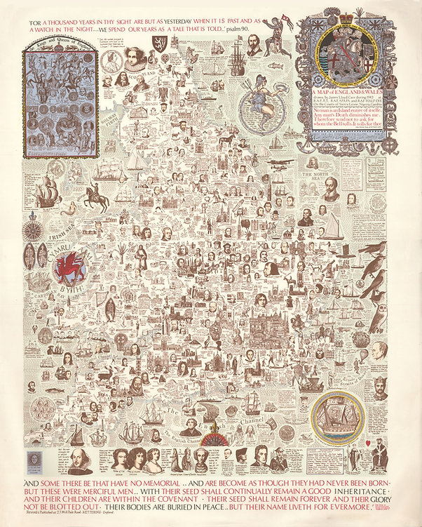
Image of map (click to enlarge)
MAP-E&W1.v: First edition, fifth impression
Publisher: J.L. Carr
Year: unknown
ISBN:
Limitation: none stated
Size: 632 x 481 mm
Signed: Yes
Proofs where: AH
Notes: This map has no limitation. Carr has written next to the colophon, where he would usually write the limitation: J.L. Carr 1944, Bathhurst, The Gambia, West Africa
. The only other difference from the first edition is a line of text at the very bottom, written by hand: "and to them this map is dedicated". These hand-written inscriptions are printed.
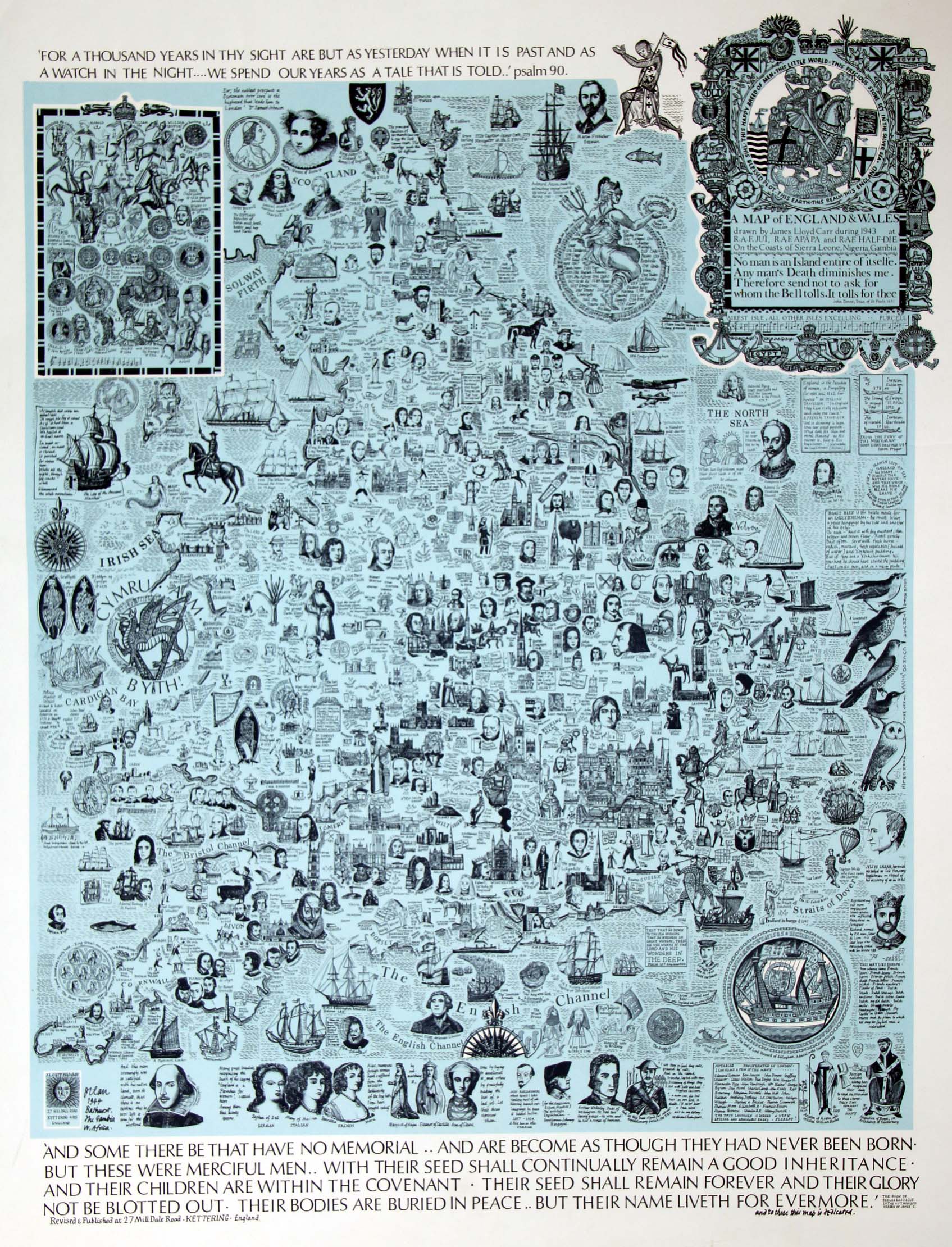
Image of map (click to enlarge)