Durham
Two editions of maps of County Durham are known.
(Last updated on 14/12/2020)
MAP-DUR1: First edition
Publisher: J.L. Carr, 27 Mill Dale Road, Kettering
Year: 1973; December 1974 according to Amazon
ISBN: 0900847840
Limitation: 773 sheets
Size: 553 x 455 mm
Paper: thin off-white card printed in three colours
Signed: Yes
Proofs where: Kettering Public Library (proof), AH (map and proof)
Notes: According to Amazon the ISBN was registered is December 1974 but the number of sheets indicates that it was published in 1973.
Dedicated to two unknown Durham infantrymen met in Winchester Close, June 1944, who wryly told me they were 'so well thought of' that, after Alamein and Italy they had been brought back 'to shove in at the front door'.
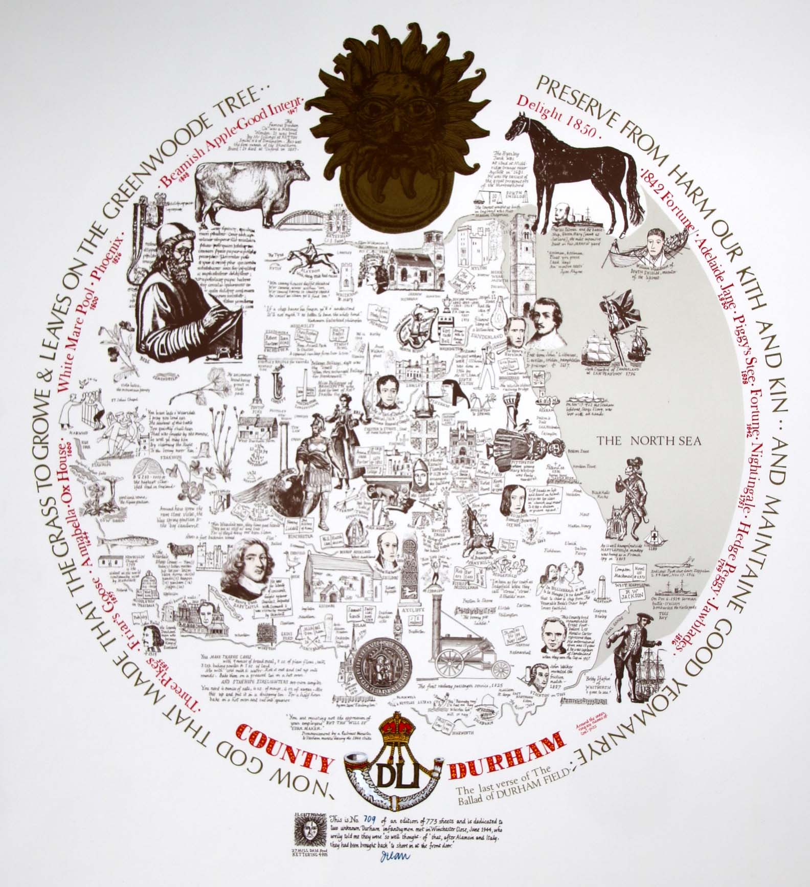
Image of map (click to enlarge)
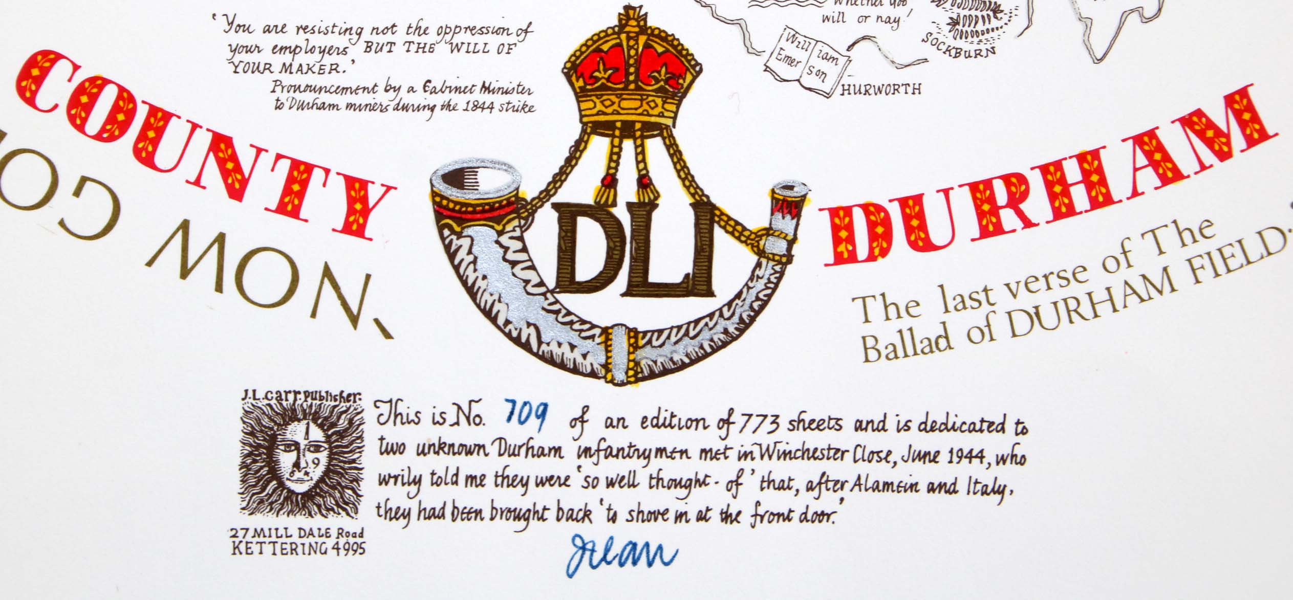
Detail of limitation (click to enlarge)
MAP-DUR1: Second edition
Publisher: J.L. Carr, 27 Mill Dale Road, Kettering
Year: 1982
ISBN: none
Limitation: 773 sheets
Size: 540 x 427 mm
Signed: Yes
Proofs where: Kettering Public Library (map)
Notes: Thanks to Tim Dean for the image of the map.
In 2026 the Quince Tree Press were selling unsigned, numbered proofs of the same map with the same limitation for £15.
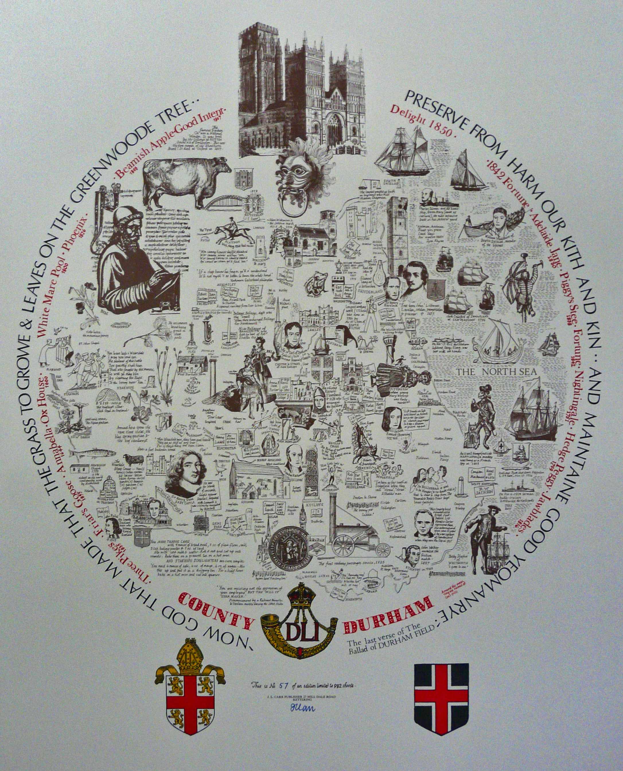
Image of map (click to enlarge)
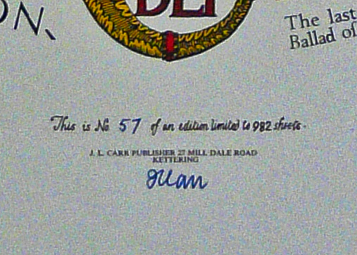
Detail of limitation (click to enlarge)