Devon
Two maps of Devon or Devonshire are known, the first published in 1970 and the second in 1978.
(Last updated on 14/2/2026)
MAP-DEV1: First edition
Publisher: J.L. Carr
Year: May 1970, according to Amazon
ISBN: 0900847263
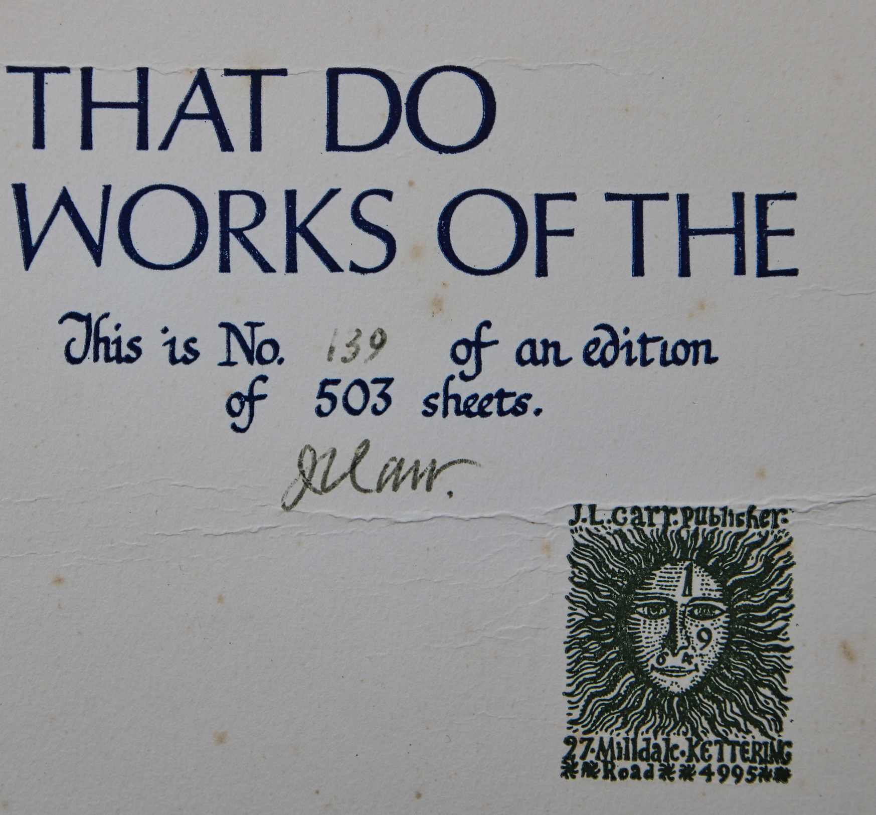
Limitation: 503 sheets
Size: 575 x 480 mm, approx
Paper: not seen
Signed: Yes, lower right by colophon
Proofs where: AH
Notes: At base, Psalm 107: They that go down to the sea in ships, that do business in great waters, these see the works of the Lord and his wonders in the deep.
The entry on Amazon under this ISBN states that there are 500 sheets in a limited, signed edition.
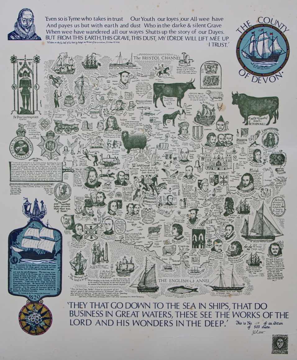
Image of map (click to enlarge)
Detail of limitation (click to enlarge)
MAP-DEV1: Second edition
Publisher: J.L. Carr, 27 Mill Dale Road, Kettering
Year: 1978, presumed from limitation
ISBN: none
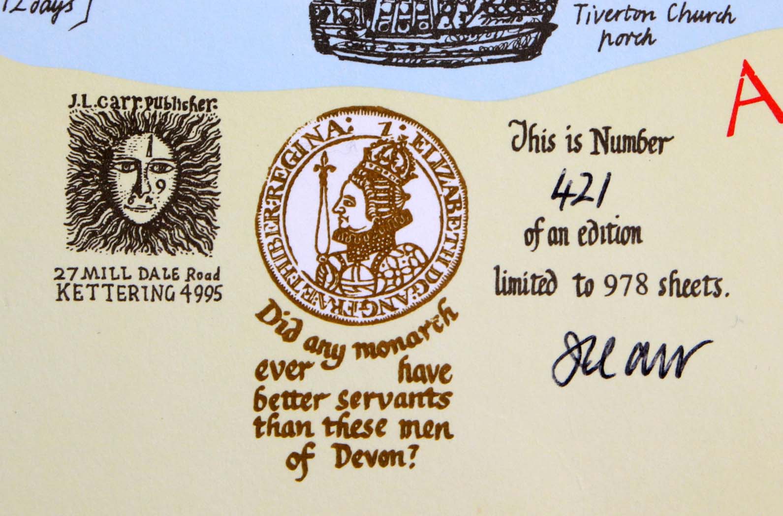
Limitation: 978 sheets
Size: 527 x 454 mm
Paper: thin white card, printed in colours
Signed: Yes, below limitation
Proofs where: Kettering Public Library; AH
Notes: In the middle of the map:
John Lee was hung 3 times on Feb. 23, 1885 in Exeter Goal for the murder of Emma Keyse of Babbacombe. He died in U.S.A. in 1933.
In 2026 the Quince Tree Press were selling unsigned, numbered proofs of the same map with the same limitation for £15.
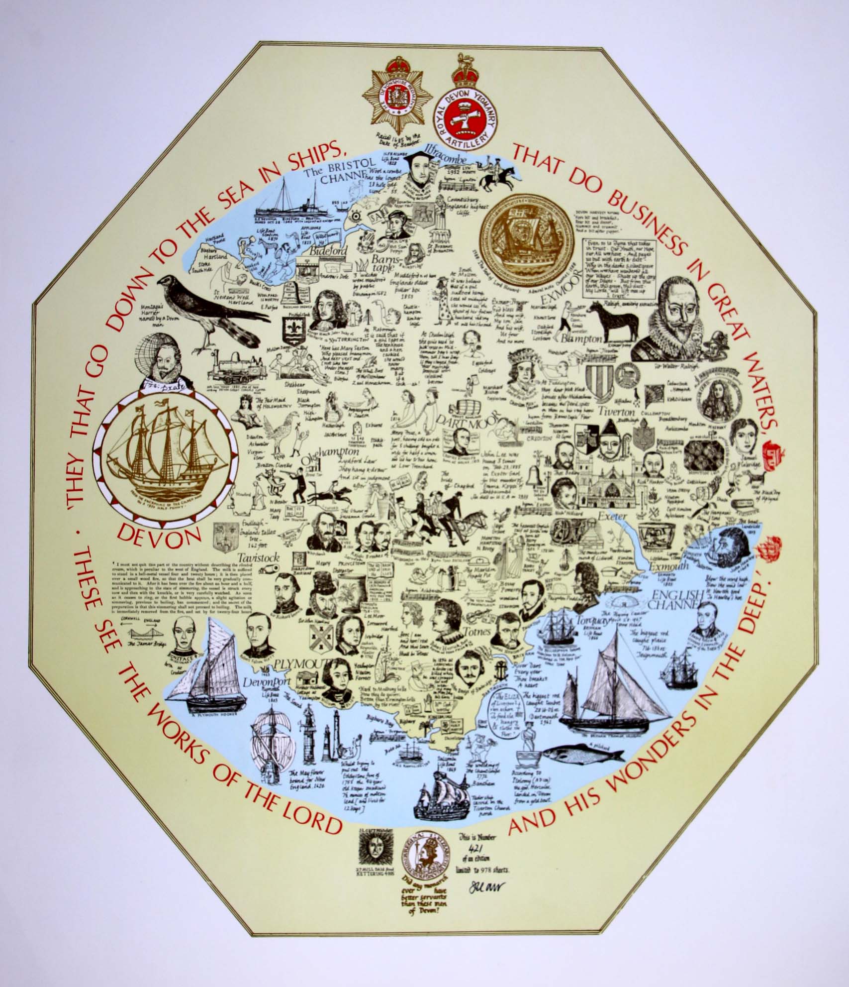
Image of map (click to enlarge)
Detail of limitation (click to enlarge)