Derbyshire
Carr reported three maps of Derbyshire in his History of the QTP, but only two have been seen, which are largely the same. As the two were published in 1974 and 1980, if there is a third map it is likely to have been issued before 1974. If anyone has one, I'd like to know about it, please.
(Last updated on 14/2/2026)
MAP-DER1: First edition
Publisher: J.L. Carr
Year: 1974?; September 1975 according to Amazon
ISBN: 0900847549
Limitation: 774 sheets
Size: 630 x 395 mm
Paper: thin cream linen texture card
Signed: Yes
Proofs where: AH
Notes: This map is dedicated to that typical [I trust] Derbyshire man, William Hutton, 'Walking William', who in 1749, left stocking weaving and, without a car or student grant, set up as a bookseller by walking to London and back to buy a set of bookbinding tools.
The ISBN was registered in 1975 according to Amazon, but the limitation indicates that the map was issued in 1974.
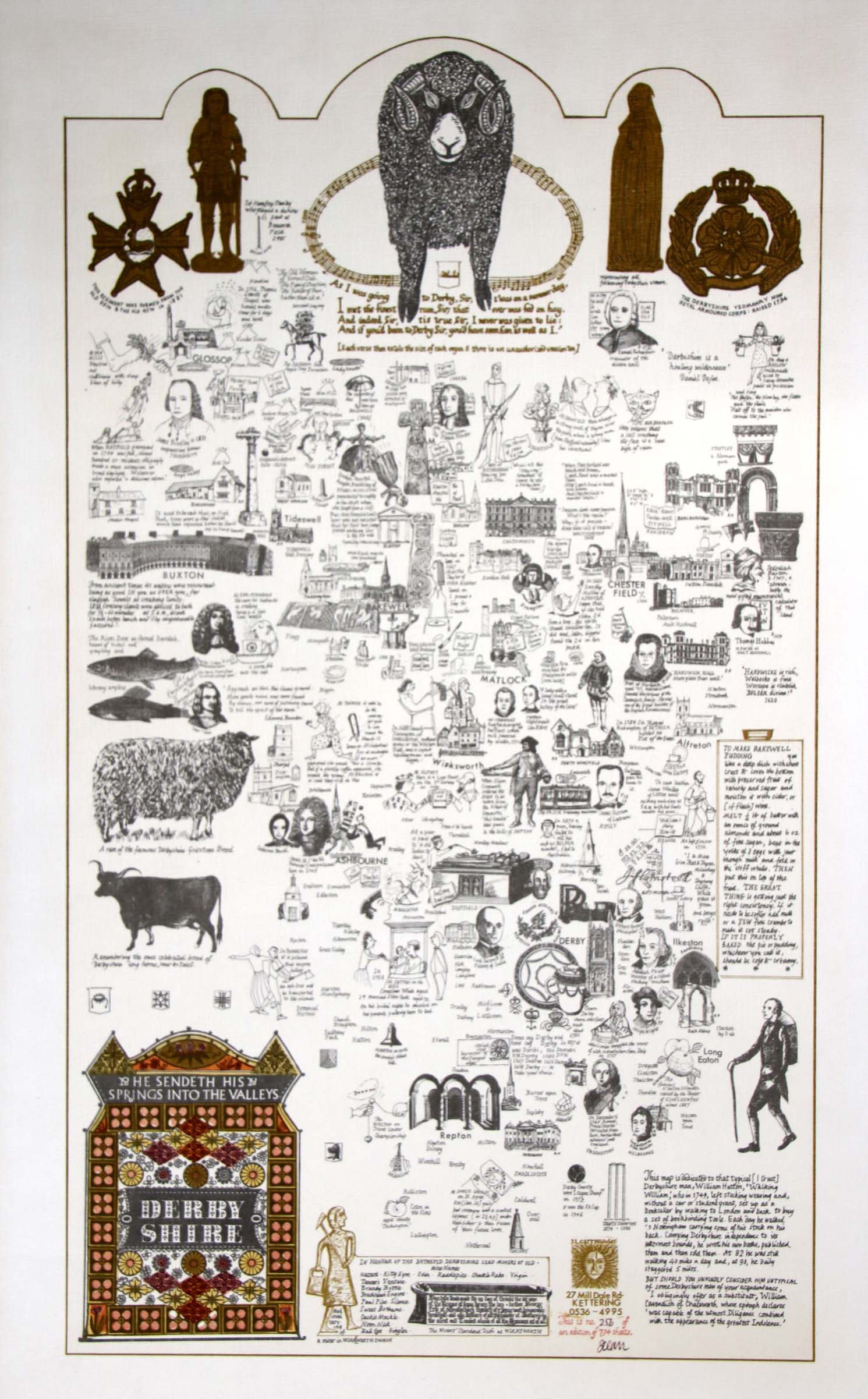
Image of map (click to enlarge)
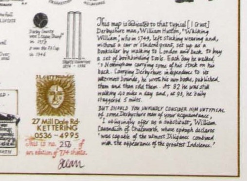
Detail of limitation (click to enlarge)
MAP-DER2: Second edition
Publisher: J.L. Carr
Year: 1980
ISBN: none
Limitation: 980 sheets
Size: 635 x 379 mm
Paper: thin white card
Signed: Yes
Proofs where: Kettering Public Library; AH
Notes: In honour of the intrepid Derbyshire lead miners of old.
Much of the central detail of this map was not changed for the second edition. The designs in the four corners have been changed or moved.
In 2026 the Quince Tree Press were selling unsigned, numbered proofs of the same map with the same limitation for £15.
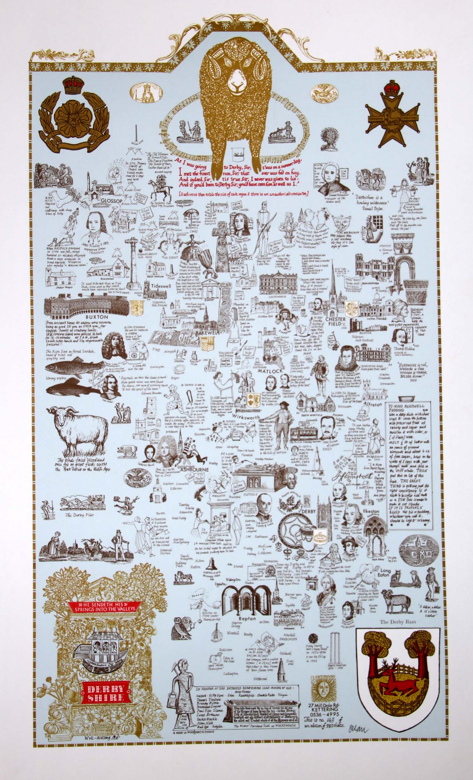
Image of map (click to enlarge)
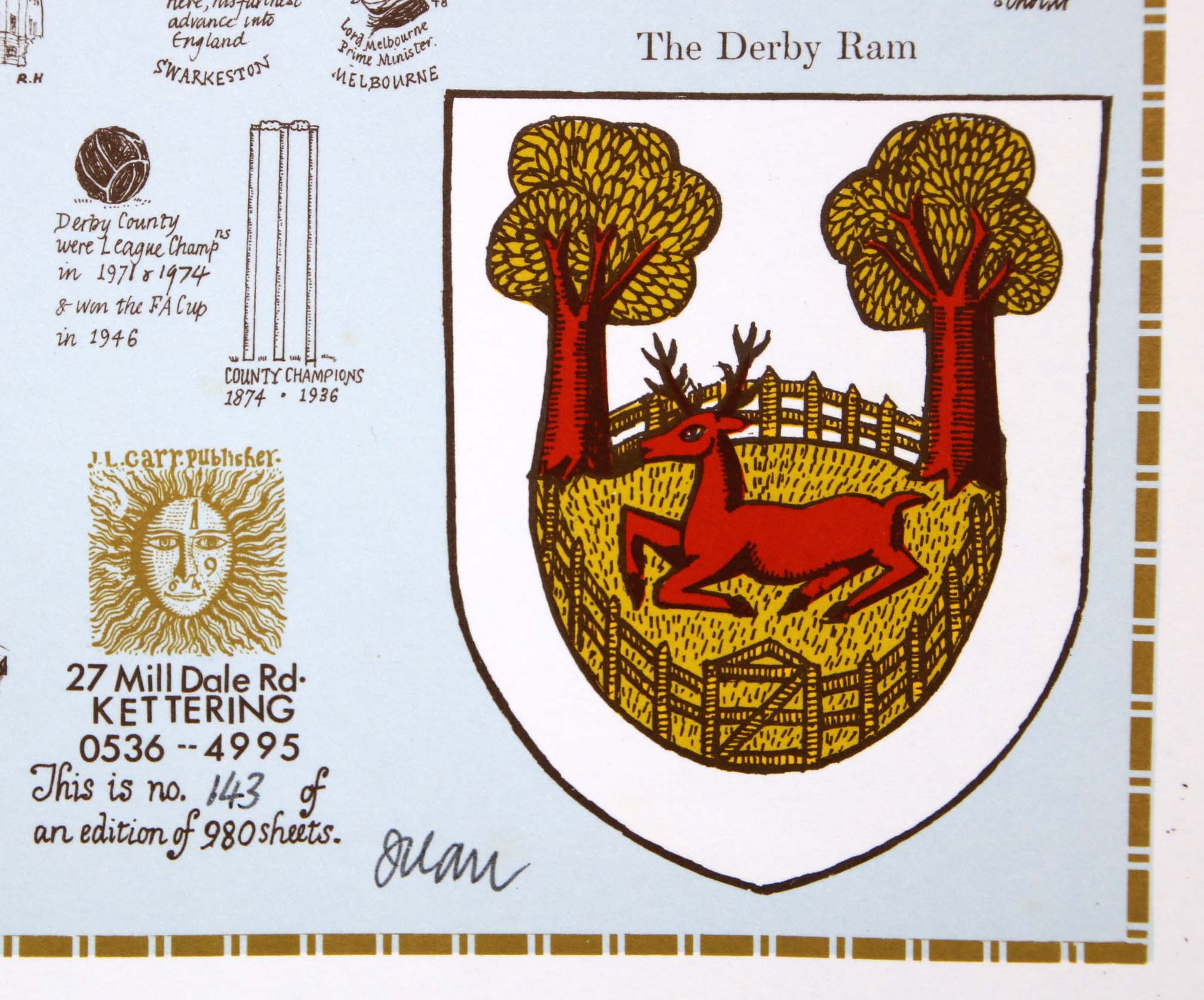
Detail of limitation (click to enlarge)