Cumberland
Only one design of a map of Cumberland is known, but it seems to have been printed in two editions, both of 777 copies. It is also possible that the same design was printed in two batches with different colours but I suspect, to keep down costs, Carr would have the whole edition printed at once.
(Last updated on 8/1/2025)
MAP-CUM1: First edition, first impression
Publisher: J.L. Carr, 27 Milldale Road, Kettering
Year: March 1977, according to Amazon
ISBN: 0900847778
Limitation: 777 sheets
Size: not known, but presumably similar to 2nd imp
Paper: not seen
Signed: Yes
Proofs where:
Notes: This map is dedicated to the ESKDALE parson who kept a stone coffin in his church porch, explaining 'Ah weel, y'see, et's a varra gud thing. Et minds 'em o' their Latter End, ye knaw. And it's varra useful for their umberellas'
This proof of the map may have faded.
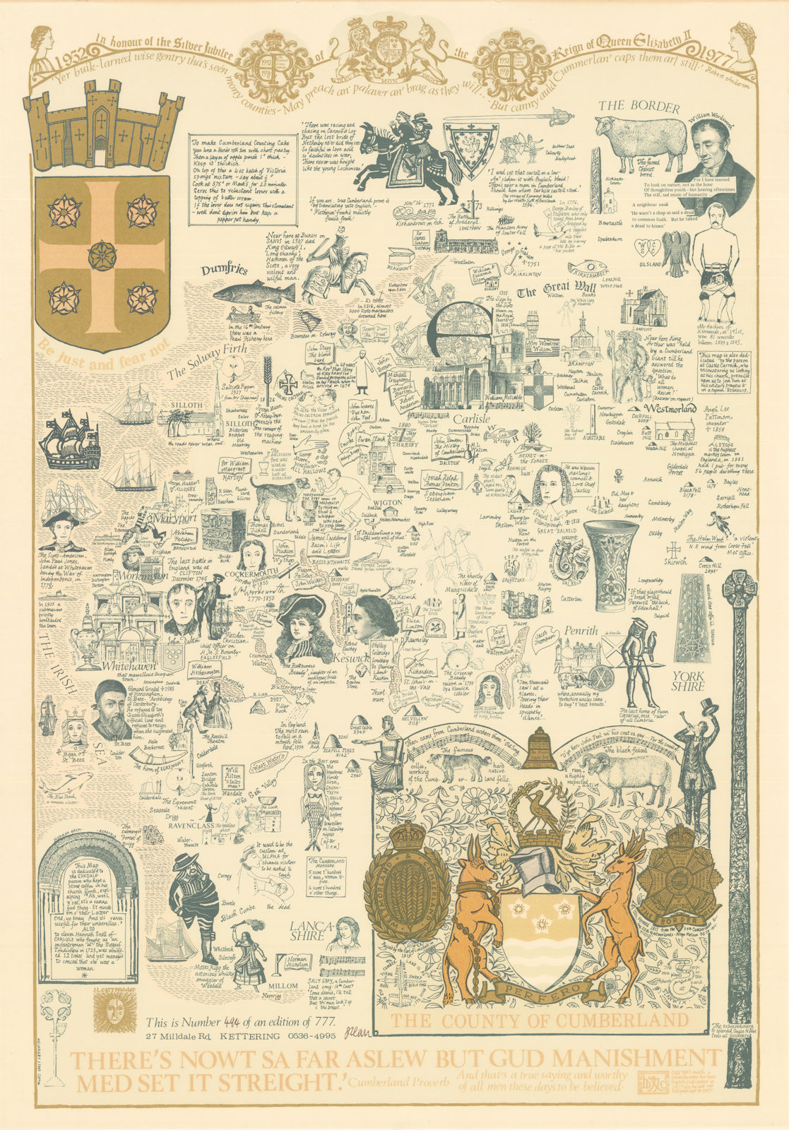
Image of map (click to enlarge)
MAP-CUM1: First edition, second impression
Publisher: J.L. Carr, 27 Milldale Road, Kettering
Year: March 1977, according to Amazon
ISBN: 0900847778
Limitation: 777 sheets
Size: 635 x 445 mm
Paper: thin white card
Signed:
Proofs where: AH
Notes: This map is the same design as the first impression above, but has been printed in colours, especially the water around the coast, indicating that it is a later impression of the same design. Whereas Carr usually designed a new edition of a map, this seems to be an example of a map published in two limited editions of 777 sheets.
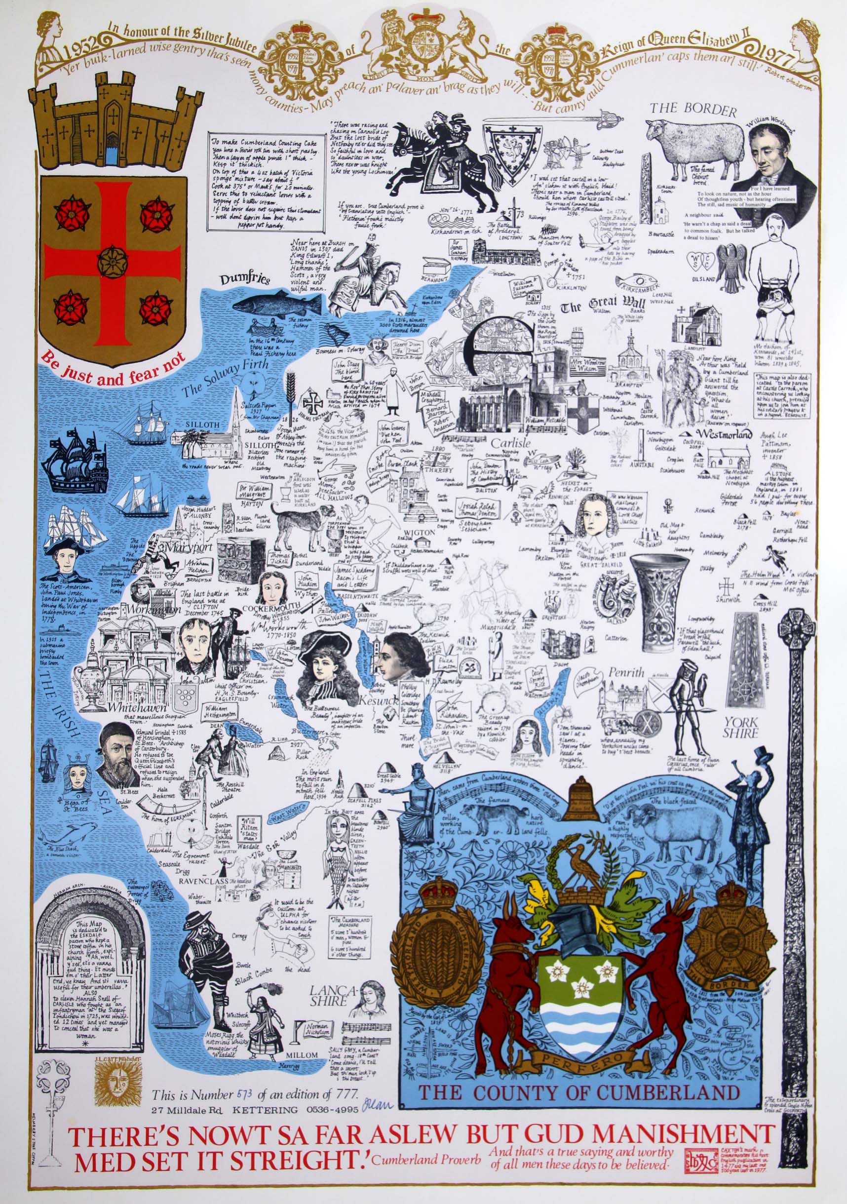
Image of map (click to enlarge)
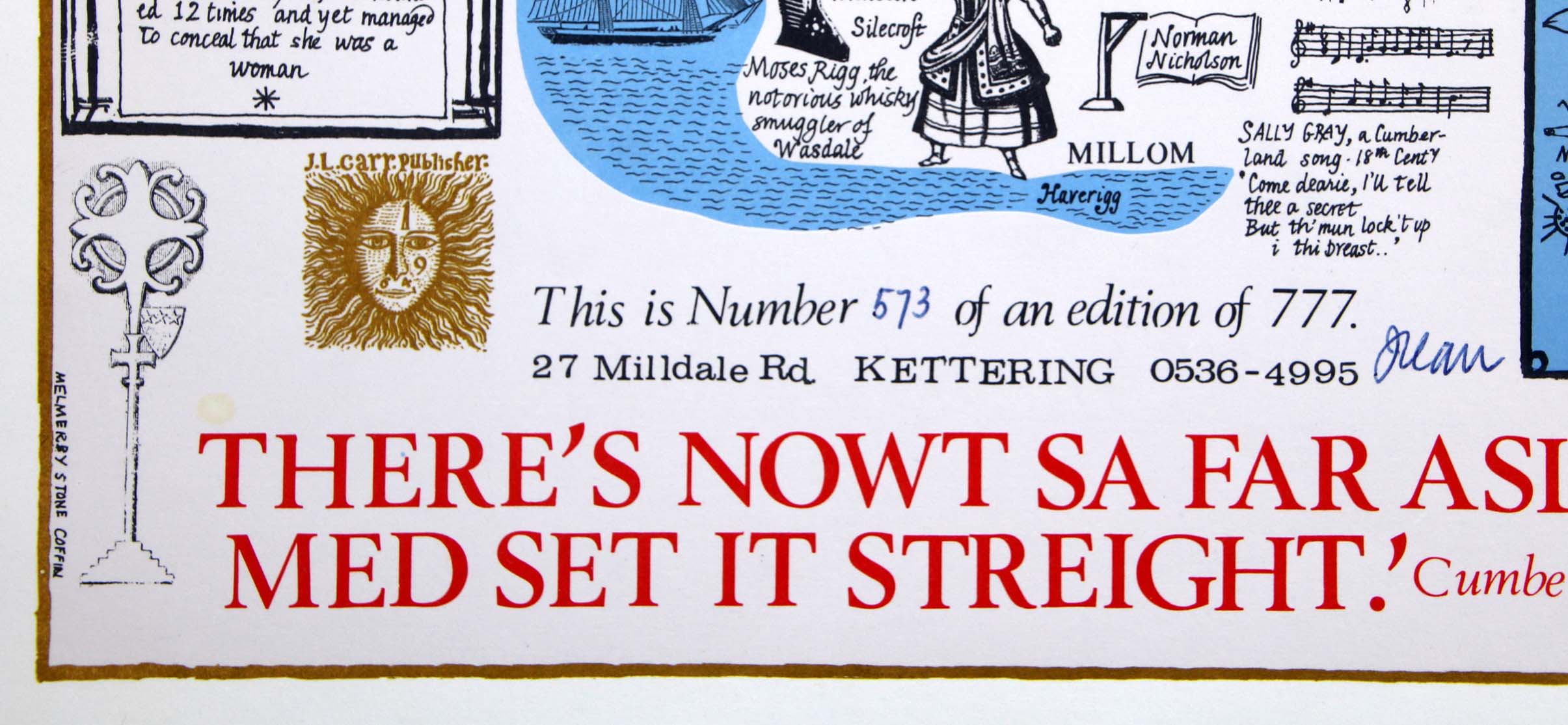
Detail of limitation (click to enlarge)