Cambridgeshire
This map shows Cambridgeshire and the Isle of Ely, before it was merged to create a new county of Cambridgeshire with a part of Huntingdonshire.
(Last updated on 7/12/2020)
MAP-CAM1: First and only edition
Publisher: J.L. Carr
Year: December 1974
ISBN: 0900847824
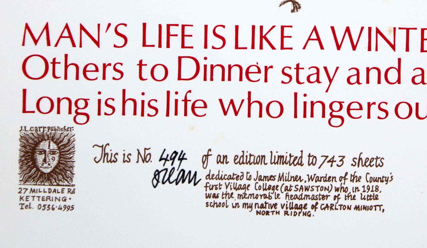
Limitation: 743 sheets
Size: 633 x 454 mm
Paper: thin white card
Signed: Yes
Proofs where: Kettering Public Library (map and proof) and Purdy/Kresge Library at Wayne State University Library in Detroit, Michigan
Notes: This map does not follow the relationship between the year of publication and the limitation. If it was published in 1974 then it should have a limitation of 774 proofs rather than 743, like the other six maps published in 1974, unless the first two digits represent the year? This is an anomaly.
Below the limitation the map is:
Dedicated to James Milner, Warden of the County's first Village College at SAWSTON, who in 1918, was the memorable headmaster of the little school in my native village of CARLTON MINIOTT, NORTH RIDING.
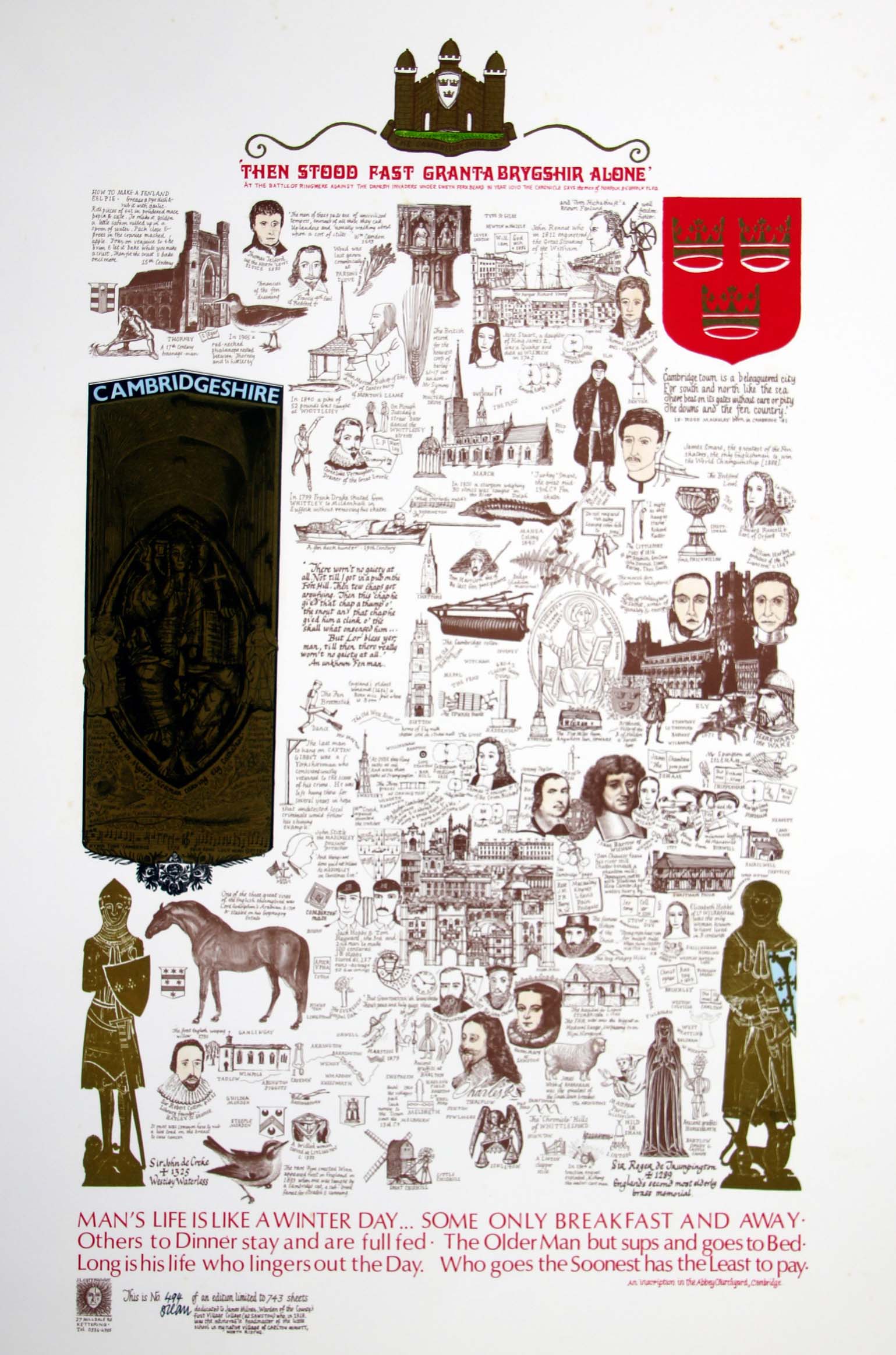
Image of map (click to enlarge)
Detail of limitation (click to enlarge)