Buckinghamshire
This is one of 11 maps that Carr may have designed in 1974, or at least their limitation suggests that they were designed in that year. The county was omitted from the list of maps in the History of the QTP. It is the only known map that Carr designed of the County of Buckinghamshire.
(Last updated on 7/12/2020)
MAP-BUC1: First and only edition
Publisher: J.L. Carr, 27 Mill Dale Road, Kettering
Year: 1974; dated as September 1975 in an ISBN search
ISBN: 0900847530
Limitation: 574 sheets
Size: 633 x 425 mm
Paper: thin white card
Signed: Yes
Proofs where: Kettering Public Library; Purdy/Kresge Library at Wayne State University Library in Detroit, Michigan
Notes: This map is dedicated respectfully to John Neild of LONG MARSTON who was a most loyal subject & left Queen Victoria a quarter of a million pounds in 1852 [at least £2,000,000 in 1974 currency.] To a woman who had once saved his life he left NOTHING. The Queen graciously gave her a weekly pension of £2.
The number of proofs indicates it was published in 1974 but the date given by Amazon is September 1975.
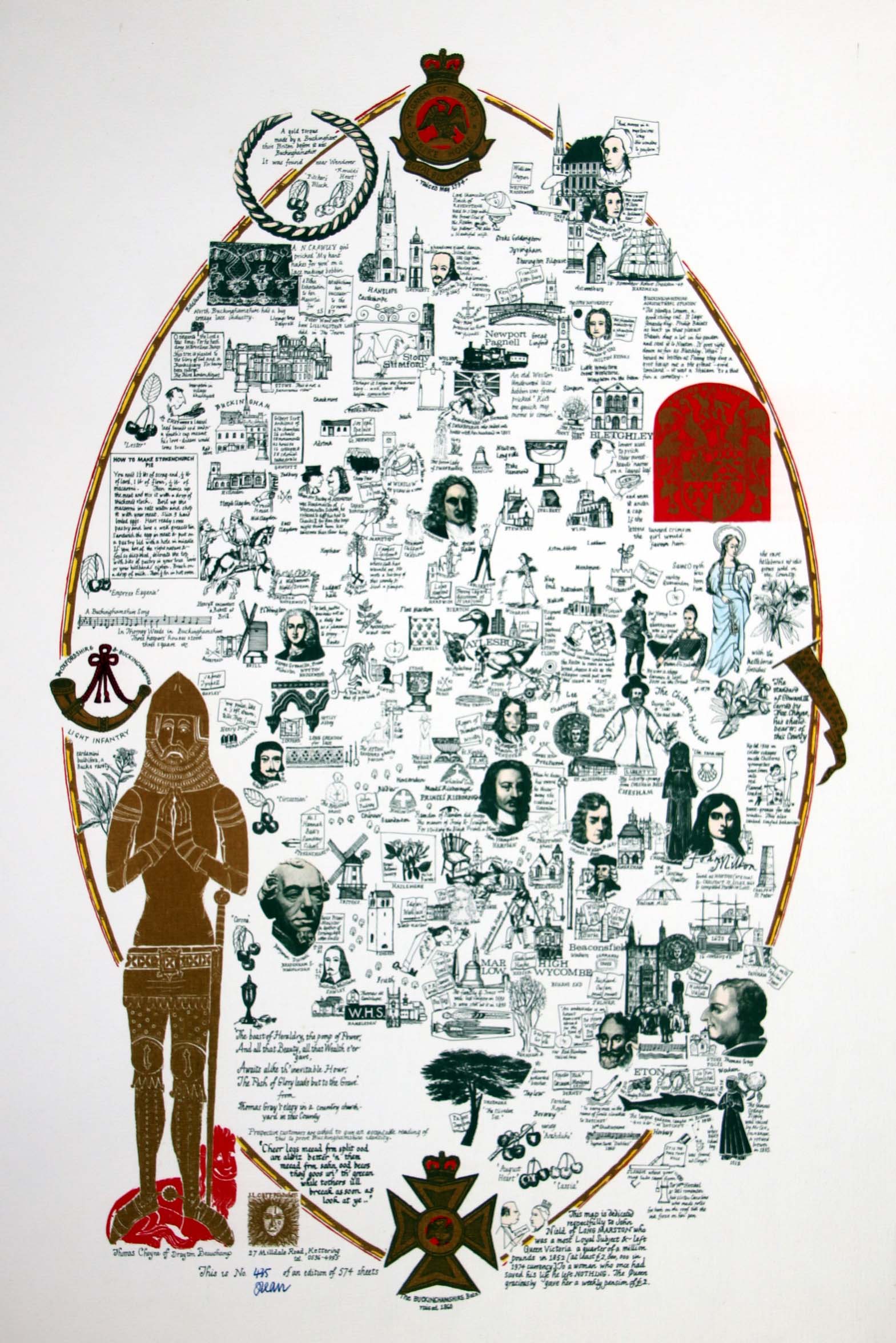
Image of map (click to enlarge)
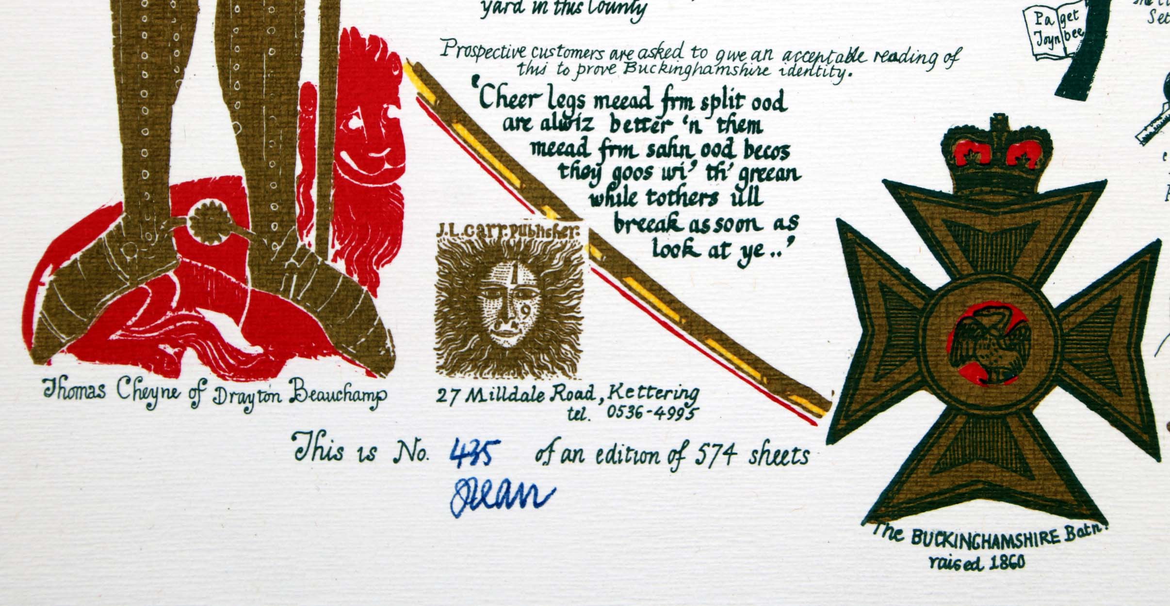
Detail of limitation (click to enlarge)